

Spotlight: Overview of the rocks of the Rocky Mountains region of the southwestern United States, including Colorado, New Mexico, and Utah.
Topics covered on this page: Overview; Precambrian; Paleozoic; Mesozoic; Cenozoic; Resources.
Credits: Most of the text of this page is derived from "Rocks of the Southwestern US" by Lisa R. Fisher and Richard A. Kissel, chapter 2 in The Teacher-Friendly Guide to the Earth Science of the Southwestern US (published in 2016 by The Paleontological Research Institution. The book was adapted for Earth@Home web by Elizabeth J. Hermsen and Jonathan R. Hendricks in 2022. Changes include formatting and revisions to the text and images. Credits for individual images are given in figure captions.
Updates: Page last updated March 28, 2022.
Image above: Eroded volcanic ash deposits at the Wheeler Geologic Area in Colorado (learn more below). Photograph by C. K. Hartman (Flickr; Creative Commons Attribution 2.0 Generic license; image cropped and resized).
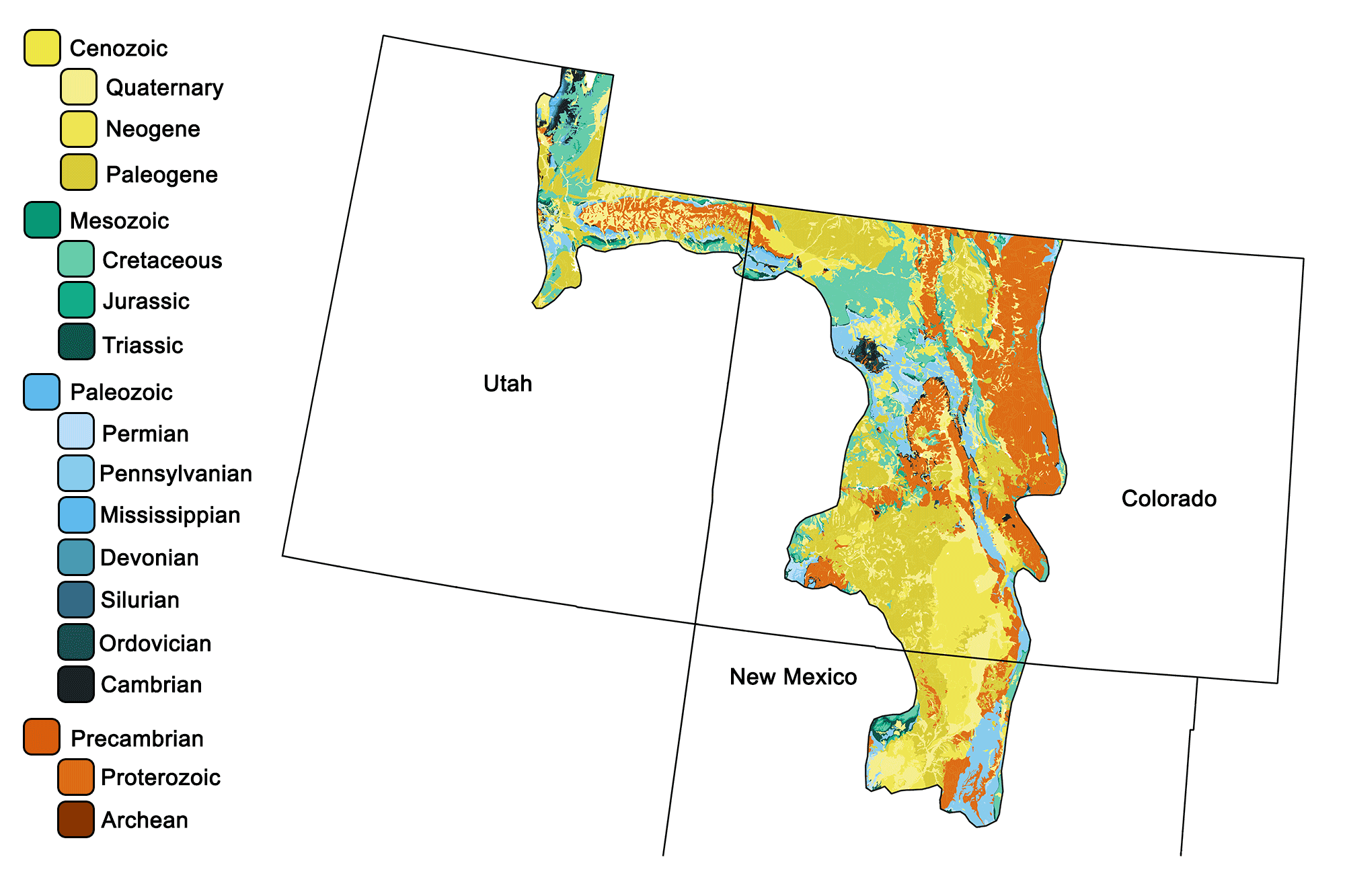
Geologic map of the Rocky Mountains region of the southwestern United States showing maximum ages of mappable units. Image by Jonathan R. Hendricks for the Earth@Home project developed using QGIS and USGS data (public domain) from Fenneman and Johnson (1946) and Horton et al. (2017).
Overview
The Rocky Mountains of the Southwest consist of multiple mountain ranges resulting from both the Sevier and Laramide orogenies, which uplifted numerous discrete blocks of terrain along thrust faults that accommodated compressional shortening and thickening of the crust. The overlying sediments were subsequently eroded to expose deeper Precambrian rock as well as Paleozoic and Mesozoic sedimentary formations. The thrust-faulted uplift also produced adjacent basins, which subsequently accumulated sediments eroded from the surrounding mountains. In the Southwest, the Rockies are located in central and western Colorado, north-central New Mexico, and northeastern Utah.
Precambrian
Precambrian rocks are well exposed in the Rocky Mountains, where 1.9- to 1.6-billion-year-old metamorphosed volcanic and sedimentary rocks represent the accretion of an ancient terrane to this portion of the North American continent. These ancient rocks are typically metamorphosed and deformed, but occasionally some of the original sedimentary and volcanic textures can still be observed, including bedding, cross-bedding, and pillow lavas. Coarse-grained, dark-colored metamorphic rocks are ubiquitous. Many of these Precambrian rock units can be seen in exposures along roads that wind through the mountains. For example, the Uinta Mountains, an east-west segment of the southern Rockies in northeastern Utah, are made of uplifted and metamorphosed sedimentary rocks deposited in a shallow marine basin over 700 million years ago. The rocks at the mountains’ peaks include reddish quartzite and sandstones, slate, and shale. These are part of a thick (4- to 7-kilometer [13,000- to 24,000-foot]) sequence of rocks known as the Uinta Mountain Group that were uplifted during the Laramide Orogeny.
King’s Peak, the highest peak in Utah’s Uinta Mountains, is composed primarily of Neoproterozoic sandstone, siltstone, and shale. Photograph by "summit cheese" (Flickr; Creative Commons Attribution-ShareAlike 2.0 Generic license; image resized).
Colorado’s Precambrian rocks are primarily metamorphosed volcanics with intermixed sedimentary units. Schist—metamorphosed sediment—is fairly common in the Rocky Mountains, and can be found throughout the region. It is usually composed of shale and siltstone that have been compressed to form relatively large crystals (especially micas) that are layered into sheetlike structures. Gneisses—metamorphosed rhyolite or granite—are common in the Colorado Rockies.
Hikers exploring Chiquita and Ypsilon mountains in the Mummy Range of northern Colorado. Ypsilon Mountain is principally composed of 1.7-billion-year-old biotite schists and gneisses. Photograph by Micah MacAllen (Flickr; Creative Commons Attribution-NonCommercial-ShareAlike 2.0 Generic license; image resized).
In contrast, the Precambrian rocks of New Mexico have a higher ratio of sedimentary units, including more quartzite and conglomerate, than is found in Colorado. Quartzite—metamorphosed sandstone—is very resistant to erosion, so it forms steep slopes and is often found at the core of ridges or mountains. This rock ranges in color from white and gray to pink and purple, depending on the amounts of iron and other minor minerals that were deposited with the sand grains. The Picuris Range near Taos in New Mexico contains more Precambrian quartzite than do the mountains of Colorado. (The best quartzite outcrops in Colorado are south of Boulder in El Dorado State Park, and in Coal Creek Canyon, along Highway 72.)
Three major igneous intrusions followed the original deposition of these rocks, forming large granitic batholiths approximately 1.8, 1.4, and 1.1 billion years ago. These batholiths are more resistant to erosion than the surrounding rocks are, and form many high mountain peaks including Pike’s Peak, Mount Evans, and Long’s Peak in the Colorado Front Range. The Pike’s Peak granite (1.8 billion years old) is well known for its pegmatites.
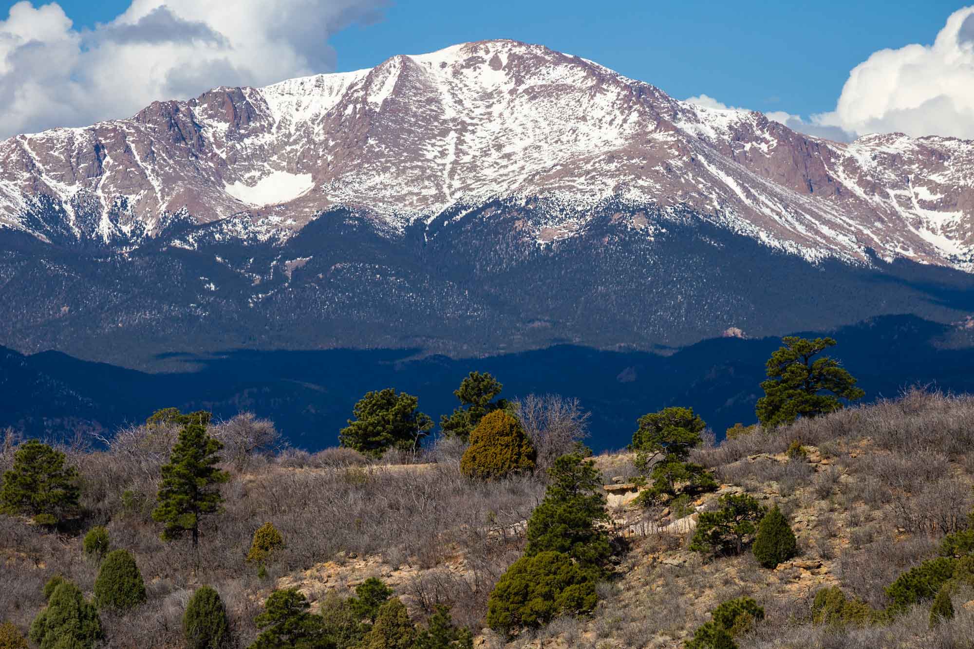
Pike's Peak near Colorado Springs, Colorado. Photograph by Joel Tonyan (Flickr; Creative Commons Attribution-NonCommercial-ShareAlike 2.0 Generic license; image resized).
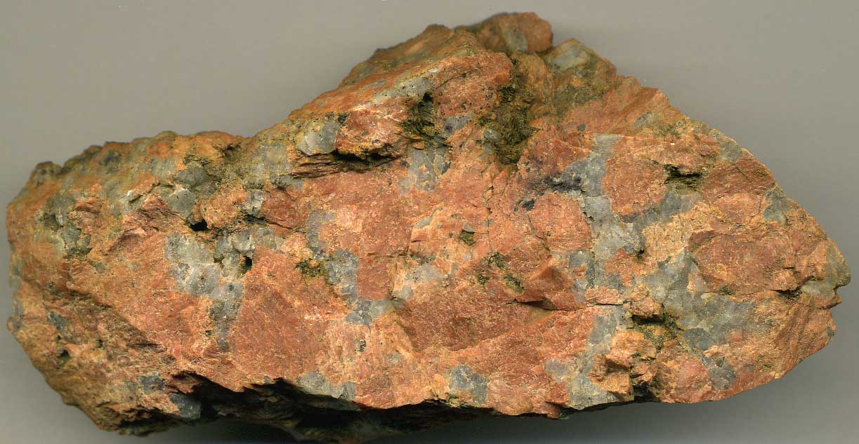
Coarsely-crystalline granite from the Pike’s Peak batholith in central Colorado. This Proterozoic-aged pegmatite is dominated by feldspar, quartz, and mica. Photograph by James St. John (Flickr; Creative Commons Attribution 2.0 Generic license).
Although they have essentially the same composition as the surrounding granite, pegmatites are composed of much larger crystals and may also yield rare, potentially valuable, minerals.
Paleozoic
The Rocky Mountains, like other regions of the Southwest, contain a succession of Paleozoic sandstone, limestone, and shale. Between the Cambrian and Mississippian, these rocks were deposited in shallow marine environments on what was then the western shore of North America. Early Paleozoic rock units can be found in the canyons of Utah’s Wasatch Mountains, at the edge of the Sawatch Range in Colorado, and along the deep gorge of the Colorado River, where thick layers of Cambrian and Ordovician sediments overlie the Precambrian basement.
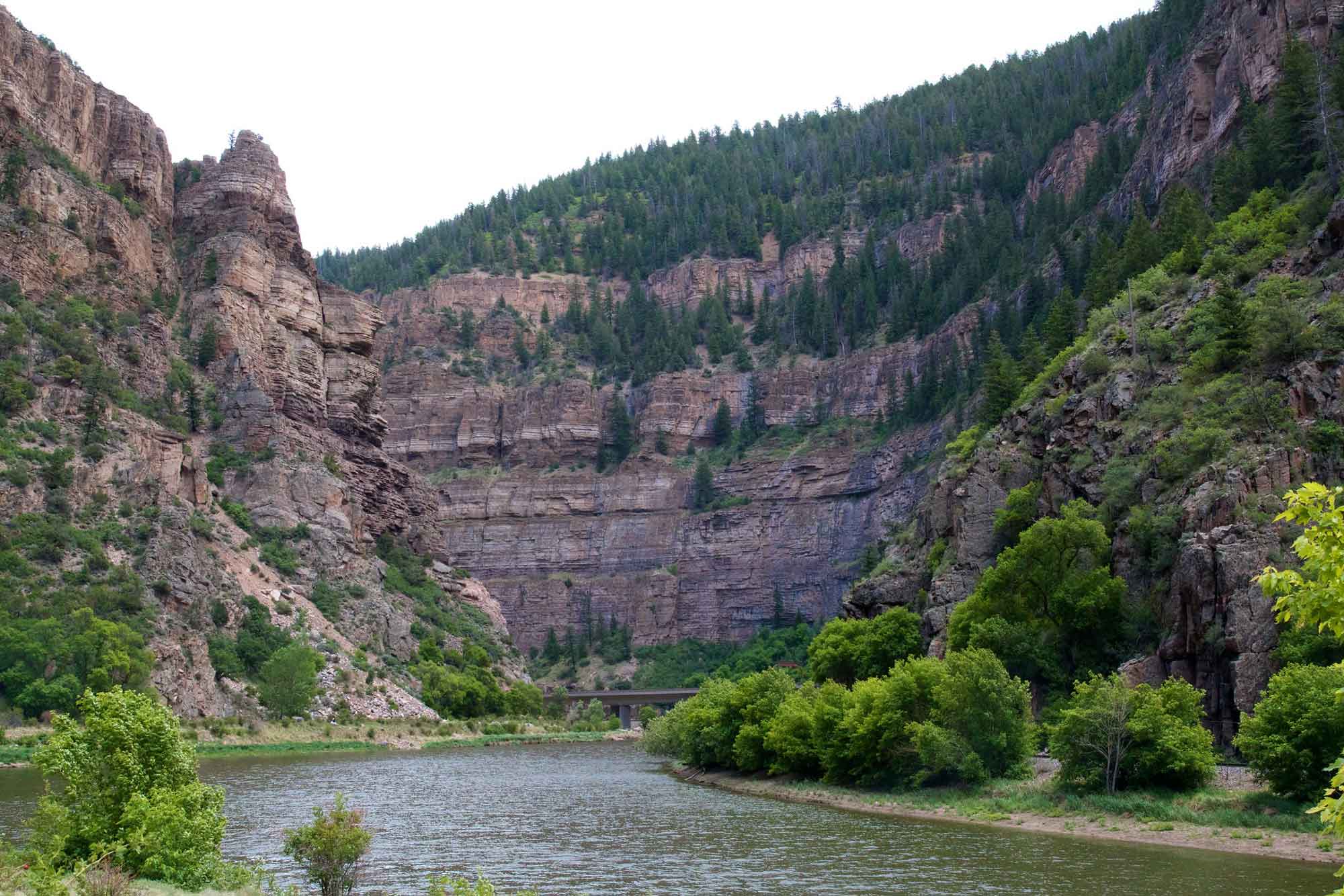
Cambrian and Ordovician strata are exposed in Glenwood Canyon, Colorado, where Interstate Highway I-70 follows the Colorado River. Photograph by Patrick Rasenberg (Flickr; Creative Commons Attribution-NonCommercial 2.0 Generic license; image resized).
Erosion during the Carboniferous deposited sediments on both the east and west sides of the mountains. This resulted in the formation of alluvial fans along the mountain flanks, and bedded sediments in lower areas. Mississippian rocks are generally gray limestone and dolomite; Cave of the Winds near Manitou Springs, Colorado is a cavern system developed in Mississippian limestone. The Pennsylvanian Fountain Formation along the eastern flank of the Colorado Front Range was deposited as a series of alluvial fans—wedge-shaped deposits of sediment formed when sediment was deposited at the mouths of ancient streams coming out of the mountains. It is composed of arkose covered by conglomerate and thin layers of mud and siltstone.
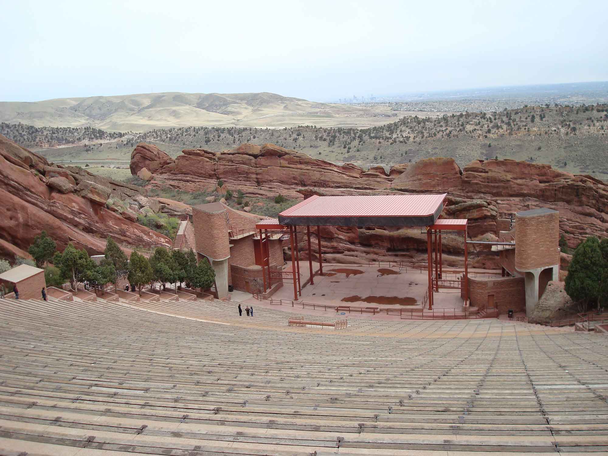
Red Rocks Park, a major music venue, is nestled within the towering Fountain Formation in Morrison, Colorado. The formation is composed of a sedimentary rock called arkose, which is red in color due to the presence of oxidized iron and a large number of pink feldspar and quartz grains. Photograph by Penn State University Library (Flickr; Creative Commons Attribution-NonCommercial 2.0 Generic license; image resized).
By the Permian, erosion had leveled the ranges and the area was flooded by shallow and evaporating seas, which deposited marine sandstone, mudstone, limestone, and phosphate-rich rocks (in the deeper zones). Today, these sedimentary layers are best seen around the edges of the Rocky Mountains, where beds have been tilted and pushed upward by mountain building processes. Fossils of marine invertebrates are common in these Paleozoic rocks (learn more here).
Mesozoic
Mesozoic rock units in the Rocky Mountains contain abundant fossils, especially those of dinosaurs and other vertebrates (learn more here). The region’s Triassic and Jurassic rocks were deposited in terrestrial settings, and include red beds, sandstone, mudstone, and limestone. Triassic red beds are composed of iron-rich sandstone or siltstone, while the Jurassic Morrison Formation is a striking variegated siltstone and shale colored in red, purple, gray, tan, and green. The Morrison includes lenses of sandstone, which often contain dinosaur bones that were deposited in streambeds. During the Cretaceous, marine shale and sandstone formed when the epicontinental Western Interior Seaway flooded the area, and coal formed along coasts and swamps. The Cretaceous Dakota Group is a yellow sandstone, often bearing ripple marks formed in beach or tidal zones.
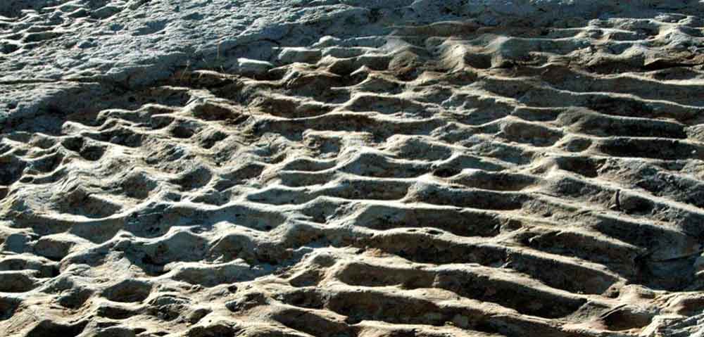
Ripple marks in the Dakota Sandstone of Dinosaur Ridge, Colorado. Photograph by James St. John (Flickr; Creative Commons Attribution 2.0 Generic license; image resized).
Dinosaur bones and trackways are present in several places. Cretaceous shale units have thick layers of black, gray, or tan, and often weather into badlands topography.
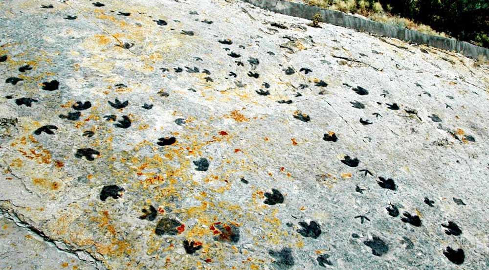
Dinosaur footprints in the Cretaceous Dakota Sandstone at Dinosaur Ridge, Colorado. Photograph by James St. John (Flickr; Creative Commons Attribution 2.0 Generic license; image resized).
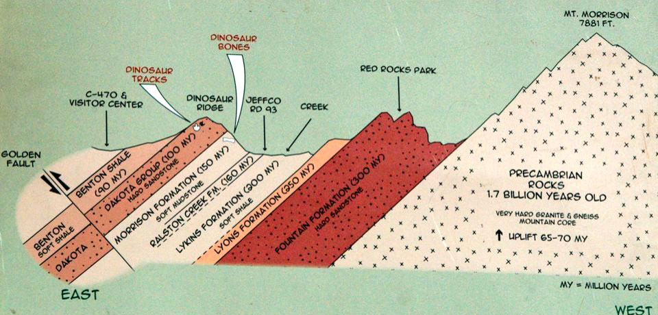
The Dakota Hogback is located along the edge of the Front Range just west of Denver, Colorado. This area preserves an important stratigraphic section that includes the Pennsylvanian Fountain Formation, Permian Lyons Formation, Permo-Triassic Lykins Formation, Jurassic Ralston Creek Formation and dinosaur fossil-bearing Morrison Formation, Cretaceous Dakota Group, and various Cenozoic formations that are exposed at the edge of the Denver Basin.
Stratigraphic units of the Dakota Hogback, a north-south trending ridge of eastward-dipping Mesozoic sedimentary rocks in north-central Colorado. Photograph by James St. John (Flickr; Creative Commons Attribution 2.0 Generic license).
The modern Rocky Mountains rose near the end of the Cretaceous—earlier in eastern Utah during the Sevier Orogeny, and later in Colorado and New Mexico during the Laramide Orogeny.
Cenozoic
Cenozoic rocks in the Rocky Mountains are mainly sandstones, shales, conglomerates, and mixed sediments that formed when eroding sediment from the uplifted Rocky Mountains was deposited by rivers onto alluvial fans, and into lakes, basins, and swamps. Where they are adjacent to volcanic areas, some stream sediments carry cobbles of volcanic rocks. Thick wedges of Cenozoic sediments were deposited on the flanks of uplifted ranges, and sedimentary basins and lakes were centers for the deposition of thick layers of shale and mudstone. Cenozoic deposits differ from one basin to another, reflecting local differences in weather and erosion.
The San Juan Volcanic Field is in the San Juan Mountains of southwestern Colorado and consists mostly of Oligocene lavas and breccias, and Miocene and Pliocene basalts. These rocks represent stratovolcano deposits, and include numerous calderas and ash flows, which contain rhyolite tuffs (felsic) and andesite (intermediate in composition).
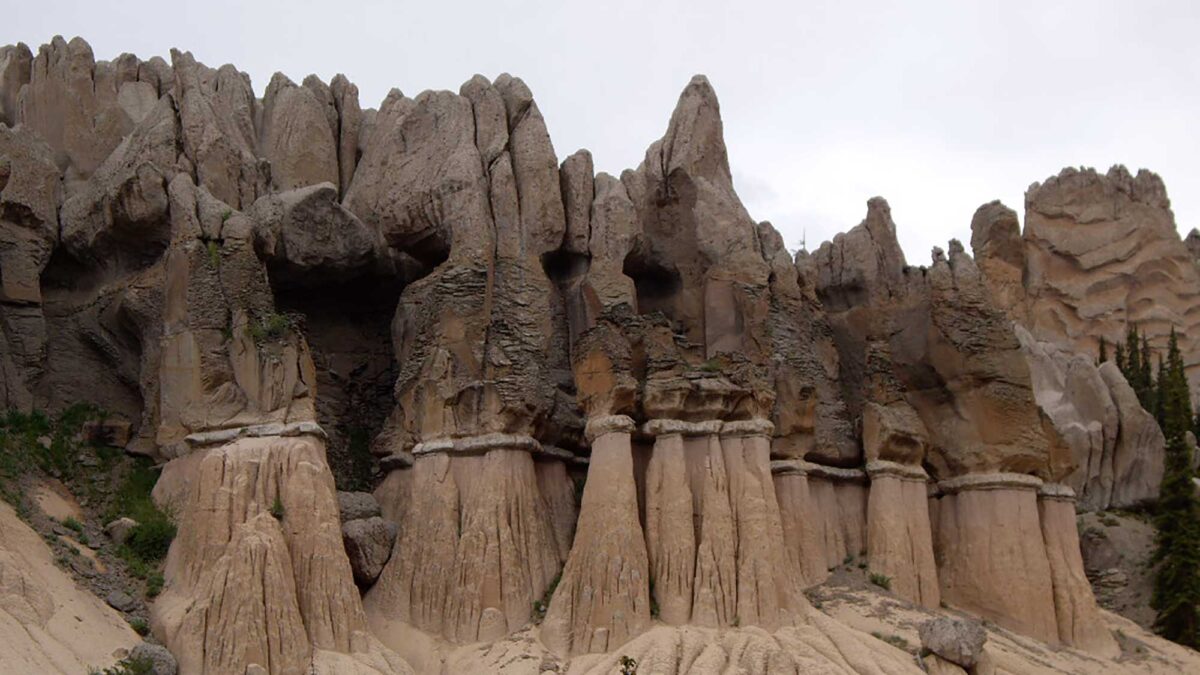
The field’s largest known caldera, La Garita, is associated with its largest known ash flow deposit. During the Oligocene, this caldera deposited thick layers of coarse volcanic tuff. Ash-flow tuffs are the result of pyroclastic flows—explosions that contain pulverized rock and superheated gases, which can reach temperatures of up to 1000°C (1830°F). The violent expansion of hot gas shreds the erupting magma into tiny particles that cool in the air to form dense clouds of volcanic ash. The tremendous explosions that are necessary to create ash-flow tuffs are caused by rhyolitic magma, which is felsic in nature. High silica content makes the magma quite viscous, preventing gas bubbles from easily escaping, thus leading to pressure build-ups that are released by explosive eruptions. The ash flows from these violent explosions tend to hug the ground, eventually solidifying into tuffs. Tuffs and other pyroclastic materials are vesicular (porous) due to gases expanding within the material as it cools. The Wheeler Geologic Area in the La Garita Mountains in southern Colorado is recognized for the unusual jagged shape of its terrain due to the erosion of these tuffs, forming striking hoodoos.
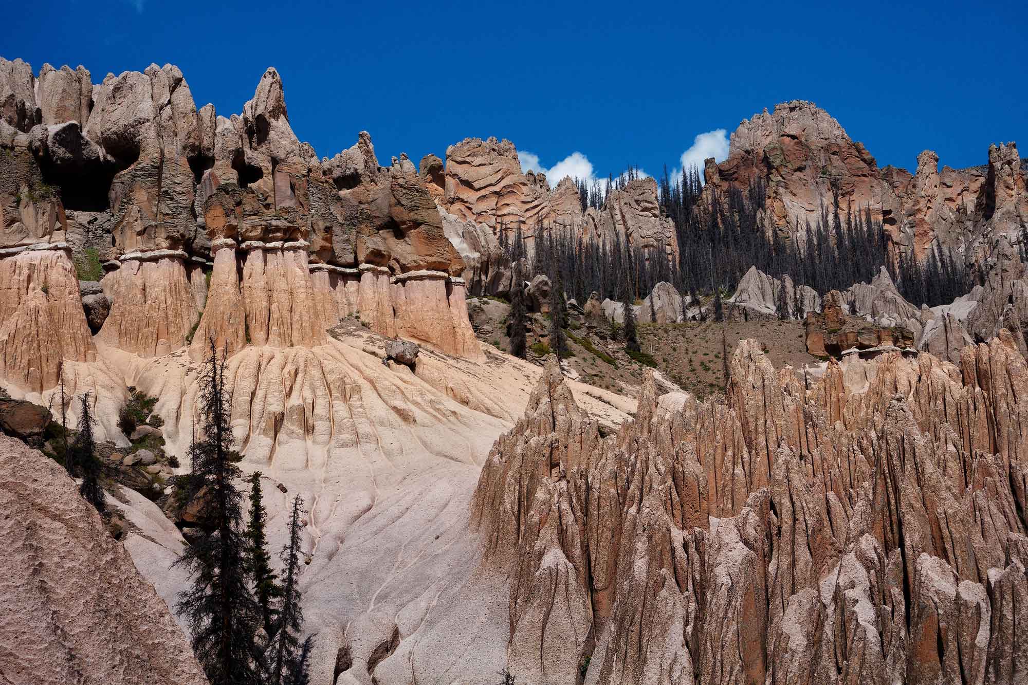
Eroded volcanic ash deposits in the Wheeler Geologic Area that resulted from the eruption of the La Garita supervolcano. Photograph by John Fowler (Flickr; Creative Commons Attribution 2.0 Generic license; image resized).
By the Miocene, volcanism in the area had become more mafic, representing a tectonic change to rifting during crustal extension.
Other than the volcanic fields at the edge of the Colorado Plateau and Great Plains, Phanerozoic volcanic and plutonic rocks are minor in the Rocky Mountain region. There are, however, a few notable exceptions. The Colorado Mineral Belt is a structural weakness in the Precambrian crust through which multiple igneous rock bodies were emplaced or erupted during the Paleocene (approximately 65 to 60 million years ago). The accompanying fluids carried gold, silver, other metals, and uranium, many of which have been mined for profit. (This was the primary source of gold during the Gold Rush of 1859.) In addition to deposits emplaced by hydrothermal solutions, contact metamorphism from the heat of Paleogene igneous activity altered the surrounding rock to form deposits such as the Yule Marble. This metamorphosed Mississippian limestone was transformed into a distinctive, smooth, white stone that is 99.5% pure calcite. Thanks to its smooth texture and pure white appearance, the Yule Marble has been used to cover the exterior of a variety of buildings and monuments including the Tomb of the Unknown Soldier and the Lincoln Memorial.
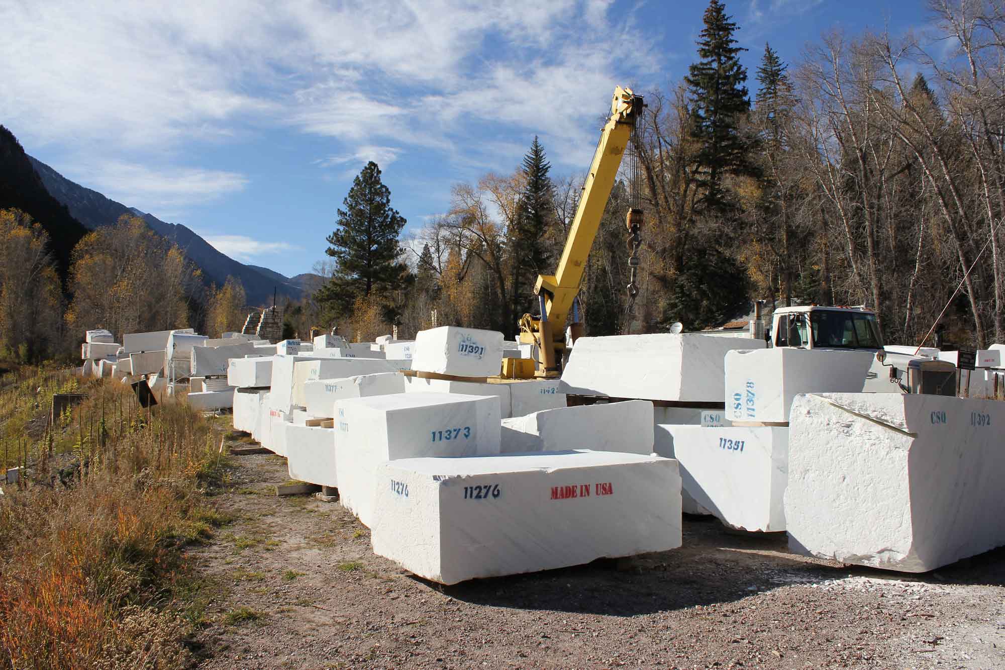
Blocks of quarried Yule Marble. Photograph by Jeffrey Beall (Flickr; Creative Commons Attribution-ShareAlike 2.0 Generic license; image resized).

The Lincoln Memorial’s brilliant white exterior is faced with Yule Marble. Photograph by Arthur T. LaBar (Flickr; Creative Commons Attribution-NonCommercial 2.0 Generic license; image resized).
Other Cenozoic-aged volcanic and intrusive activity can be found at Cripple Creek, Colorado (host of another large gold deposit); Questa, New Mexico (host of a molybdenum deposit); Thirty-Nine-Mile Volcanic Field southwest of Denver; and in various volcanic rocks near Steamboat Springs and North Park, Colorado. Near Gunnison, Colorado, there is an unusual igneous rock known as a carbonatite, a carbonate intrusive rock that does not possess the usual silicate composition. Some of the youngest volcanic activity in the region includes a basaltic cone and lava flow at Dotsero, Colorado, dated at approximately 2200 BCE. Interstate Highway I-70 actually crosses the foot of the flow.
Pleistocene glaciation produced glacial till and outwash material in the mountains and basins. Alpine glaciers, rather than continental ice sheets, carved cirques and deposited moraines in mountain valleys. Modern stream sediments are still deposited today.
Resources
Resources from the Paleontological Research Institution
Digital Encyclopedia of Earth Science: Minerals.
Earth@Home: Introduction to Rocks.
Earth@Home: Geologic maps.
Earth@Home: Geologic time scale.
Earth@Home Virtual Collection: Rocks (Virtual rock collection featuring 3D models of rock specimens sorted by type.)