

Page snapshot: Iowa State Geologic Map; Fossil; 3D models; Rock; Mineral; Gem; Highest and Lowest Elevations; Places to Visit; and Additional Resources.
Image above: Exposure of fossiliferous Devonian sedimentary rocks at Fossil & Prairie Park Preserve in northern Iowa. Photograph by Joe Passe (Flickr; Creative Commons Attribution-ShareAlike 2.0 Generic license; image cropped and resized).
Geologic Map of Iowa
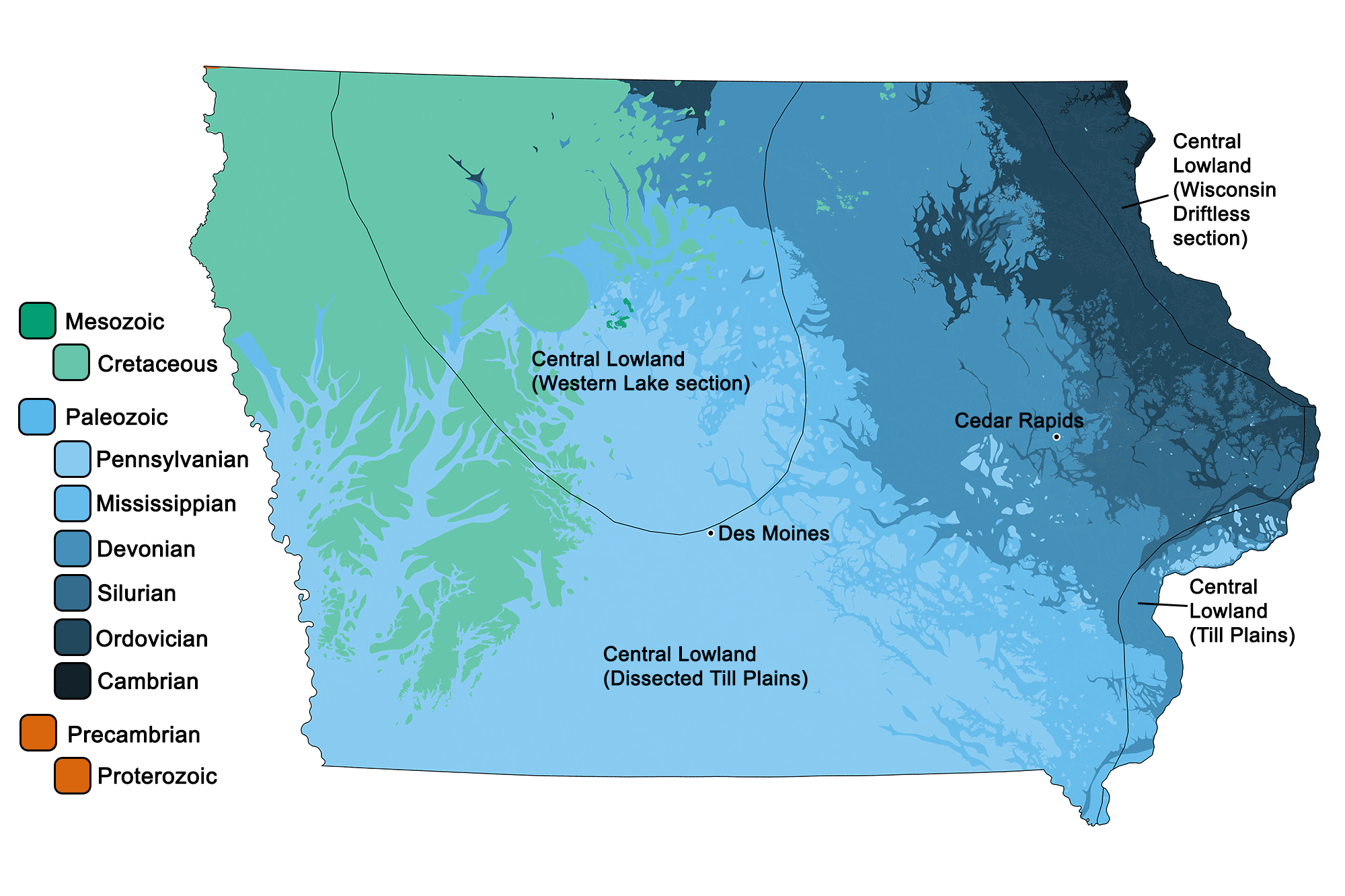
Geologic map of Iowa showing maximum ages of mappable units. Image by Jonathan R. Hendricks for the Earth@Home project developed using QGIS and USGS data (public domain) from Fenneman and Johnson (1946) and Horton et al. (2017).
Iowa State Fossil: None
Iowa does not yet have an official state fossil.
3D Models of fossils from Iowa
Fossil specimen of the tabulate coral Favosites favosus from the Silurian of Delaware County, Iowa (PRI 76737). Length of specimen is approximately 10 cm. Specimen is from the collections of the Paleontological Research Institution, Ithaca, New York.
Fossil specimen of the brachiopod Spinocyrtia iowensis from the Devonian of Benton County, Iowa (PRI 70766). Specimen is from the collections of the Paleontological Research Institution, Ithaca, New York. Longest dimenion of specimen is approximately 7 cm.
Fossil rugose coral (or, horn coral) Acrocyathus floriformis from the Mississippian of Van Buren County, Iowa (PRI 50370). Specimen is on display at the Museum of the Earth, Ithaca, New York. Length of specimen is approximately 9 cm.
Fossil ammonoid (goniatite) cephalopod Imitoceras rotatorium from the Mississippian of Floyd County, Iowa (PRI 44566). Specimen is on display at the Museum of the Earth, Ithaca, New York. Maximum diameter of specimen is approximately 8.5 cm.
Iowa State Rock: Geode
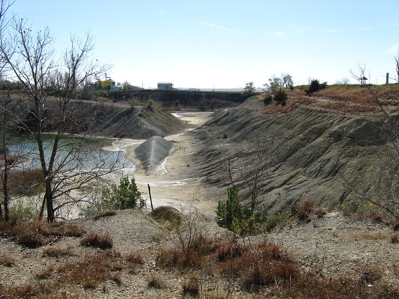
The state rock of Iowa is a geode. The town of Keokuk in southeastern Iowa is one of the most productive sites of geodes in the world. The formation of these geodes is not completely understood, but it is thought that when the bedrock initially formed, spherical concretions of calcium carbonate were accumulated among the layers of mudstone. Subsequently, water richer in silicon dissolved these concretions, leaving an open space in the rock where silicon, as quartz, could precipitate. In this way, the quartz crystals grew slowly from the outside inward, frequently leaving a hollow space in the center. Because quartz geodes are much harder than mudstone, the hollow orbs may often be found loose on the ground after the bedrock has been eroded away.
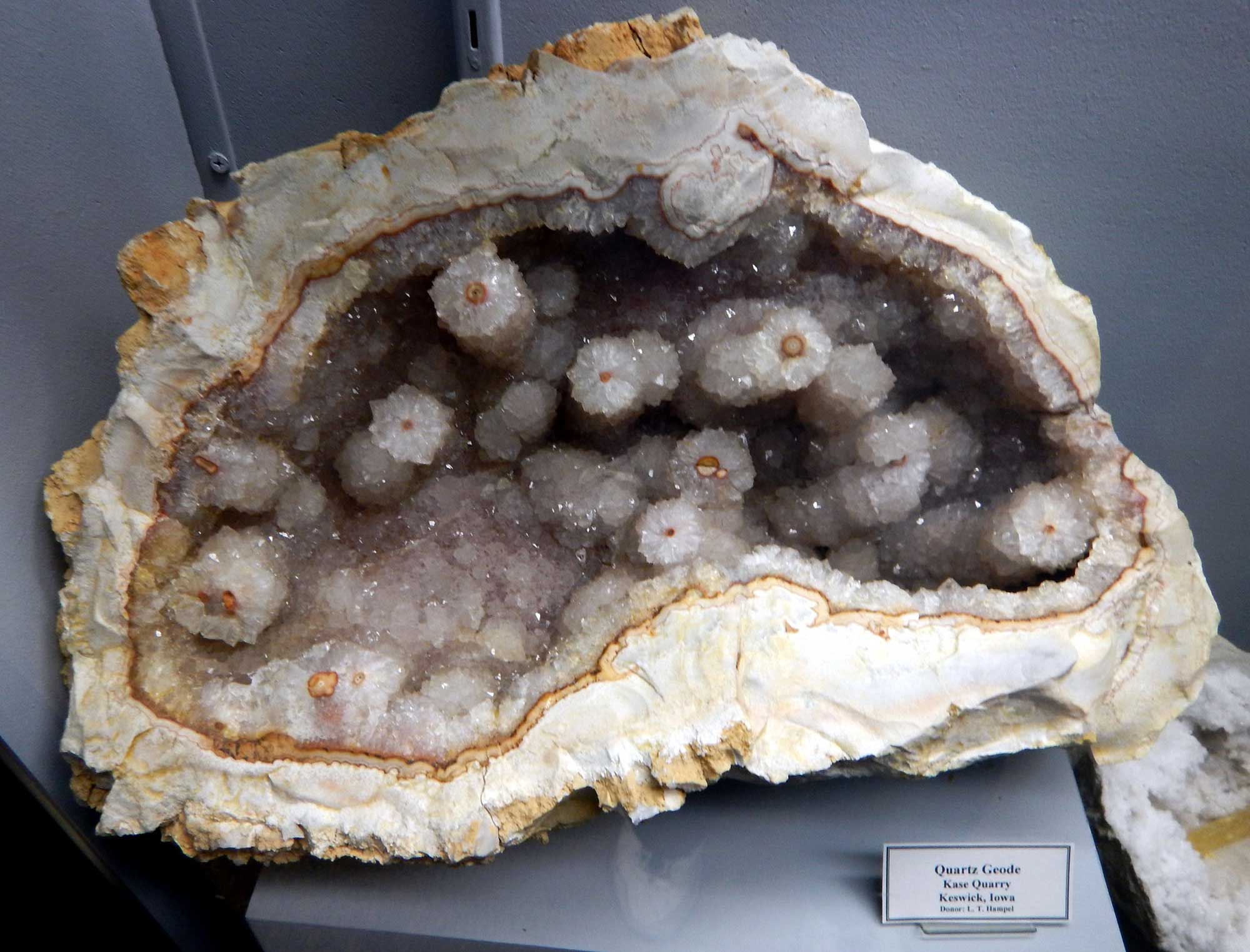
A large geode from Keswick, Iowa. Photograph by Mike Beauregard (Flickr; Creative Commons Attribution 2.0 Generic license).
State Mineral: None
Iowa does not yet have an official state mineral.
Iowa State Gem: None
Iowa does not yet have an official state gem.
Iowa's Highest and Lowest Elevations
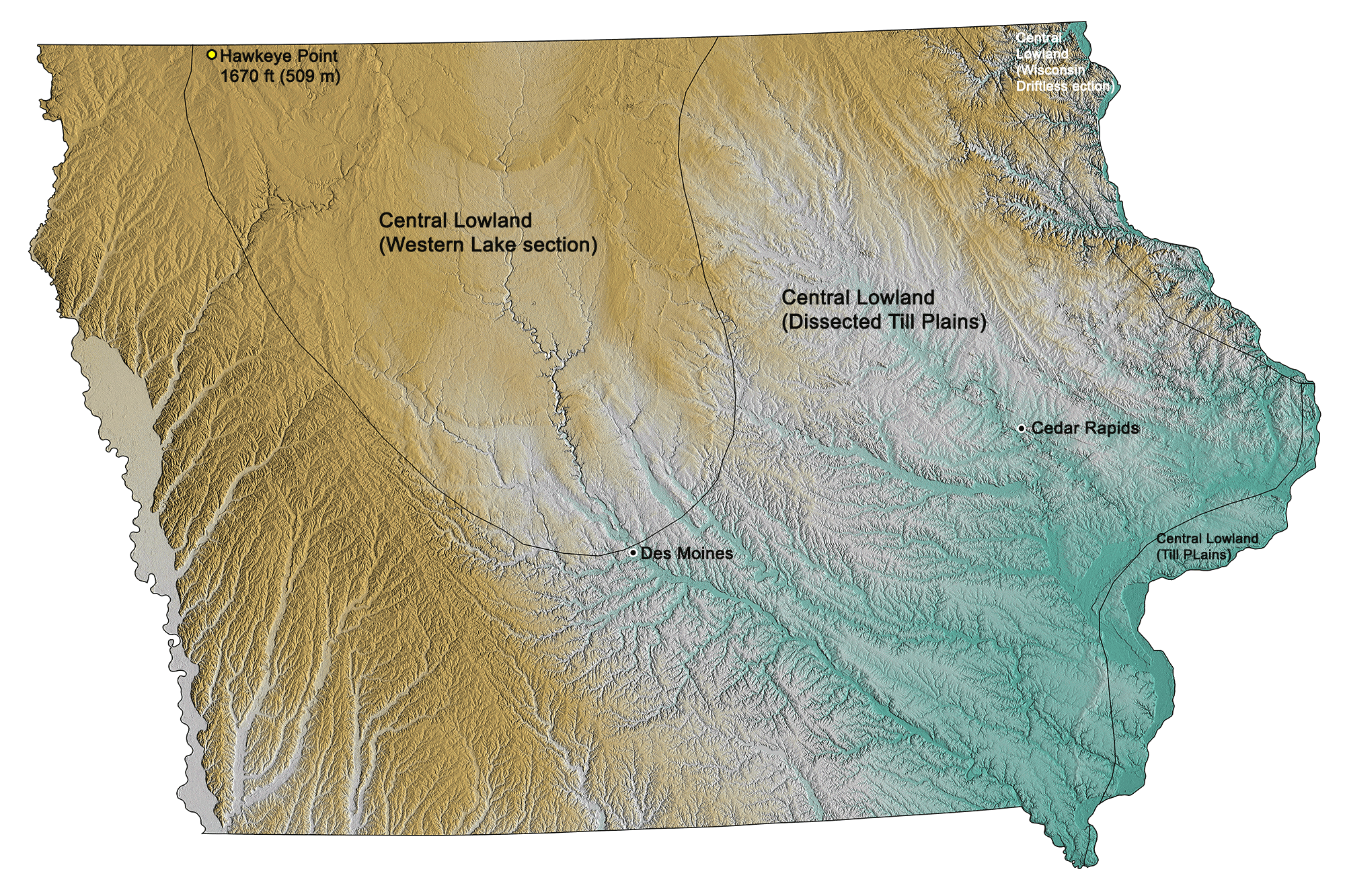
Topographic map of Iowa with physiographic regions and point of highest elevation identified. Topographic data are derived from the Shuttle Radar Topography Mission (SRTM GL3) Global 90m (SRTM_GL3) (Farr, T. G., and M. Kobrick, 2000, Shuttle Radar Topography Mission produces a wealth of data. Eos Trans. AGU, 81:583-583).
Highest Elevation: Hawkeye Point
Hawkeye Point, the highest point in Iowa at 509 meters (1670 feet), is just south of the Minnesota border in the northwest.
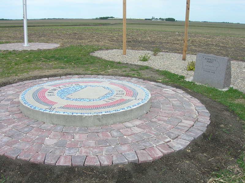
Hawkeye Point, the highest elevation in Iowa. Photograph by Jimmy Emerson, DVM (Flickr; Creative Commons Attribution-NonCommercial-NoDerivs 2.0 Generic license).
Lowest Elevation: Des Moines and Mississippi Rivers
Iowa’s lowest point of 146 meters (480 feet), the confluence of the Des Moines and Mississippi Rivers, also marks the southeastern-most point in the state.
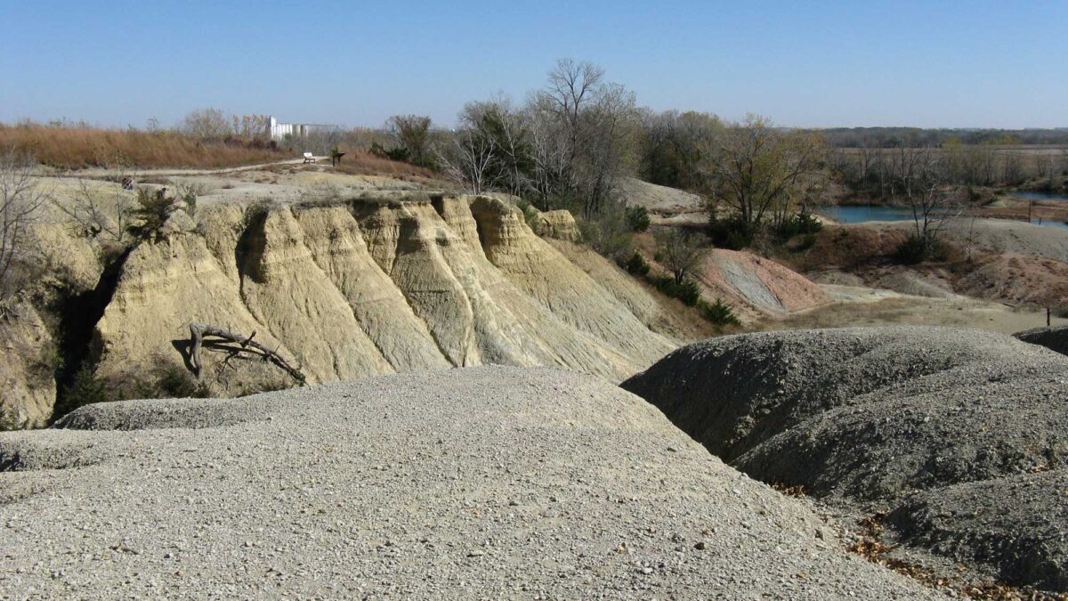
Places to Visit
Fossil & Prairie Park Preserve. Photograph by Joe Passe (Flickr; Creative Commons Attribution-ShareAlike 2.0 Generic license).
Anderson Geology Museum
Cornell College, Mount Vernon, Iowa.
Additional resources
Earth@Home resources about Iowa and nearby states:
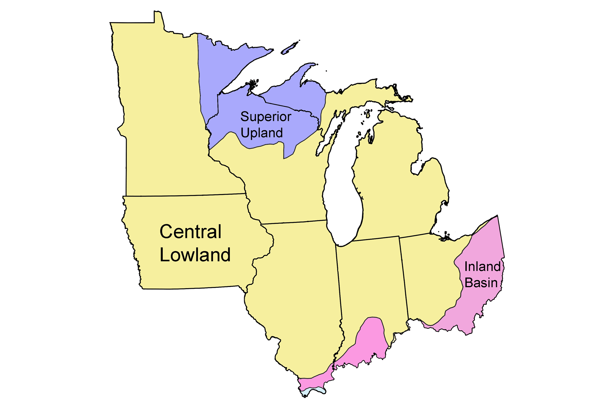
- Rocks: Superior Upland, Central Lowland, and Inland Basin
- Fossils: Superior Upland, Central Lowland, and Inland Basin
- Topography: Superior Upland, Central Lowland, and Inland Basin
- Mineral Resources: Superior Upland, Central Lowland, and Inland Basin
Earth@Home resources about the Midwest region of the United States: