

Chapter Contents
Photo above: raised houses on Holly Beach, LA by jc.winkler via Wikimedia Commons (CC BY 2.0)
This section presents examples of adaptation responses to different hazards from a changing climate:
Rising Sea Level
Coastal communities sometimes experience flooding during high tides. These tidal floods provide a view of the future with rising seas, when today’s tidal floods become the future’s everyday floods. Cities along the U.S. Atlantic coast are already experiencing more "nuisance" or "sunny day" flooding, from Maine to Florida. In addition to nuisance flooding, rising sea level can lead to coastal erosion, property damage, saltwater intrusion into freshwater aquifers and ecosystems, and permanent flooding of coastal land and infrastructure. When coastal storms with intense winds produce storm surge—a rising sea pushed onto land—higher sea levels lead to higher storm surge and more storm damage and risk to human lives.
Sea level rise affects billions of people worldwide. In 2020, 40% of the world’s population lived within 60 miles (100 km) of a coast. In the US, Florida has the most cities at risk, but cities such as New York, Boston, Charleston, New Orleans, San Francisco, Seattle, and many smaller cities are also vulnerable to sea level rise. Sea level rise also affects estuaries far upstream from the ocean. For example, Saugerties, NY, a town on the Hudson River, experienced storm surge flooding from Hurricane Sandy in 2012 even though the town is about 100 miles up the river. In addition, as sea level rises, salt water gets pushed further up into the freshwater region of an estuary, putting ecosystems and water resources for people at risk.
Strategies to protect coasts and communities from sea level rise include building structures that break or attenuate waves, maintaining and enhancing natural protective coastline features, setting restrictions and rules on whether and how coastal land can be developed, and relocating infrastructure and communities to higher ground. Building hard structures such as seawalls, levees, storm surge barriers, and breakwaters was common in the mid-20th century, but more recently organizations such as the Army Corps of Engineers have favored nature-based approaches such as building dunes, planting dune grasses and other native plants to stabilize dunes and reduce erosion, and nourishing (i.e., adding sand to) beaches.
Video about the Dryline, a vision for a protective system around southern Manhattan. The idea was developed as part of the Rebuild by Design project, a response to the destruction from Hurricane Sandy in 2012. "The Dryline - BIG Teams Vision for Rebuild by Design" by Bjarke Ingels Group (YouTube)
Other nature-based approaches include maintaining and enhancing wetlands, coastal forests, barrier islands, and oyster reefs. These natural features help to prevent erosion, break waves offshore, and reduce the energy of incoming waves. They also serve other functions such as absorbing stormwater and providing habitat for commercially important fish and shellfish species. Some adaptation projects have used nature-based engineering, for example, they have created artificial oyster reefs or other structures that replicate natural ones.
Policies, regulations, building codes, and flood preparedness and insurance programs all play a role in adapting to rising seas. Communities can set restrictions on where buildings can be built, limiting development extremely close to the coast where beaches and buildings are at greatest risk. Communities can also create building codes that require new construction to be more storm-resistant, built on stilts, or made with the capacity to float. They can define “rolling easements” on property, which recognize that wetlands and beaches will migrate inland, regardless of whether properties will be eroded or flooded. Flood insurance rates for coastal properties can be set to reflect the reality of the risk in coastal zones, which is high. Finally, communities need to create effective flood and storm warning and preparedness programs, to keep residents safe in place or to evacuate them when necessary.
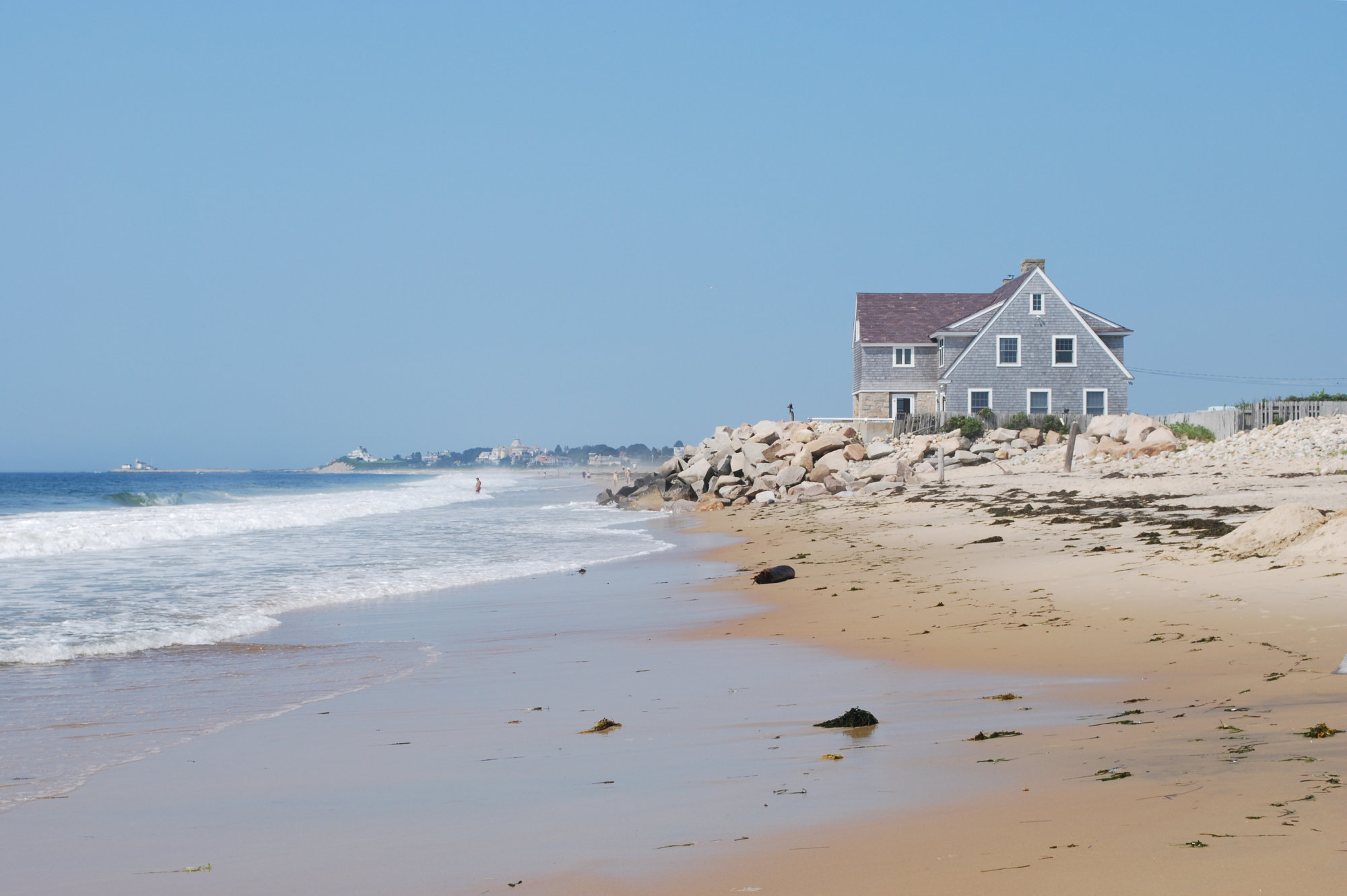
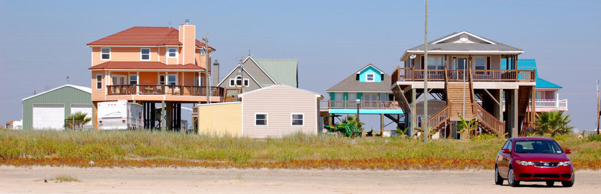
Beach house at Misquamicut Beach, RI. Photo by Juliancolton via Wikimedia Commons (public domain)
Some communities will need to consider relocation. This is already happening in places such as the village of Shishmaref, AK, where residents voted in 2016 to move their entire village away from a barrier island; in Staten Island, NY, where some residents left with no plans to return following devastation from Hurricane Sandy; and in Isle de Jean Charles, LA, where residents received the first ever grant of federal funding to help them relocate because of rising sea level brought on by climate change. Relocation can involve moving critical infrastructure such as hospitals, wastewater treatment plants, and bridges, but it can also involve moving entire communities or neighborhoods farther inland to higher ground. Other proposals have included building up low-lying areas of cities such as Norfolk, Virginia, which face the combined pressures of low elevation, rising seas, and naturally subsiding ground. The financial and social costs of relocation can be enormous, which is why mitigation—taking action to reduce the rate and magnitude of climate change, rather than relying entirely upon adaptation—is critical.
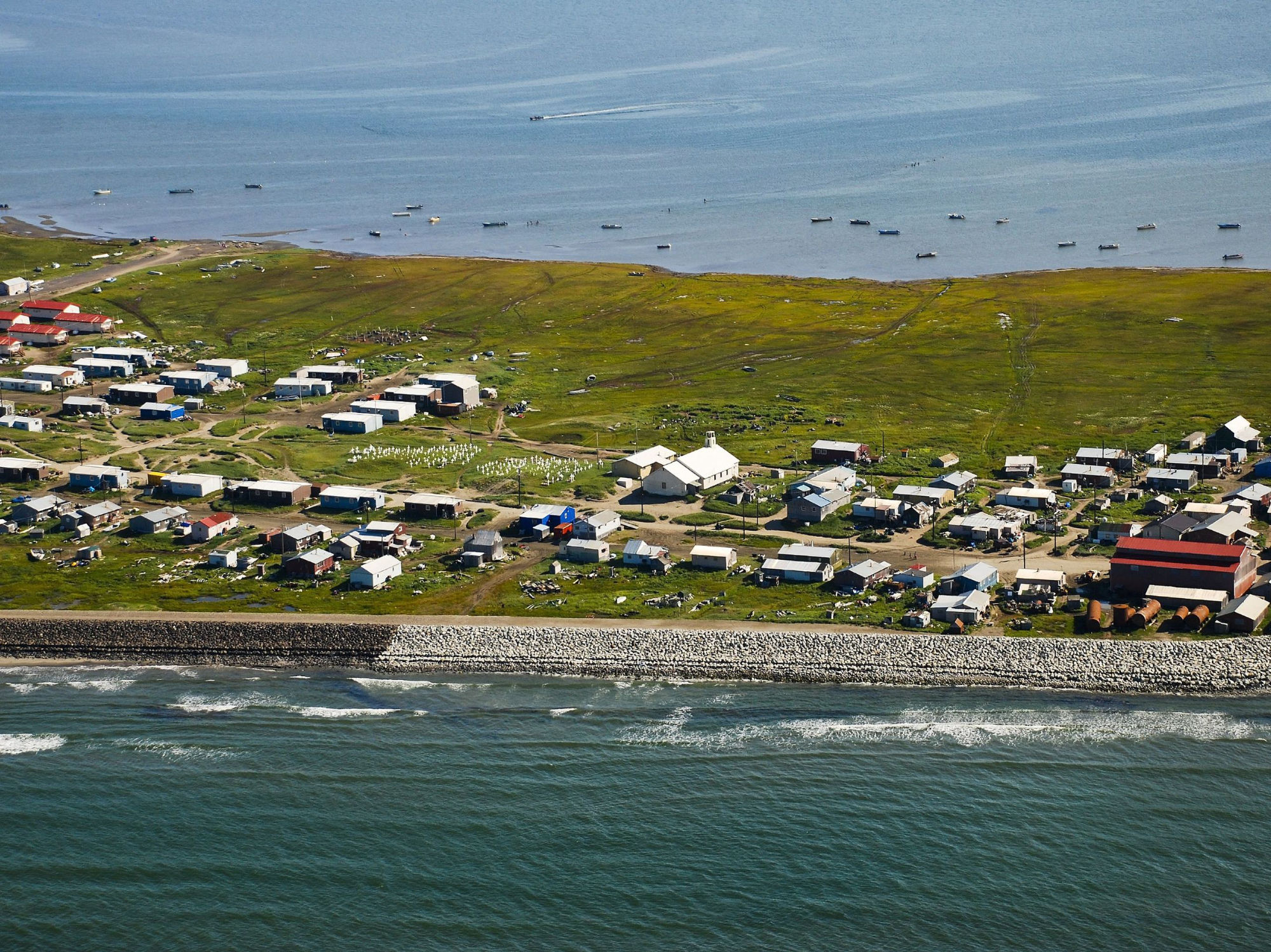
Village of Shishmaref, AK, which voted in 2016 to move inland. Photo: Bering Land Bridge National Preserve via Wikimedia Commons (CC BY 2.0)
_edit_(15653586503).jpg)
Extreme Heat
Extreme heat and heat waves—defined as a series of consecutive days with exceptionally high air temperatures—can be deadly. In fact, extreme heat is the most deadly weather hazard. According to data from the National Weather Service, extreme heat killed more people in the US during the period 1986-2020 than any other weather hazard, including floods, tornadoes, lightning, hurricanes, winter storms, and extreme cold. During an intensely hot period in July of 1995, 733 people died from heat-related illness in Chicago. In 2003, a heat wave in Europe killed over 70,000 people, and in 2010, a heat wave in Moscow killed more than 10,000 people. Heat waves often disproportionately affect vulnerable populations: people who don’t have enough income to pay for air conditioning at home, elderly people living alone who can’t get themselves to cool locations, or people living in neighborhoods with high crime rates who are afraid to open windows.
Heat waves also stress ecosystems, livestock, and infrastructure. Dairy cows produce less milk and crop growth can slow during periods of intense heat, paved roads and railways can buckle, and airplanes may not be able to take off because of physical limitations at high temperatures. Thermal power generation capacity can suffer because of lack of cool water for cooling purposes. Energy systems are strained during heat waves when electricity demand for air conditioning rises, sometimes leading to brownouts and blackouts. These power disruptions in turn put strain on communications and emergency response systems. Heat waves combined with drought can increase the likelihood of wildfires. Under a warming climate the frequency and length of heat waves has increased in much of the U.S. This trend has already been noted in recent decades and is expected to continue.
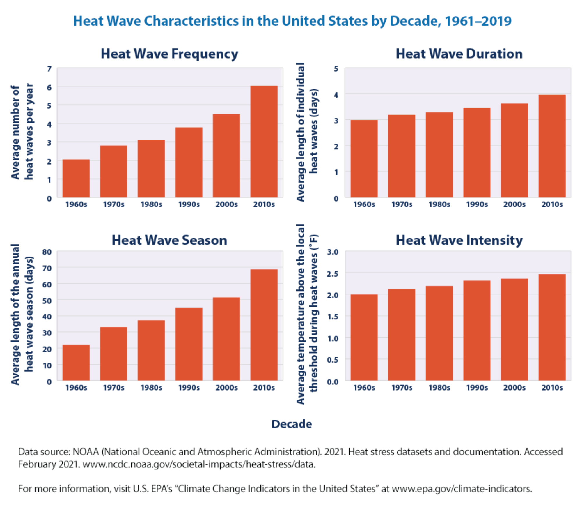
Data showing how heat waves in the U.S. have become more frequent, longer in duration, and intense since the 1960s, and how the heat wave season has expanded during this time period. Image from U.S. EPA Climate Change Indicators website.
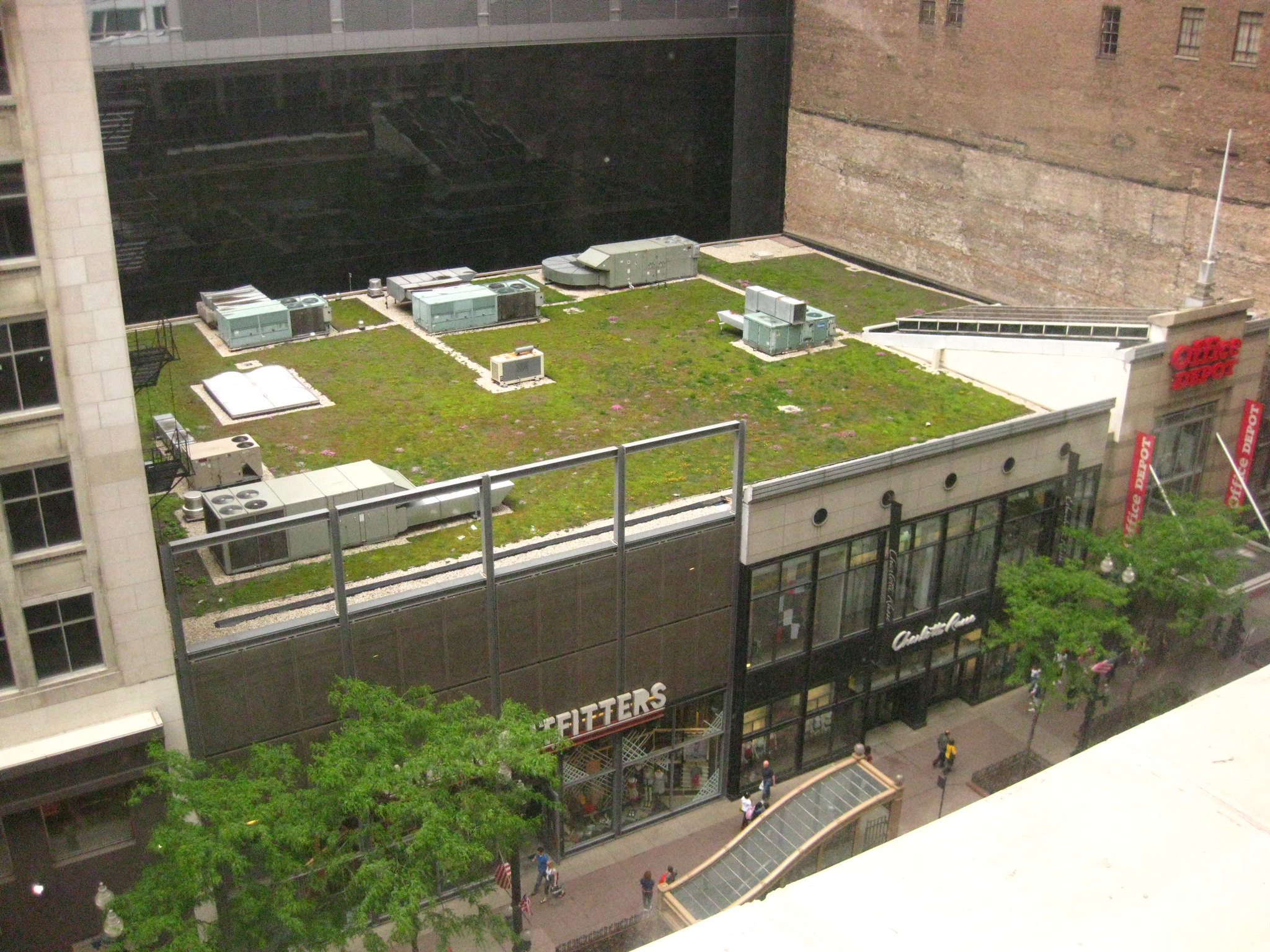
Adaptation efforts to deal with extreme heat are underway, especially in urban areas where pollution, pavement, and the surfaces of buildings magnify localized warming in a phenomenon called the urban heat island effect. Strategies to reduce this effect often focus on reducing absorption of sunlight. Approaches include planting trees along city streets and in open spaces to provide shade, and building living roofs—rooftops covered with living plants instead of asphalt or other materials. These techniques involving vegetation lead to measurable cooling: areas shaded by trees can be 20–45°F (11–25°C) cooler than the hottest temperatures of unshaded areas.[Akbari et al., 1997] Plants can cool a roof or other surface by lightening the surface color (compared with dark asphalt), since light colors absorb less sunlight and radiate less heat than dark colors. A layer of plants can also provide insulation on a roof (and they provide the added benefit of soaking up stormwater.) Where living roofs are not feasible, painting roofs with reflective paint can help keep buildings cool. Using lighter colored paving materials for streets can also reduce local warming.
In addition, plants can cool the air through evapotranspiration. Evapotranspiration is a combination of evaporation of liquid water on plant leaves and in the soil around the plant and transpiration, the transfer of water from a plant’s roots to its leaves and then to water vapor in the air. Evapotranspiration cools the air because it takes heat from the air to convert liquid water to water vapor.
In addition to making structural changes to keep cities cool, communities must develop effective heat warning systems to alert residents to the dangers of extreme heat, and put in place heat response plans to protect residents. These systems and plans must pay particular attention to vulnerable populations such as the elderly, residents with low incomes, and non-English speakers who may find it hard to get weather and safety information they can understand. The heat response plans might include actions such as using neighborhood social networks to check on elderly residents, opening air-conditioned cooling centers for the public, and providing maps and transportation to these centers.
Newscast from Houston, TX during an extreme heat event, illustrating some components of a municipal heat emergency plan. "Houston activates heat emergency plan" by KPRC (YouTube)
Agricultural strategies to adapt to more frequent heat waves include using fans, sprinklers, and other cooling methods in livestock barns, and developing new crop varieties that can tolerate heat better. For activities such as transportation, telecommunications, and energy distribution, many of the adaptation strategies for extreme heat involve technological solutions. For example, power lines may need upgrading with wiring and transformers that work well at higher temperatures. Bridge and road materials may also need upgrading, and public transportation systems such as subways and buses may need more and better air conditioning. In addition, if large-scale systems that use energy can be made more energy efficient, it will reduce the strain on electrical systems during heat waves when demand is high.
Heavy Rainfall
The air around us contains water vapor, and the amount of water vapor that the air can contain depends on temperature. For example, at standard pressure, air at 68°F (20°C) is saturated (i.e., can't hold any more water vapor) when it contains about 17 grams of water vapor per cubic meter, but air at standard pressure and a temperature of 86° F (30°C) can contain much more water vapor—about 30 grams per cubic meter. When warm, moist air is cooled, the water vapor condenses into droplets that will fall as rain under the right conditions.
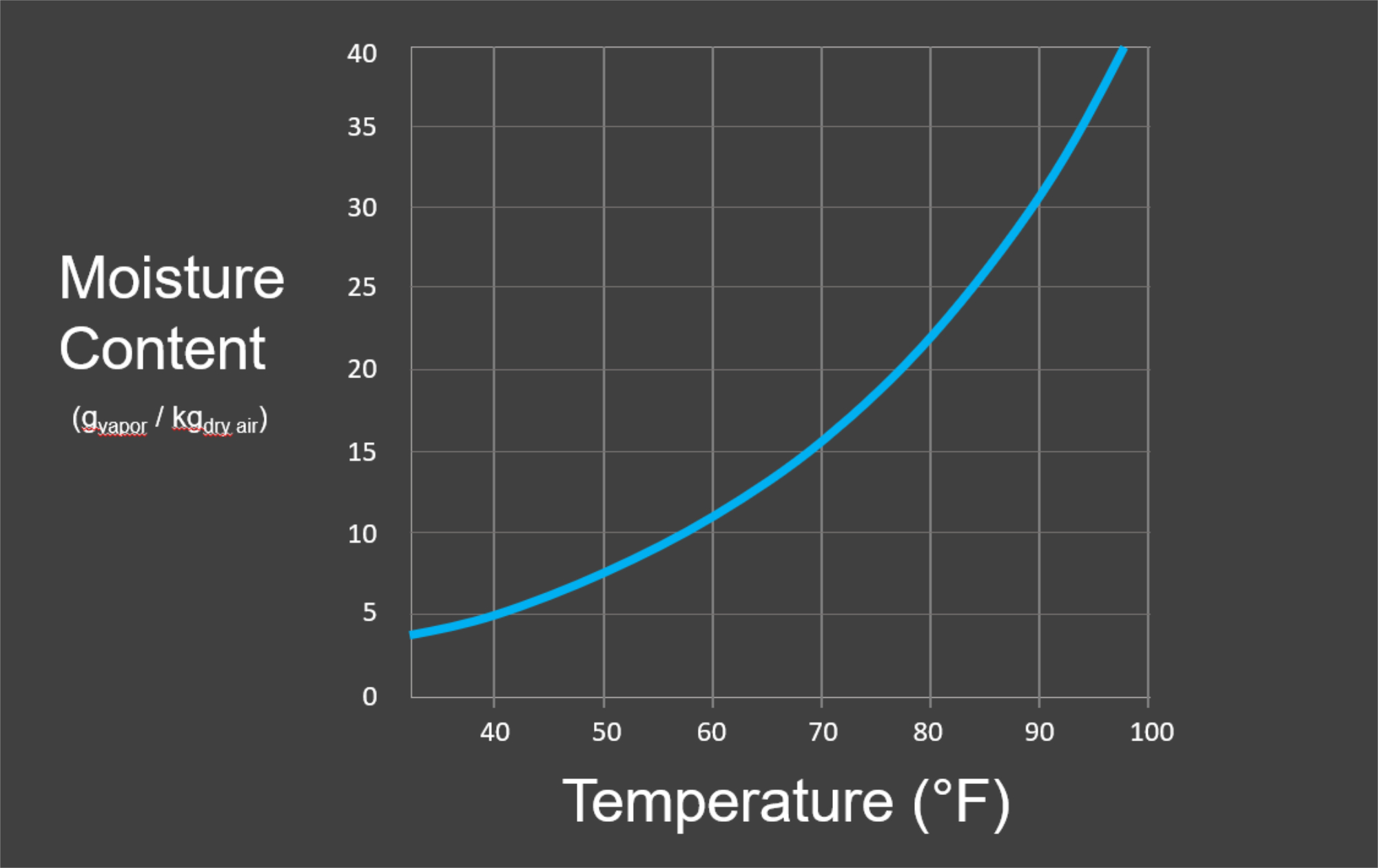
Graph of the moisture content of air at standard pressure, measured in grams of water vapor per kilogram of dry air, as a function of air temperature. Figure by Alexandra Moore and Ingrid Zabel for PRI's Earth@Home project (CC BY-NC-SA 4.0 license).
In a warming climate, higher air temperatures lead to air that contains more water vapor before becoming saturated, and this means that when it does rain, more water is available to fall. Some parts of the world are getting more rainfall and some are getting less, but heavy downpours have been increasing in most regions of the U.S., and are expected to continue to increase.
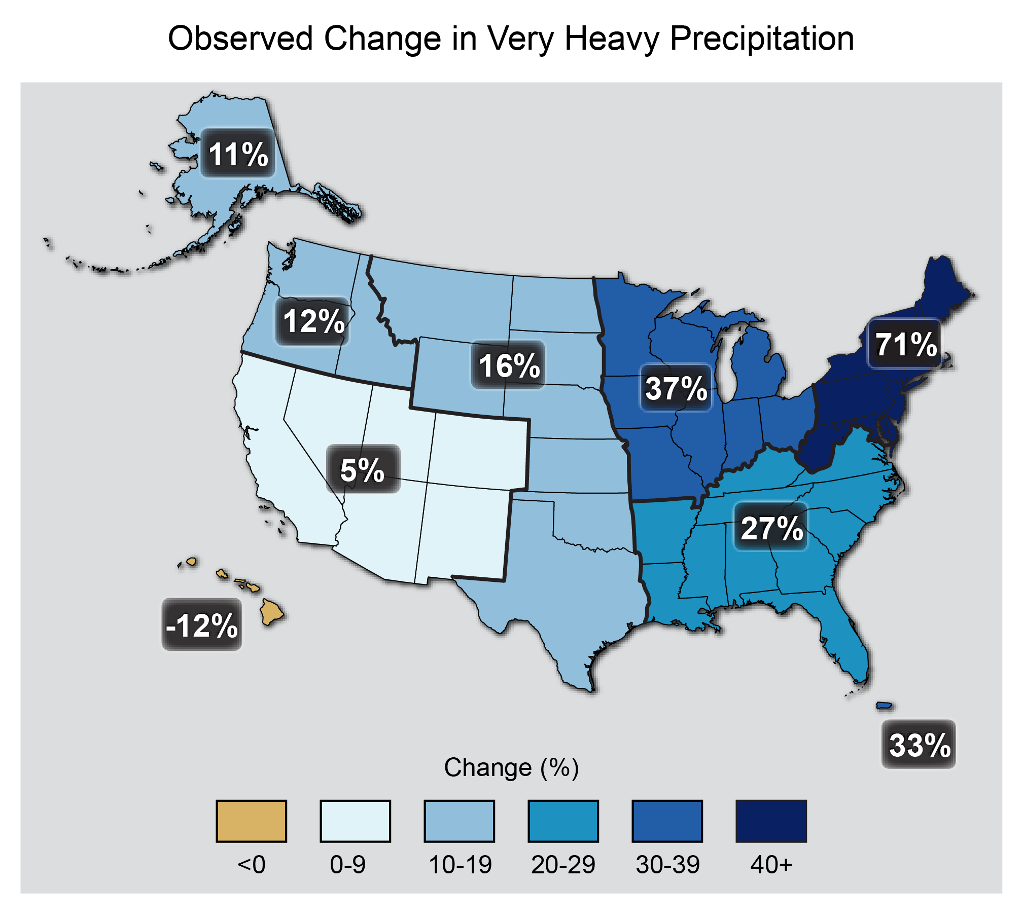
The map shows percent increases in the amount of precipitation falling in very heavy events (defined as the heaviest 1% of all daily events) from 1958 to 2012 for each region of the continental United States. These trends are larger than natural variations for the Northeast, Midwest, Puerto Rico, Southeast, Great Plains, and Alaska. The trends are not larger than natural variations for the Southwest, Hawai‘i, and the Northwest. The changes shown in this figure are calculated from the beginning and end points of the trends for 1958 to 2012.Map: US Third National Climate Assessment (2014). Original source: updated from Global Climate Change Impacts in the United States (2009); Thomas R. Karl, Jerry Melillo, and Thomas C. Peterson, eds., US Global Change Research Program.
A large amount of rain falling in a short time can overwhelm stormwater management and sewer systems and lead to dangerous, destructive flooding and mudslides. It can also wash nutrients from farms and pollutants into sensitive ecosystems and drinking water reservoirs. Heavy rains can overwhelm the natural shape and flow of a drainage basin and can lead to catastrophic flooding almost anywhere.
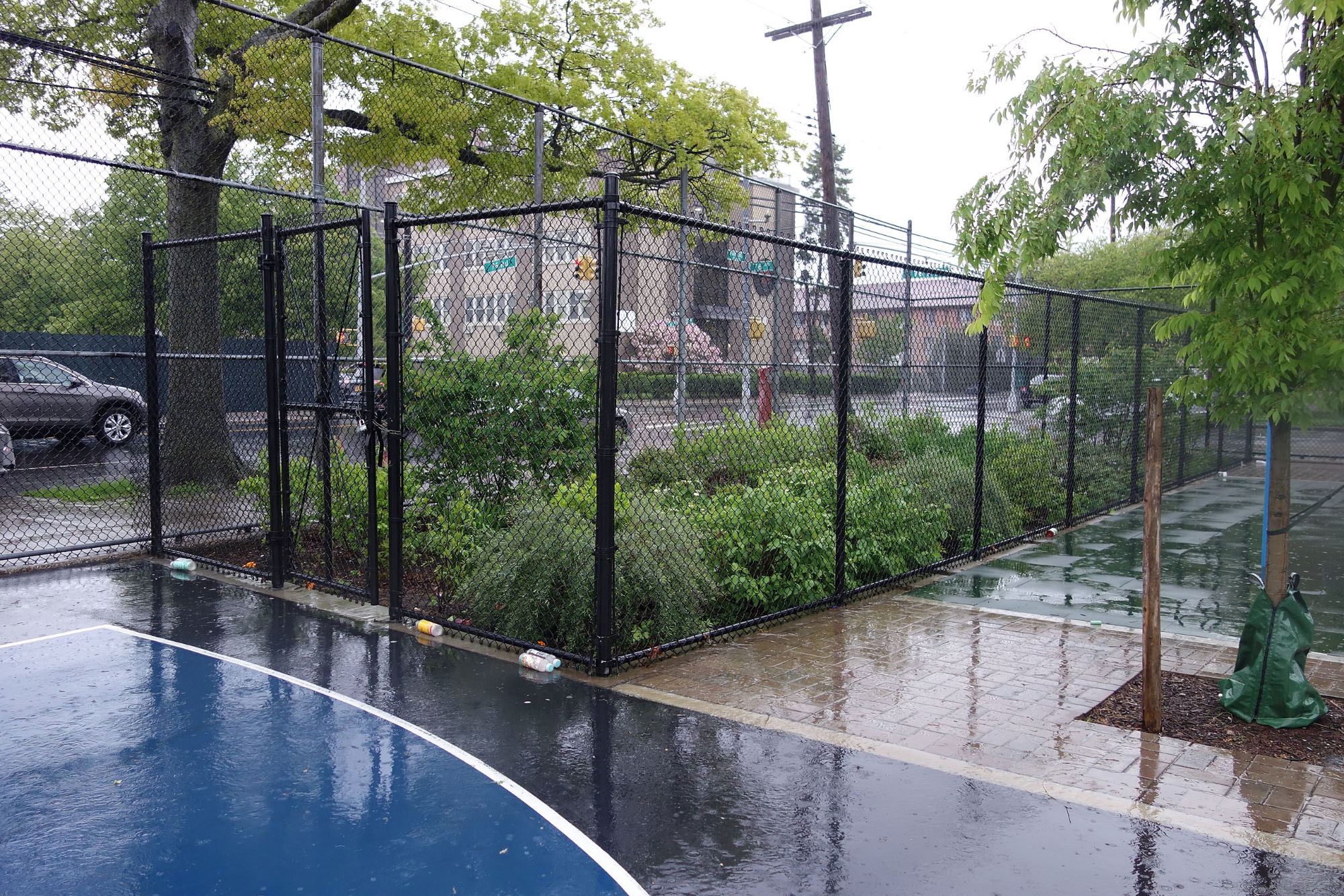
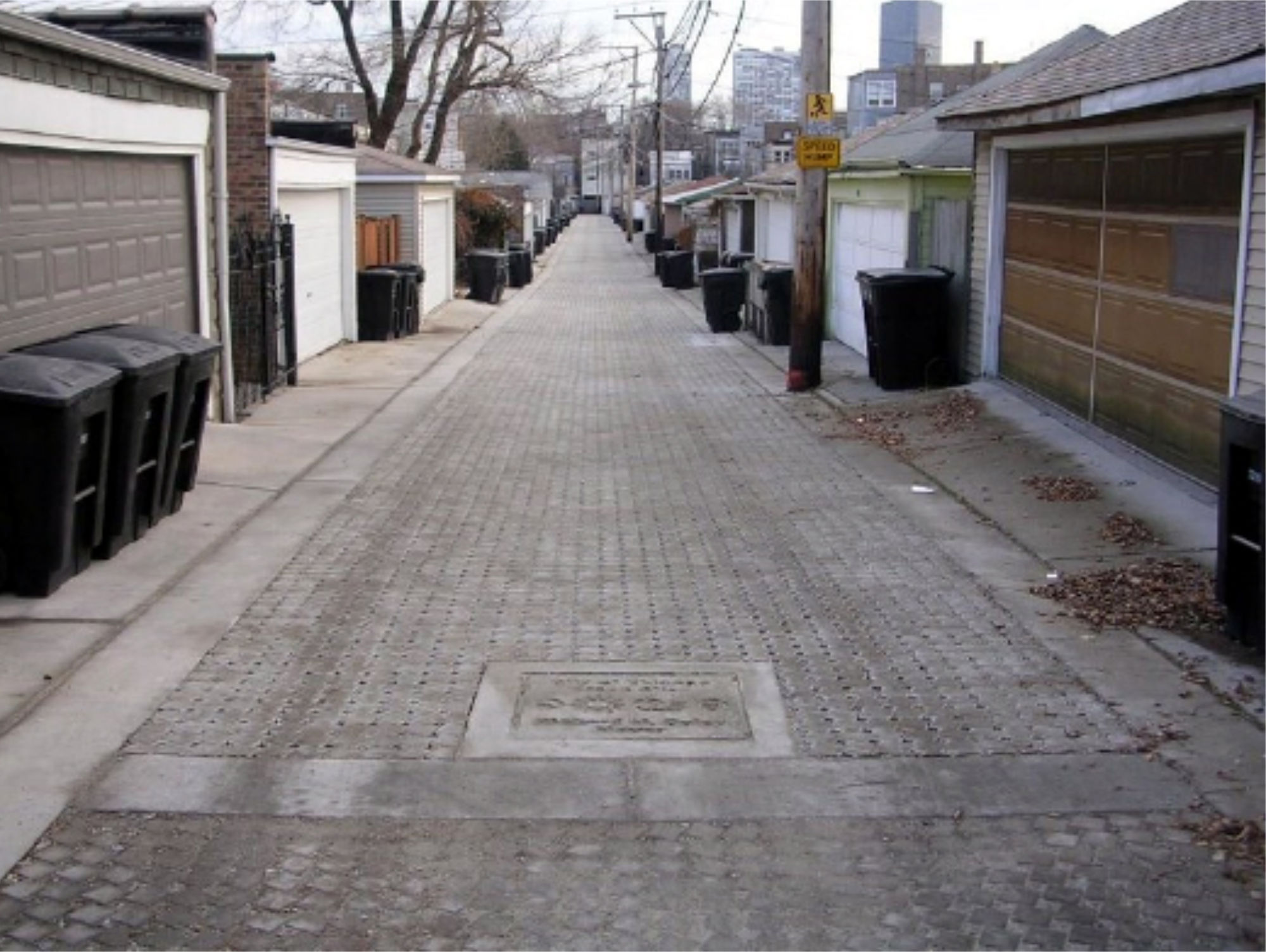
One way that cities are addressing the increased risk of heavy rainfall is through the use of green infrastructure. Conventional or “gray” ways of managing heavy rainfall in cities involve capturing the rain with gutters and storm sewers and moving it away through pipes to nearby streams, rivers, or lakes. Green infrastructure incorporates soil, trees, and other plants, and uses them to absorb and filter rainwater. The absorption reduces the amount of stormwater that could potentially flood streets and neighborhoods, and any excess water is cleaner after being filtered.
One example of green infrastructure is a rain garden, typically a basin near a sidewalk or street containing decorative plants. The garden collects and absorbs rainwater, reducing pollution and preventing flooding. Building and maintaining a rain garden can be an excellent experiential education project for a school (see rain garden resources on the Summary and Additional Resources page of this chapter for guidance).
A bioswale is a type of rain garden built as a channel along a street or parking lot. Bioswales absorb and filter water, and they also slow water down as it moves along the channel, reducing the risk of flooding. Paved areas such as parking lots can also be built to absorb stormwater, using permeable pavement instead of plants. This type of pavement has small holes that allow water to drain into the soil below.
Riparian buffers are plantings of native plants along streambanks, and they can help prevent a multitude of problems associated with heavy downpours. The long roots of the plants can help stabilize streambanks, reducing soil erosion. The plants can soak up nutrients from farm fields that would otherwise runoff into streams and degrade the water quality. This can also help reduce nutrient runoff into lakes, reducing the nutrient loading that can feed harmful algal blooms. Riparian buffers also provide habitat for aquatic and terrestrial wildlife.
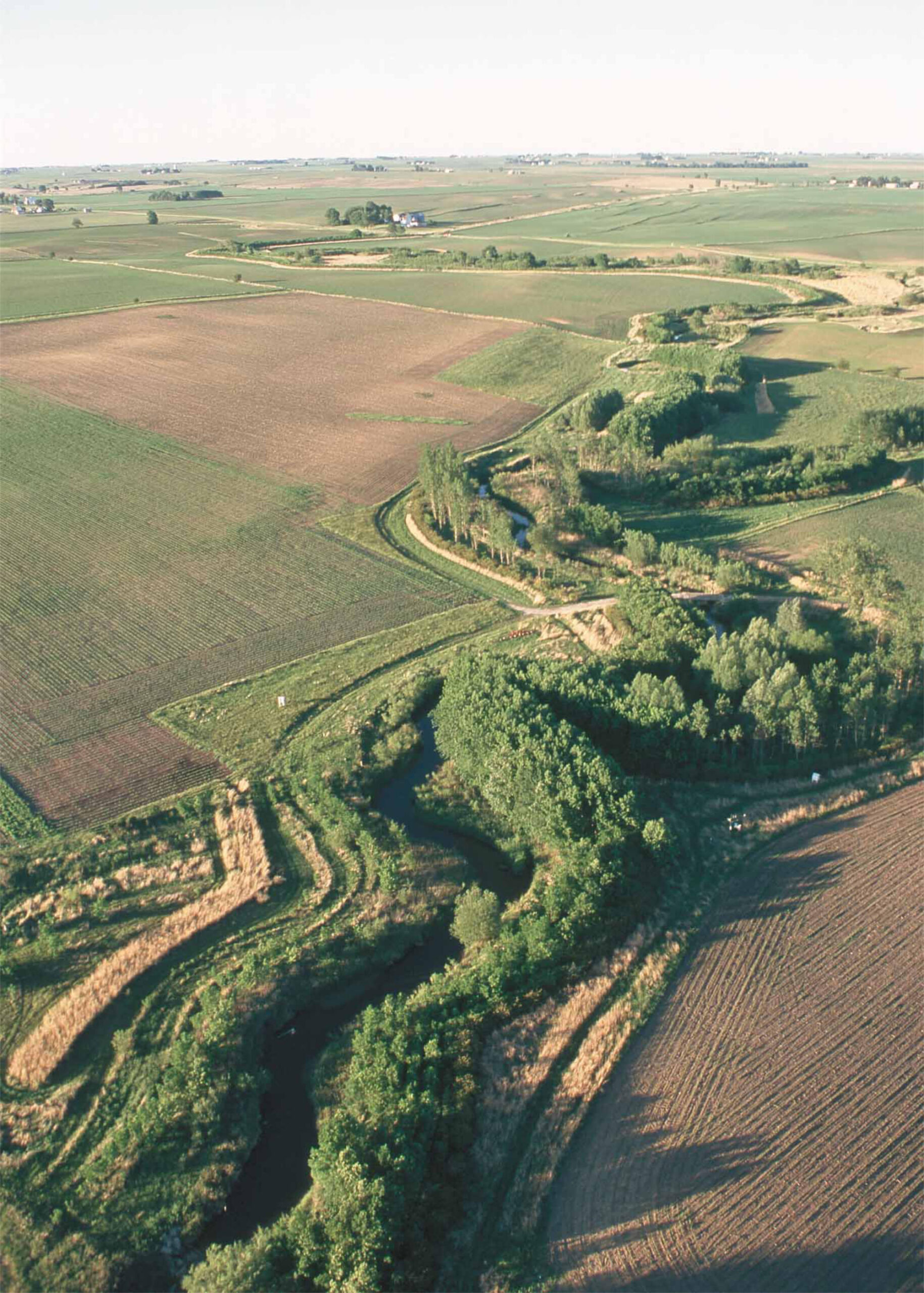
Riparian buffer on Bear Creek in Story County, Iowa, with farm fields on either side. Photo: USDA, public domain via Wikimedia Commons
Another action to address heavy rainfall involves upgrading culverts. Culverts are pipes or channels that carry water underneath roads or railroad lines. Most drivers don’t give a second thought to culverts, but when they are too small to handle water from a heavy downpour, flooding and severe erosion of the roadbed and surrounding area can occur. Many culverts around the country will need to be redesigned and rebuilt to an appropriate size for the increased heavy rains that climate change is expected to bring.
A final strategy to adapt to the increasing frequency of heavy rainfall is to relocate key infrastructure out of flood-prone areas, and to site new construction away from these areas. An important part of this strategy is having the best possible knowledge of the location of flood zones. The Federal Emergency Management Agency (FEMA) publishes and regularly updates flood hazard maps that can be used for managing floodplain development.
Drought
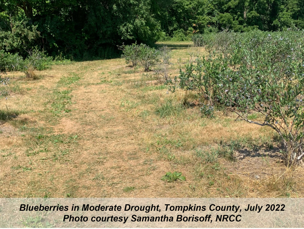
While many parts of the US have experienced drought in the past, the rising temperatures associated with global climate change will likely make droughts more severe. Warmer air leads to more evaporation from soils, lakes, and streams, and moisture loss from plants. These effects can stress agricultural production, ecosystems, and water resources for drinking water and energy production. The dry conditions from drought can also increase the risk of wildfires.
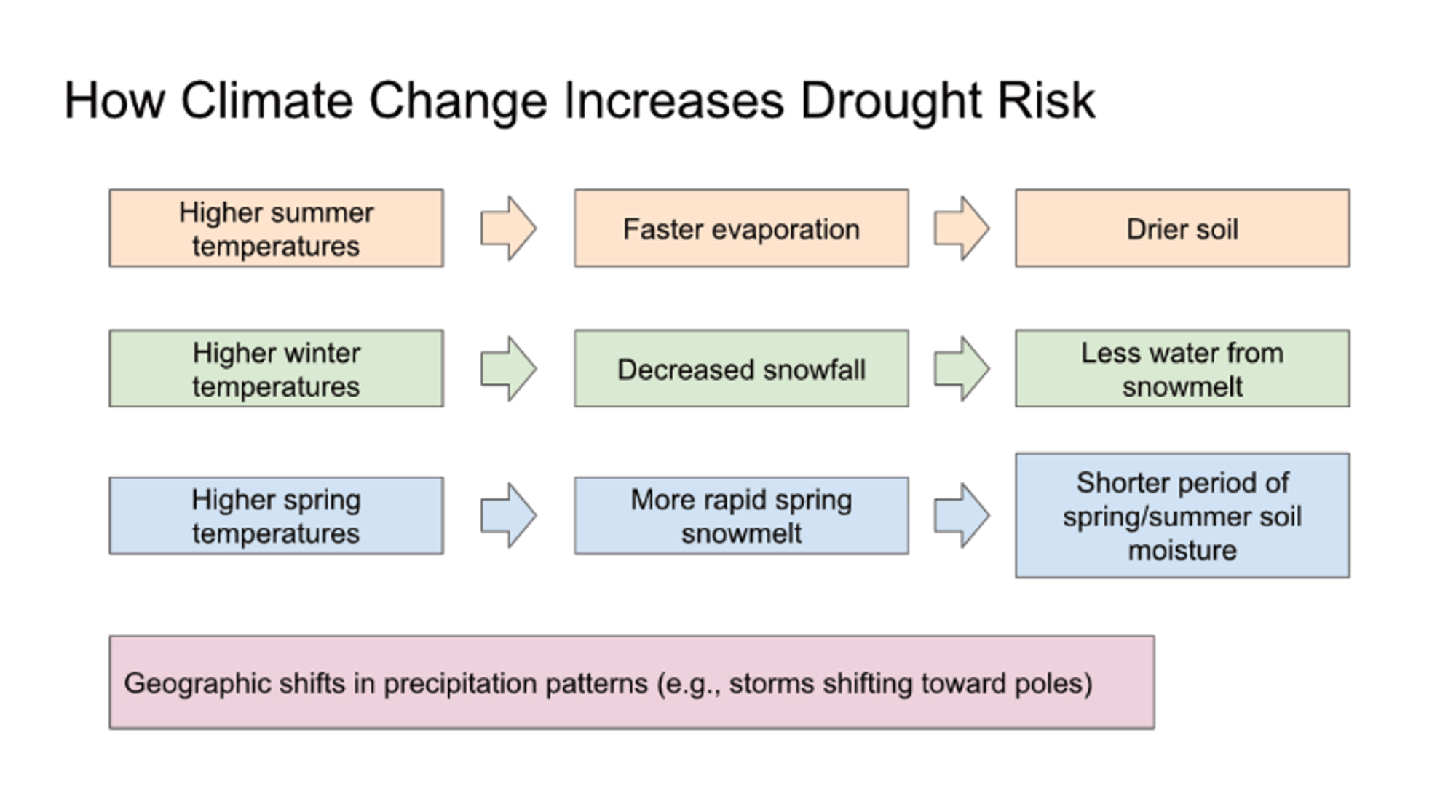
Diagram summarizing several different ways that increasing seasonal temperatures and changing precipitation patterns can increase the risk of drought. Figure by Ingrid Zabel for PRI's Earth@Home project (CC BY-NC-SA 4.0 license)
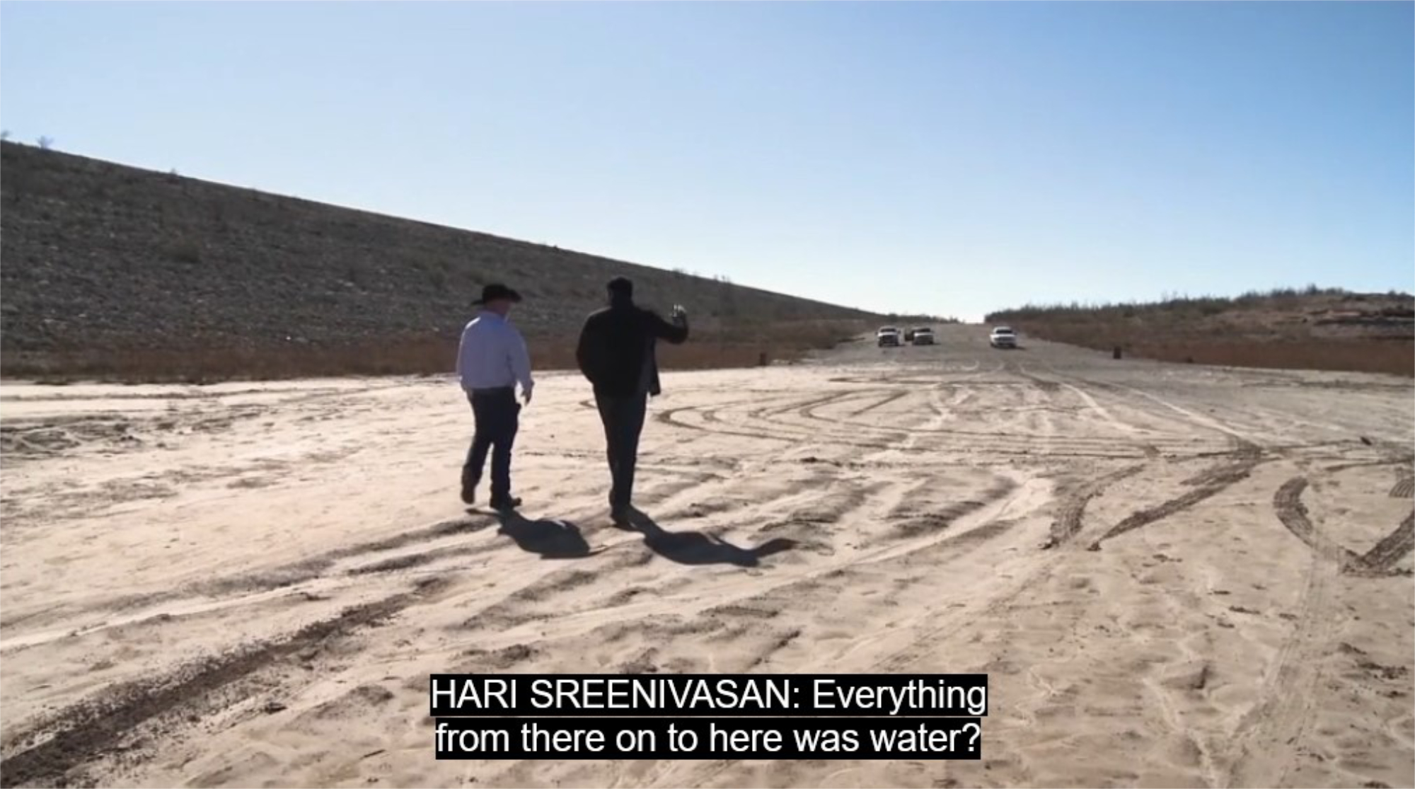
Screenshot from video "Drought Case Study: Texas" by PBS LearningMedia. See also two other videos about the impacts of drought by PBS Learning Media: "Drought Case Study: California" and "Drought Case Study: Cape Town."
Adapting to more frequent and severe drought can involve monitoring and planning, restricting water use and grazing, improving and upgrading water supply and delivery infrastructure, developing and encouraging the use of drought-tolerant plants for gardens and crops, and educating the public and farmers on water conservation practices.
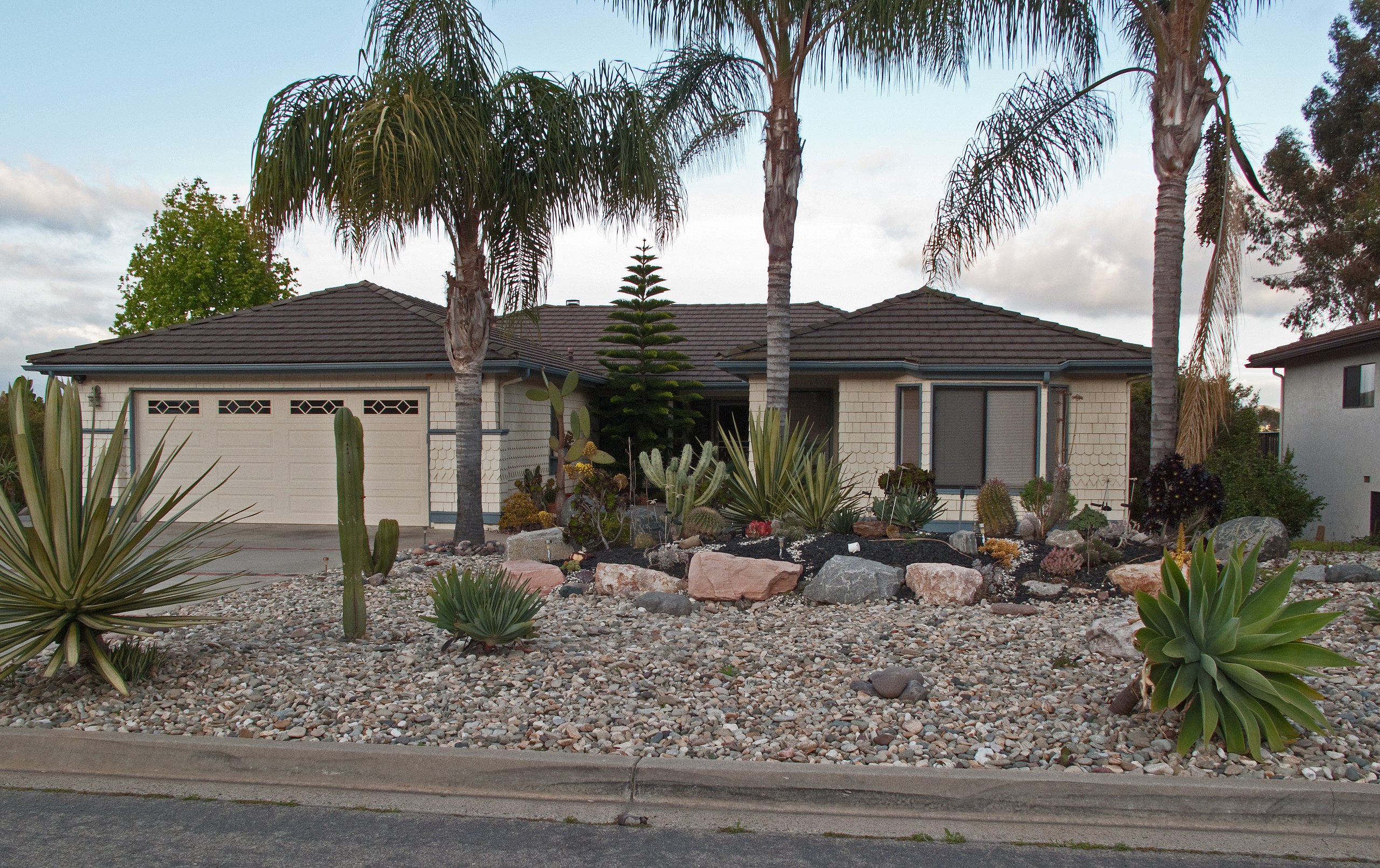
House in Southern California with xeriscaping, i.e. landscaping using plants that are tolerant of arid conditions. Photo by Downtowngal (CC BY-SA 3.0) via Wikimedia Commons
The National Drought Mitigation Center at the University of Nebraska-Lincoln, in partnership with the US government, produces weekly maps of drought conditions across the country (U.S. Drought Monitor). This monitoring, together with assessment of water sources and impacts of past droughts, can help communities plan for how to handle drought. Actions that communities can plan for include setting up a drought warning system, making arrangements for alternate water sources during drought events, and setting up irrigation schedules for farmland. An early warning system, for example, can help ranchers make decisions about grazing their cattle sustainably. Pastures may not grow during droughts, and with enough advance warning ranchers can plan to limit grazing, look for alternate sources of feed, or sell off parts of their herd in order to sustain their grazing land and livelihood.
Another important type of monitoring is checking water systems for leaks, to minimize wasted water. This falls under the broader goal of water conservation, which is a wise practice at all times and which can become critical during times of drought. Communities can conserve water by imposing restrictions—limiting water use to firefighting and other emergency or essential use—or through voluntary measures and education. Communities can also modernize out-of-date policies and restrictions, such as “use it or lose it” access to water rights in California and other western states where users waste water to avoid losing their rights to it, and policies such as in Colorado where every drop is already allocated and “water theft” via rain barrels, for example, is unlawful.
Community Science for Drought Monitoring
Another important type of monitoring is checking water systems for leaks, to minimize wasted water. This falls under the broader goal of water conservation, which is a wise practice at all times and which can become critical during times of drought. Communities can conserve water by imposing restrictions—limiting water use to firefighting and other emergency or essential use—or through voluntary measures and education. Communities can also modernize out-of-date policies and restrictions, such as “use it or lose it” access to water rights in California and other western states where users waste water to avoid losing their rights to it, and policies such as in Colorado where every drop is already allocated and “water theft” via rain barrels, for example, is unlawful.
Households can conserve water by eliminating lawn watering and practicing xeriscaping (planting gardens with drought-tolerant plants), buying low-water-use dishwashers and clothes washers and using them only when full, fixing leaks and drips promptly, building driveways with permeable pavement to allow rain to filter into the ground, and capturing and reusing rainwater or other household water. Farmers can conserve water by using planting practices that reduce erosion, slow water runoff, and maximize water absorption in soil, irrigating different areas at different times to spread the use of water over time and land area, and capturing rainwater.
Ecosystems also experience stress during times of drought, but people can take action to help plants and wildlife adapt. One example is by creating fish passages. When streams and rivers dry out because of drought, fish find it much more difficult to travel upstream to spawn. Even if they are able to spawn, low stream flows can threaten the viability of their eggs and young. Fisheries managers can help fish by building channels with sufficient stream flow to allow fish to pass, and by removing barriers such as dams and boulders.
Extreme Storms
One of the consequences of climate change is changes in extreme weather events such as heat waves, drought, hurricanes, winter storms, and coastal storm surges. Some forms of extreme weather, such as extreme heat, have become both more frequent and more intense. Other, such as hurricanes, may be becoming more intense but not necessarily occurring more frequently (see an answer to the Frequently Asked Question "How does climate change affect hurricanes?"). Some of these changes are driven by the ability of warmer air to hold more moisture while others are the result of increased temperatures and/or increased variability in temperatures, and the interconnectedness of the atmosphere, the oceans, the biosphere, and the land. Extreme weather can be highly destructive and life threatening, and poses a difficult adaptation challenge.
Adaptation strategies for drought, extreme heat, and heavy rainfall are addressed in previous sections on this page, so the focus of this section will be on storms that bring heavy winds, snow and ice, and storm surge. The more intense a hurricane, the higher the risk of damaging winds and storm surge. Storm surge occurs when offshore winds push a great volume of ocean water onto land. Sea level rise—another consequence of climate change due to warmer, expanding oceans and melting ice sheets and glaciers—exacerbates the risk associated with storm surge because it means the sea is higher relative to land to begin with.
Adapting to storm surge is a difficult challenge for coastal communities, especially since storm surges can rise over 30 feet in an intense hurricane. Houses can be raised above the land surface by being built on piles (vertical structures), which allow water to flow beneath the house. The piles are built with deep foundations to prevent erosion of and damage to the piles. Communities can set regulations that require new buildings to be set back from flood-prone areas. They can also protect and revitalize natural features that provide buffers against storms surges, such as dunes planted with beach grasses and other vegetation.
"What is a Storm Surge?" by Met Office (the official meteorological agency of the U.K.) (YouTube)
Adaptation strategies for high winds include using building practices that strengthen structures, designing building sites with high winds in mind, protecting power lines and other infrastructure, and providing education on safety in the face of severe winds. Building practices can be voluntary or made mandatory through building codes, and they include things like using extra nails when applying roof shingles, putting steel bracing around tall chimneys, and anchoring structures to permanent foundations. Site design considerations include incorporating natural wind breaks such as trees, designing features to direct wind away from buildings, and using ventilation systems to control the flow of air in and out of buildings. Power and telecommunication lines can be placed underground for protection, and regular tree trimming can help prevent damage to over-ground lines.
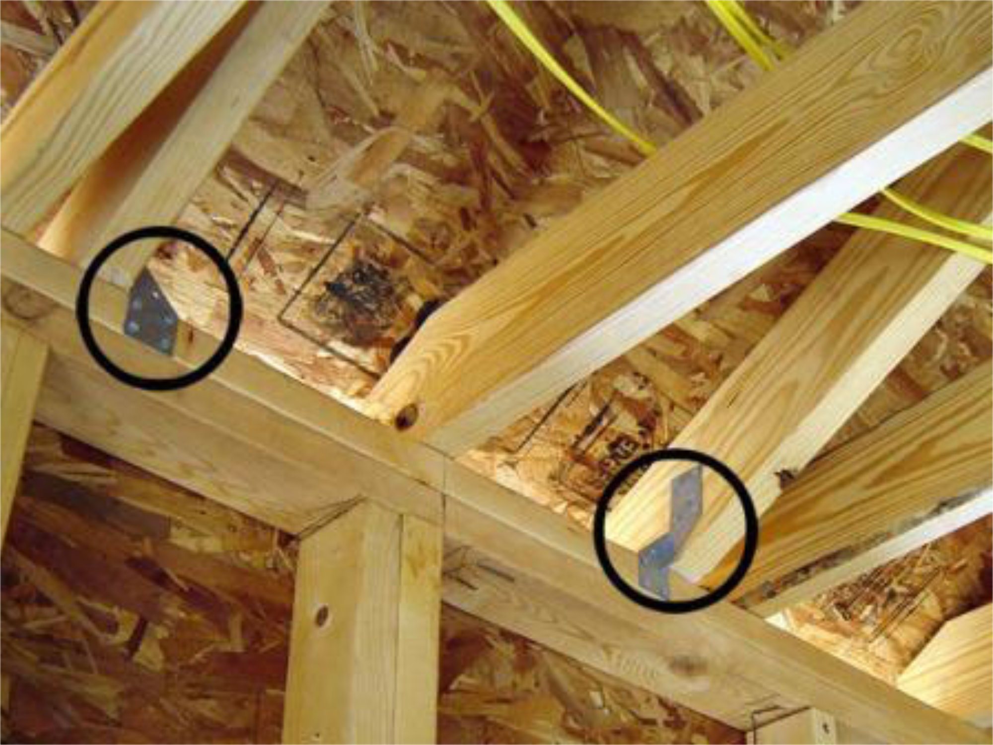
Hurricane clips, shown circled above, help anchor roofs to the main structure to prevent detachment due to severe wind. These clips can be found at many hardware stores, and are an inexpensive way to mitigate home damage from hurricanes. The home above kept its lid on during the severe winds brought by Hurricane Katrina, even though construction of the house had not been completed. Photo: Yonah Walter/FEMA (public domain) via Wikimedia Commons.
Education plays a big role in making sure communities are prepared for storms with high winds. Examples from the Federal Emergency Management Agency (FEMA) include:
- informing residents of shelter locations and evacuation routes;
- educating homeowners on the benefits of wind retrofits such as shutters and hurricane clips;
- ensuring that school officials are aware of the best area of refuge in school buildings;
- instructing property owners on how to properly install temporary window coverings before a storm; and
- educating design professionals to include defense against strong winds as part of building design.
Winter storms can include high winds and storm surge (if along the coast), but they bring the additional hazards of snow, ice, and cold temperatures. A loss of power following a winter storm can lead to lack of heat for buildings, putting people at risk and causing water pipes to freeze and burst. Implementing and enforcing building codes can help reduce the risk of weak roofs that collapse under heavy snow, and can reduce heat loss through the use of insulation. Utility lines can be protected from ice and snow damage through similar measures as described above for protection from high winds, and communities can install snow fences or rows of trees to prevent snow from drifting and building up on roads. As with other weather hazards, education is critical for preventing loss of life. People need to learn: how to drive on icy roads (and when to avoid driving); how to prevent death from carbon monoxide poisoning by venting generators to the outside, installing detectors, and not sitting in a snow-covered car with the engine on; and to check on elderly and other vulnerable neighbors who may have lost power.
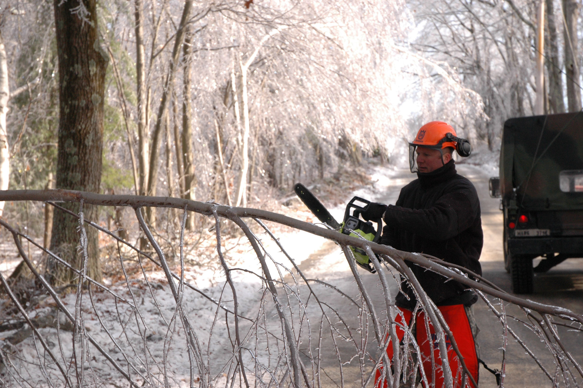
Spc. Daryl Johnson, a construction equipment operator, 379th Engineer Co. (Horizontal), Massachusetts Army National Guard, cuts a fallen tree with a chainsaw in Phillipston, Mass., Dec. 14, 2008. The town of Phillipston lost power when trees covered with ice began falling onto power lines leaving the towns 900 homes without electricity. The 379th was mobilized to cut down trees and clear roads so civilian utility companies can begin trying to restore power to the town. Photo: Sgt. 1st Class Jon Soucy (public domain) via Wikimedia Commons
Reduced Snowfall and Snowpack
Although climate change is expected to bring more intense winter storms, many parts of the country have experienced a reduction in overall snowfall and snowpack. Snowpack is an important water resource, and less snow in the winter means less meltwater in the spring, reducing the flow of streams and rivers and depleting water supplies. People depend on this water supply for household use and agriculture, and ecosystems depend on it to sustain fish and other wildlife populations. The snow itself is an important part of tourist industries such as skiing and snowmobiling, and trout fishing tourism depends on streams with cold meltwater from snowpack. In addition to less snowpack, climate change is expected to bring earlier springs and earlier flows of meltwater.
Adapting to changes in snowpack and snowmelt is largely a question of water management. Communities may need to expand or build additional reservoirs to store more water in preparation for times of low snowmelt. They may also need to work out arrangements with communities in other watersheds, to purchase water from elsewhere in times of great need. A critical part of adapting to dwindling water resources is to do a much better job of conserving water.
Tourist industries that depend on snowpack can take several steps to adapt to less snow. Ski resorts, for examples, can use snowmaking technology, alter and develop slopes so they require less snow, and diversify their businesses to offer other attractions. These practices come with costs, of course. The recreational trout fishing season may shift to earlier months when streams are cooler, and anglers may switch to fishing for warm-water species such as bass.