

Page snapshot: Ohio State Geologic Map; Fossil; 3D models; Rock; Mineral; Gem; Highest and Lowest Elevations; Places to Visit; and Additional Resources.
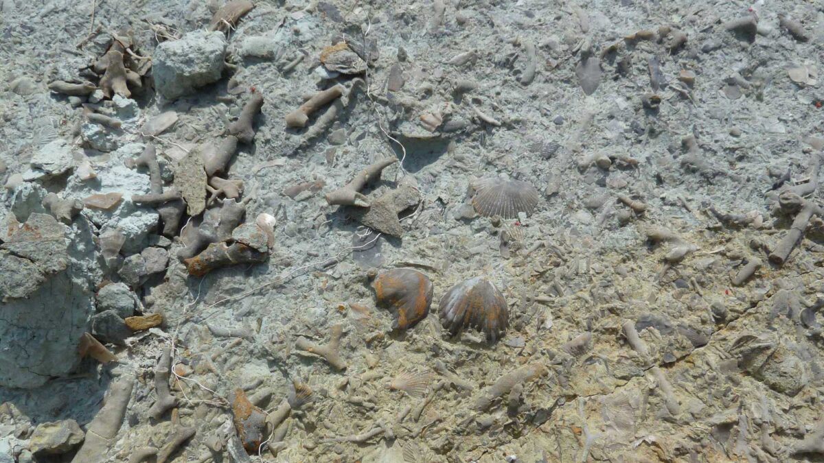
Image above: Ordovician-aged marine invertebrate fossils from southwestern Ohio. Photograph by Jonathan R. Hendricks.
Geologic Map of Ohio
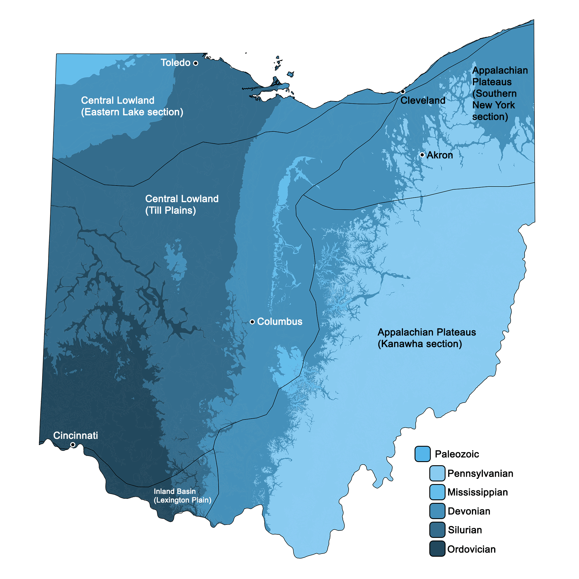
Geologic map of Ohio showing maximum ages of mappable units. Image by Jonathan R. Hendricks for the Earth@Home project developed using QGIS and USGS data (public domain) from Fenneman and Johnson (1946) and Horton et al. (2017).
Ohio State Fossils: Trilobite and Dunkleosteus
Ohio has two official state fossils: the Ordovician trilobite Isotelus maximus and the placoderm fish Dunkleosteus terrelli.
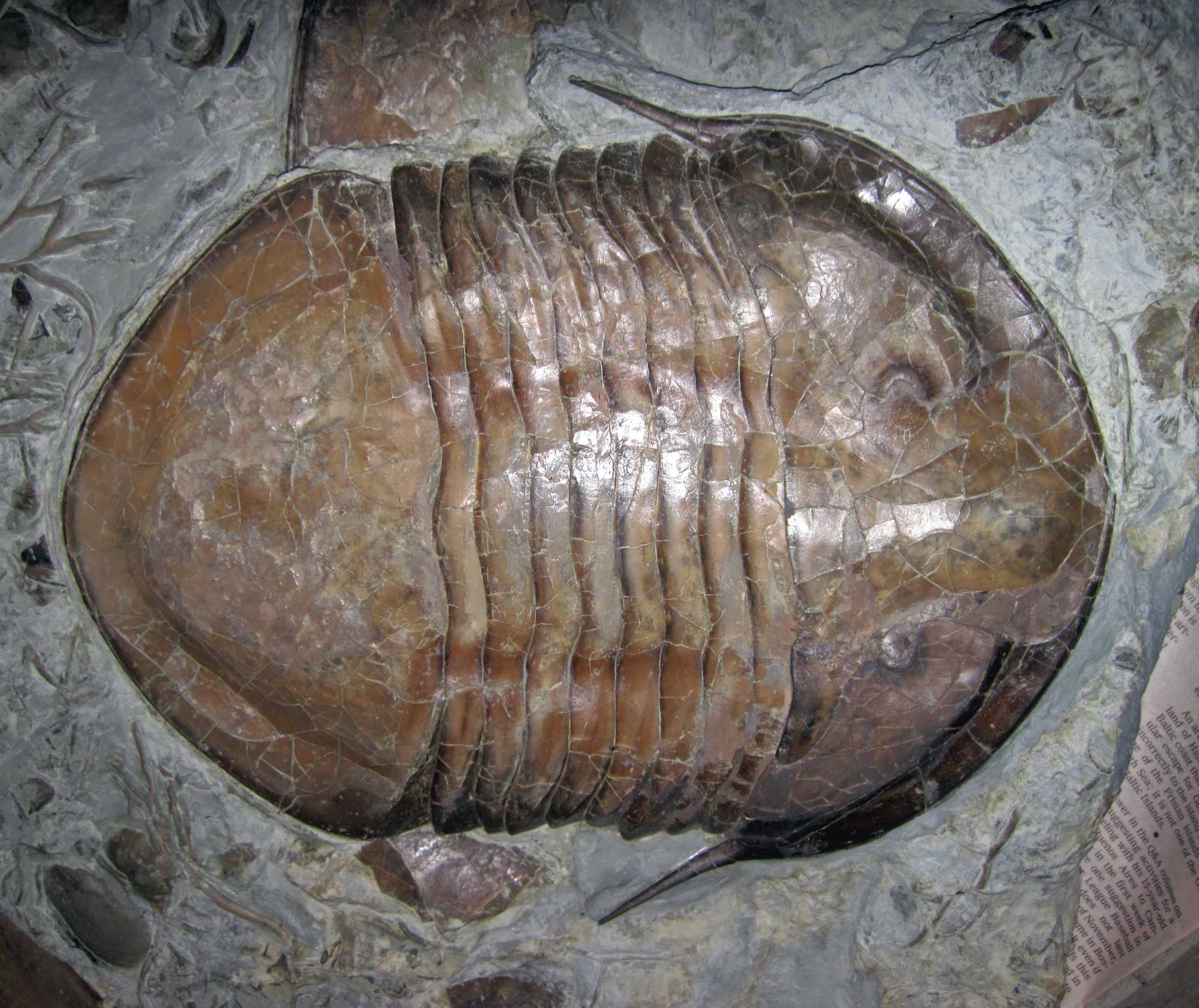
Isotelus maximus from the Ordovician of Adams County, Ohio. Photograph by James St. John (Flickr; Creative Commons Attribution 2.0 Generic license; image resized).
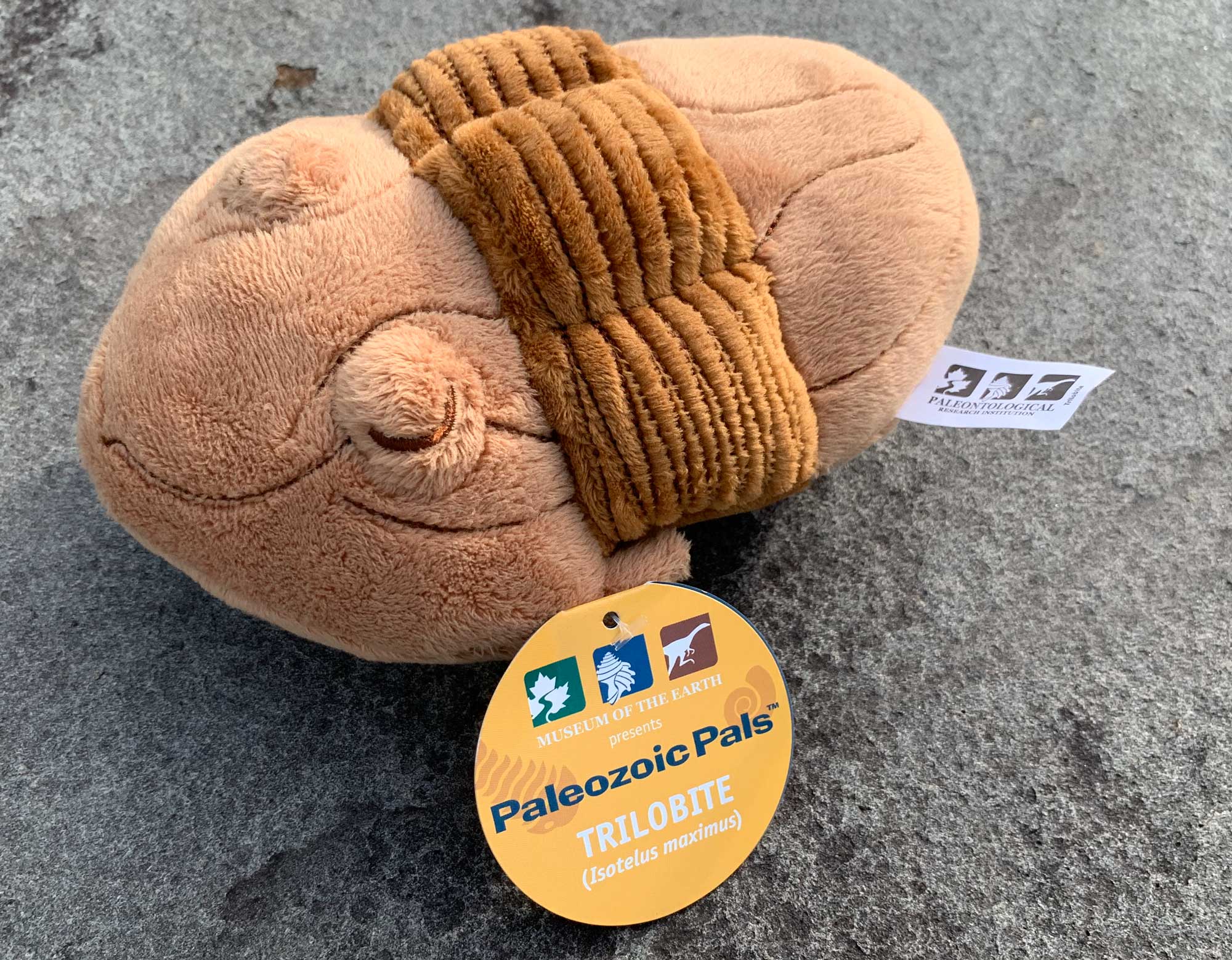
Isotelus plush available for sale from the Paleontological Research Institution. Order here.
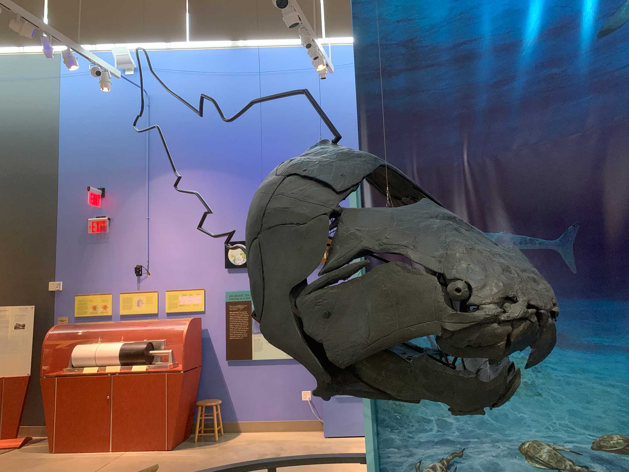
Dunkleosteus skull on display at the Museum of the Earth in Ithaca, New York. Photograph by Jonathan R. Hendricks.
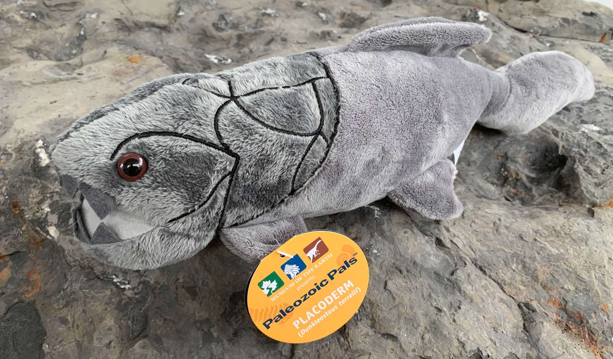
Dunkleosteus plush available for sale from the Paleontological Research Institution. Order here.
3D Models of fossils from Ohio
Fossil trilobite Flexicalymene meeki from the Ordovician Ft. Ancient Formation of Brown County, Ohio (PRI 41460). Specimen is on display at the Museum of the Earth, Ithaca, New York. Length of specimen is approximately 3.5 cm.
Fossil specimen of the trilobite Eldredgeops crassituberculata from the Devonian Silica Formation of Sylvania, Ohio (PRI 49388). Specimen is from the collections of the Paleontological Research Institution, Ithaca, New York. Maximum diameter of specimen is approximately 2.5 cm.
Fossil specimen of the brachiopod Strophodonta demissa from the Devonian Silica Shale of Lucas County, Ohio (PRI 70765). Specimen is from the collections of the Paleontological Research Institution, Ithaca, New York. Longest dimension of specimen is approxiately 4 cm.
Fossil specimen of the orthocerid cephalopod Treptoceras cf. duseri from the Ordovician Richmondian Stage of Cincinnati, Ohio (PRI 45492). Specimen is from the collections of the Paleontological Research Institution. Maximum length of specimen is approximately 17 cm.
Ohio State Rock: None
Ohio does not yet have an official state rock.
Ohio State Mineral: None
Ohio does not yet have an official state mineral.
Ohio State Gem: Ohio flint
Ohio flint is a high-quality chert found throughout eastern and central portions of the state. Native Americans used Ohio flint to make tools as early as 12,000 years ago. It is a variety of microcrystalline quartz and a favorite of lapidarists.
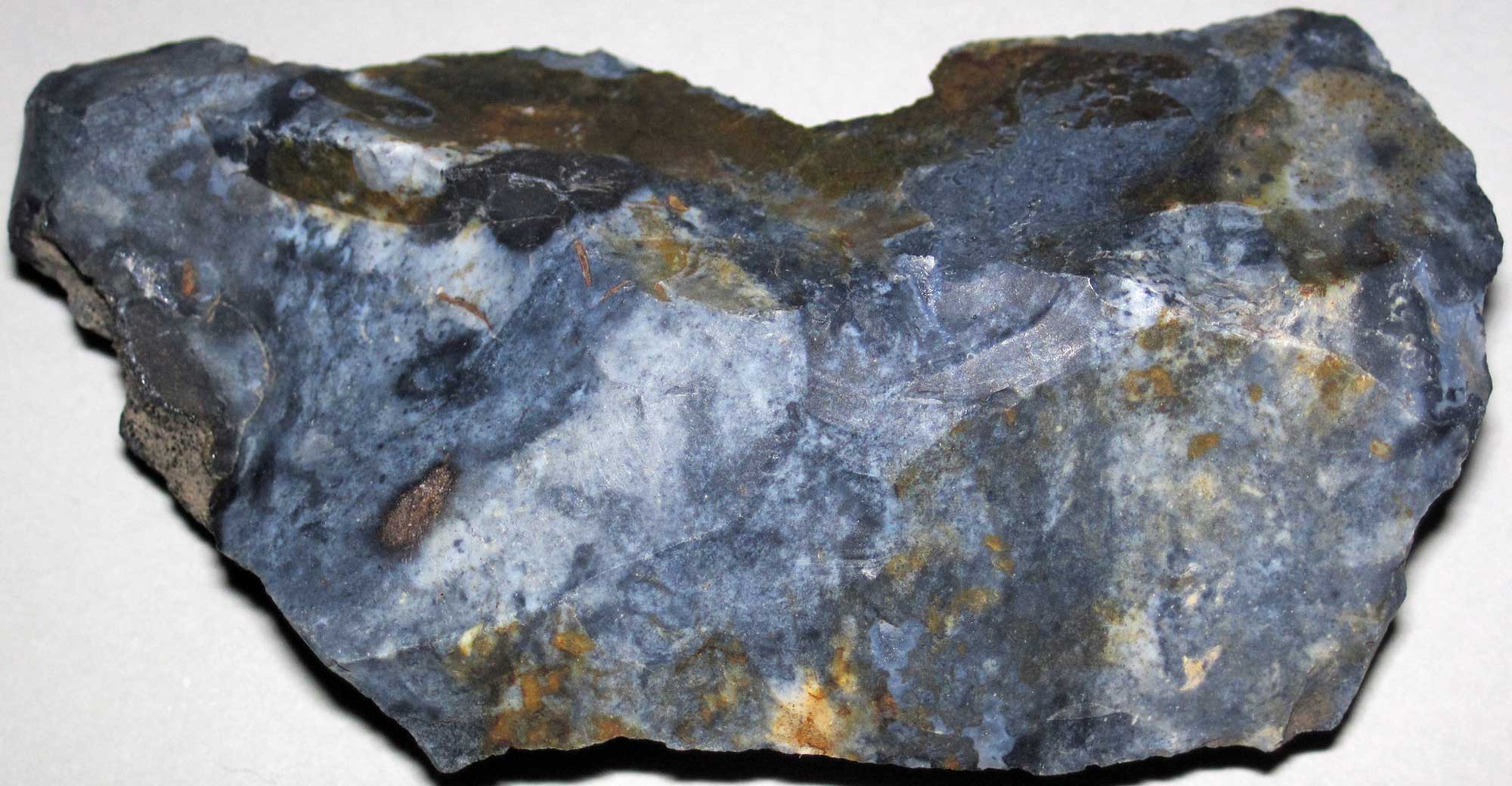
Sample of Nellie Blue Flint from the Pennsylvanian of eastern Ohio. Photograph by James St. John (Flickr; Creative Commons Attribution 2.0 Generic license).
Ohio's Highest and Lowest Elevations
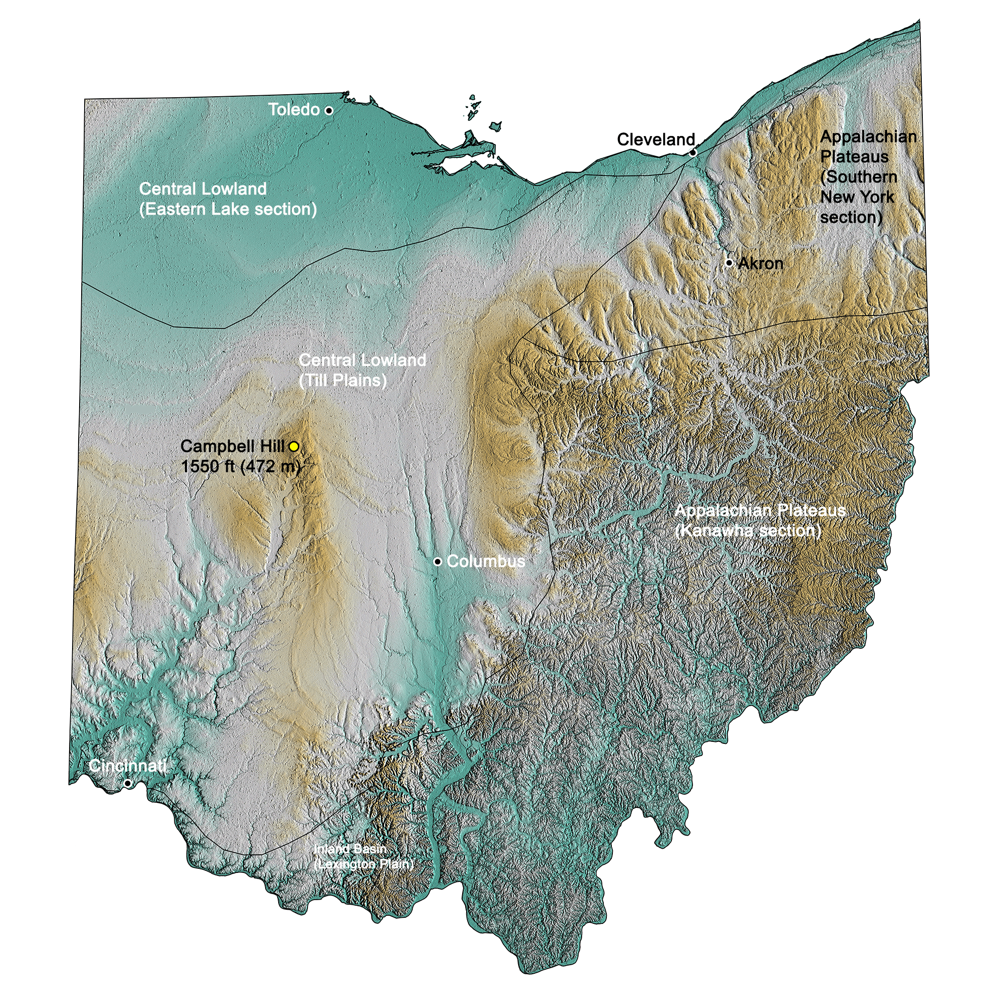
Topographic map of Ohio with physiographic regions and point of highest elevation identified. Topographic data are derived from the Shuttle Radar Topography Mission (SRTM GL3) Global 90m (SRTM_GL3) (Farr, T. G., and M. Kobrick, 2000, Shuttle Radar Topography Mission produces a wealth of data. Eos Trans. AGU, 81:583-583).
Highest Elevation: Campbell Hill
Campbell Hill, 472 meters (1550 feet) high, is located in the city of Bellefontaine, in eastern central Ohio, and it is the state’s highest point.
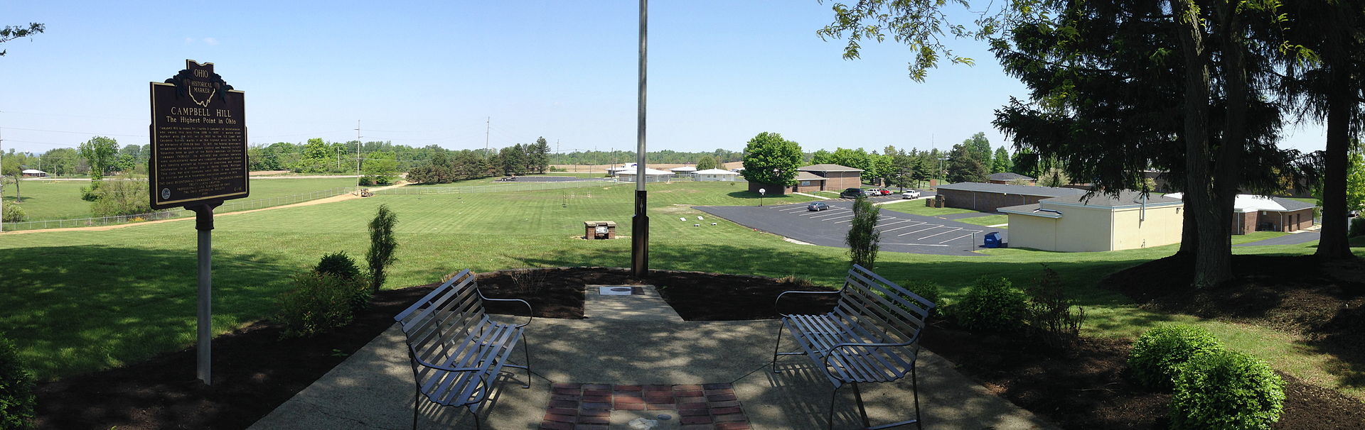
Campbell Hill, the point of highest elevation in Ohio. Photograph by "Fredlyfish4" (Wikimedia Commons; Creative Commons Attribution-Share Alike 4.0 International license).
Lowest Elevation: Ohio River
The southern extreme of the Ohio’s border with Indiana, on the Ohio River, is Ohio’s lowest point at 139 meters (455 feet).
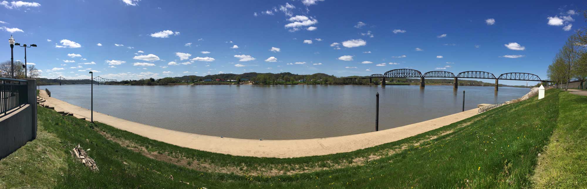
The Ohio River as viewed from Point Pleasant, West Virginia.
Places to Visit

The Cincinnati Museum Center. Photograph by Warren LeMay (Flickr; Creative Commons Attribution-ShareAlike 2.0 Generic license).
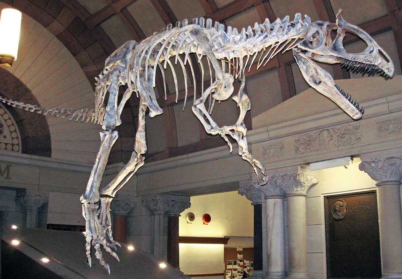
Skeleton of the Jurassic theropod dinosaur Cryolophosaurus ellioti on display at the Orton Geological Museum at The Ohio State University.
Fossil Park
Search for your own Devonian fossils! Sylvania, Ohio.
Additional resources
Earth@Home resources about Ohio and nearby states:
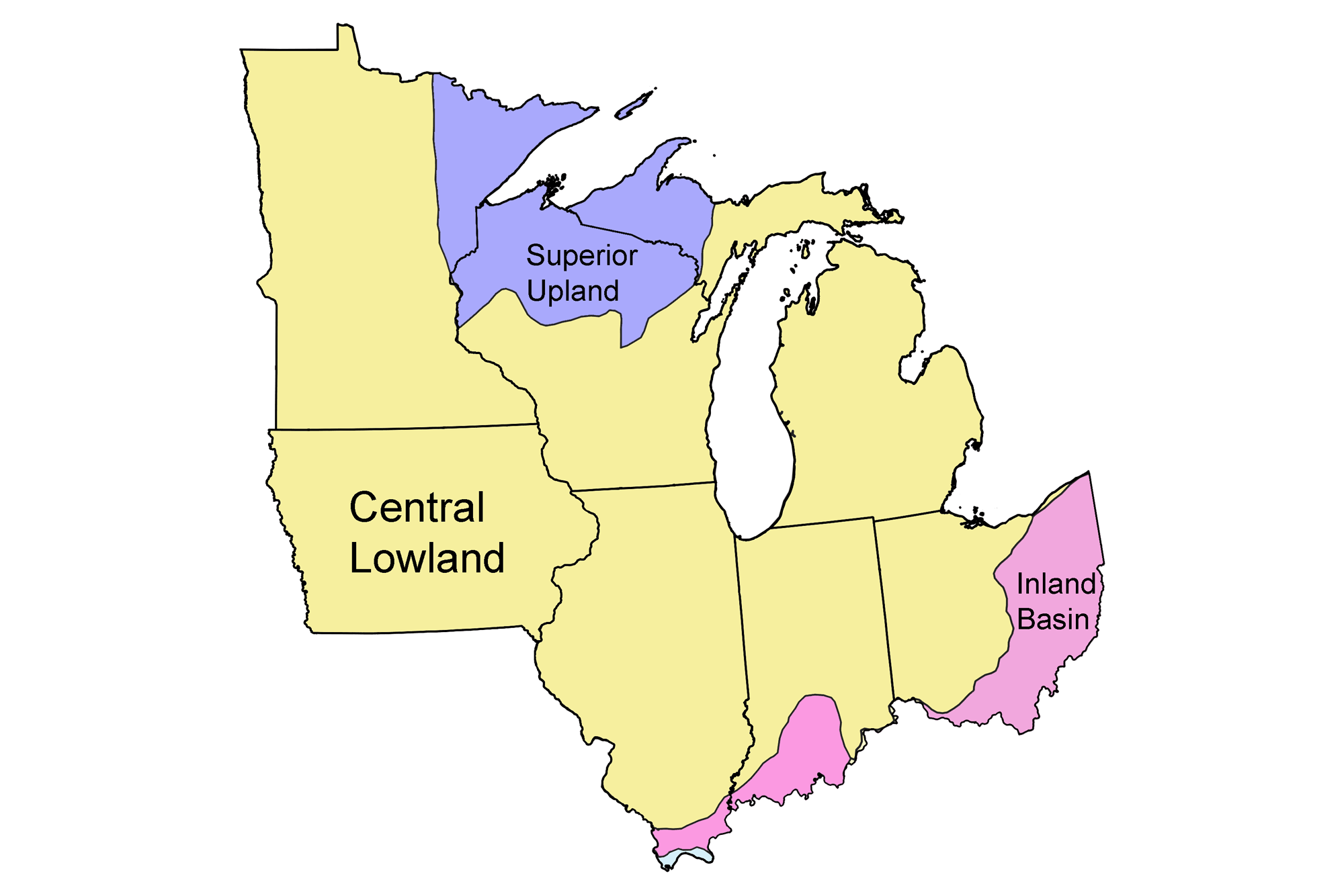
- Rocks: Superior Upland, Central Lowland, and Inland Basin
- Fossils: Superior Upland, Central Lowland, and Inland Basin
- Topography: Superior Upland, Central Lowland, and Inland Basin
- Mineral Resources: Superior Upland, Central Lowland, and Inland Basin
Earth@Home resources about the Midwest region of the United States: