

Spotlight: Overview of the rocks of the Coastal Plain region of the Northeastern United States.
Topics covered on this page: Overview; Cretaceous; Paleogene to Neogene; Quaternary; Resources.
Credits: Most of the text of this page is derived from "Rocks of the Northeastern US" by Jane Elizabeth Ansley, from The Teacher-Friendly Guide to the Earth Science of the Northeastern US (published in 2000 by the Paleontological Research Institution, reprinted in 2016; currently out of print), as updated by A. N. Swaby in 2020 (unpublished). The text was adapted for Earth@Home web by Elizabeth J. Hermsen and Jonathan R. Hendricks in 2023. Changes include formatting and revisions to the text and images. Credits for individual images are given in figure captions.
Updates: Page last updated September 20, 2023.
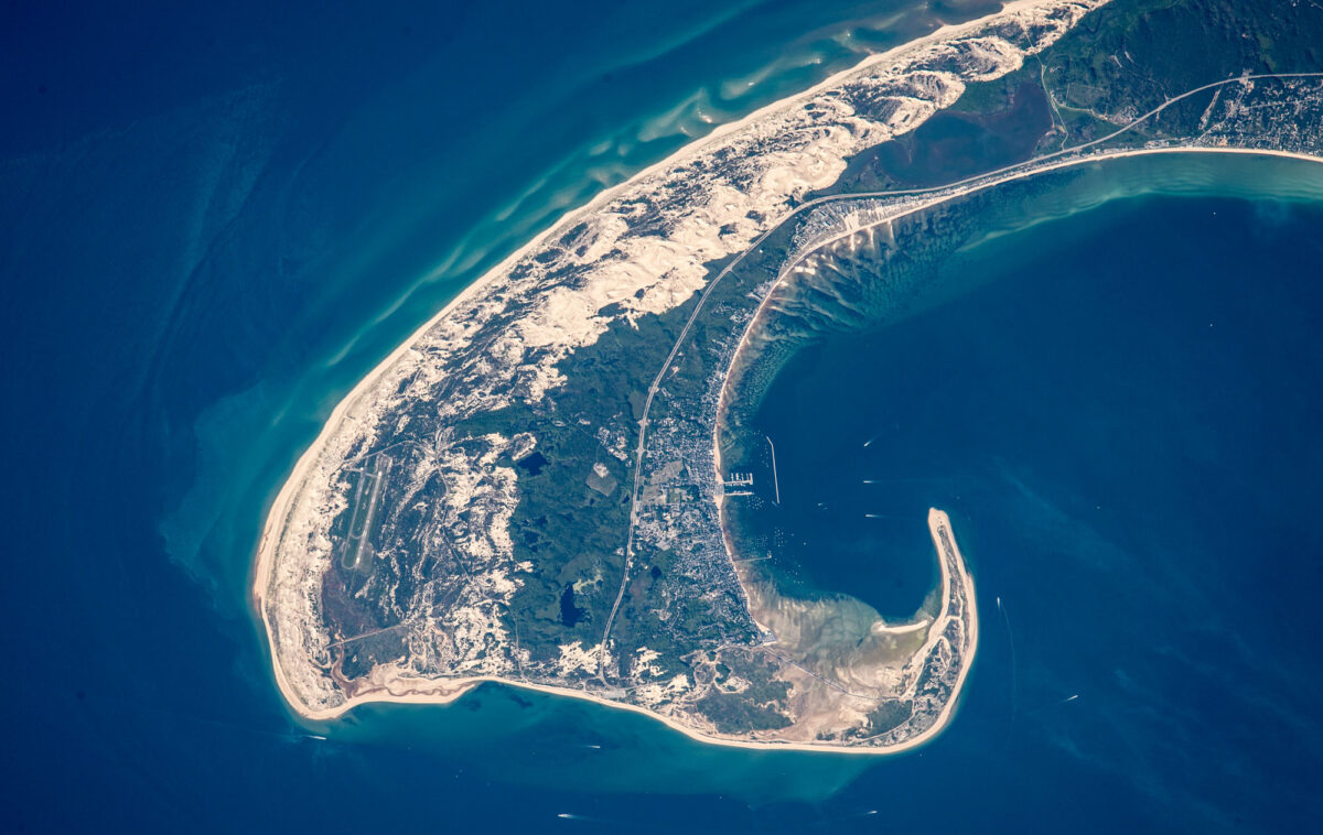
Image above: Photograph of the tip of Cape Cod from space. Cape Cod is made up of Pleistocene sediments. Source: Astronaut photograph ISSO44-E0610, via NASA Earth Observatory.
Overview
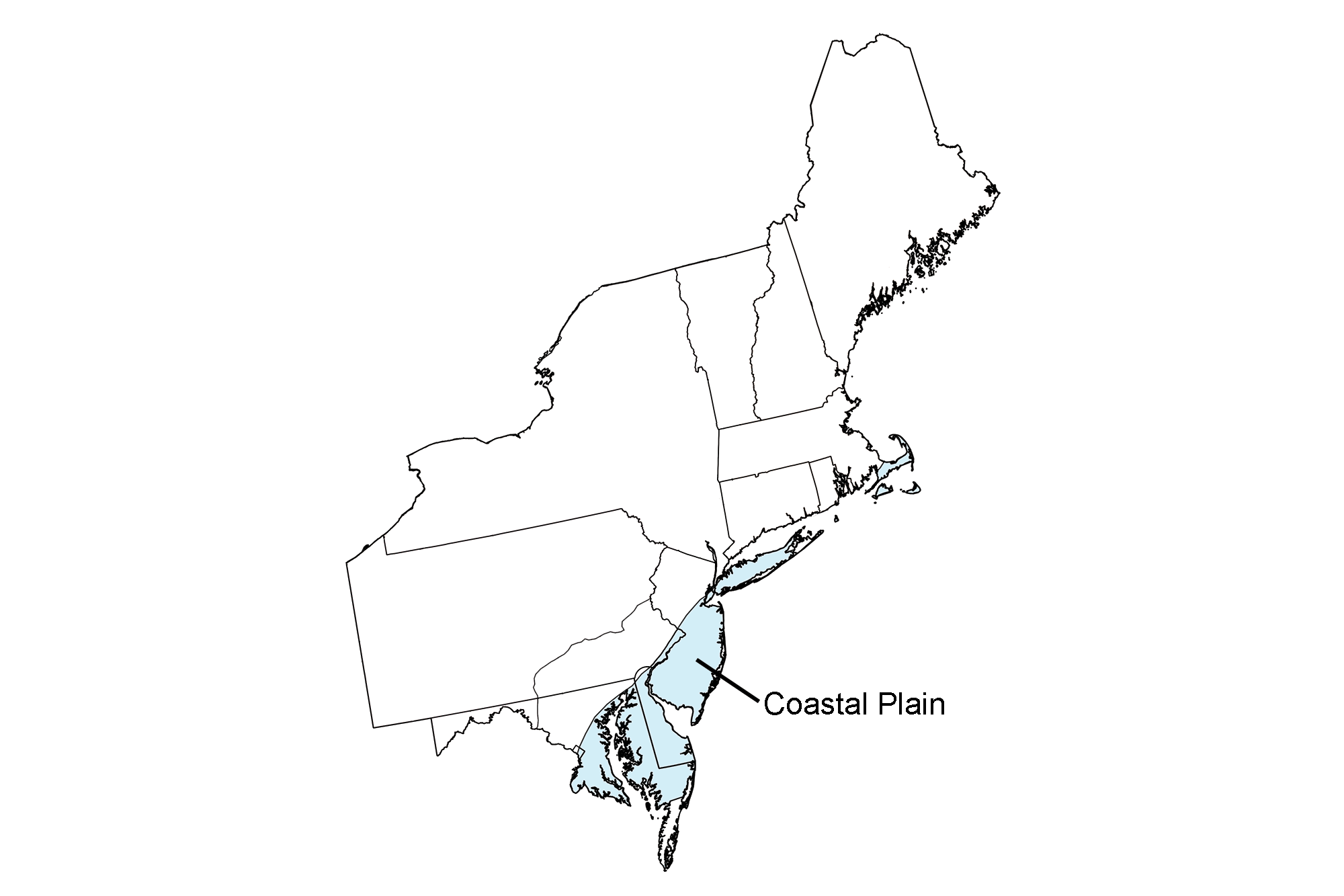
After the breakup of Pangaea during the Mesozoic, the North American plate drifted away from the Mid-Atlantic Ridge. Decreased tectonic activity along the continent’s eastern and southeastern edge led to the formation of a passive continental margin. The Coastal Plain extends along this margin, sweeping across Maryland, Delaware, and New Jersey, and encompassing Long Island and Cape Cod. The sediment and rock of the Coastal Plain is geologically very young, ranging in age from the Cretaceous to the present.
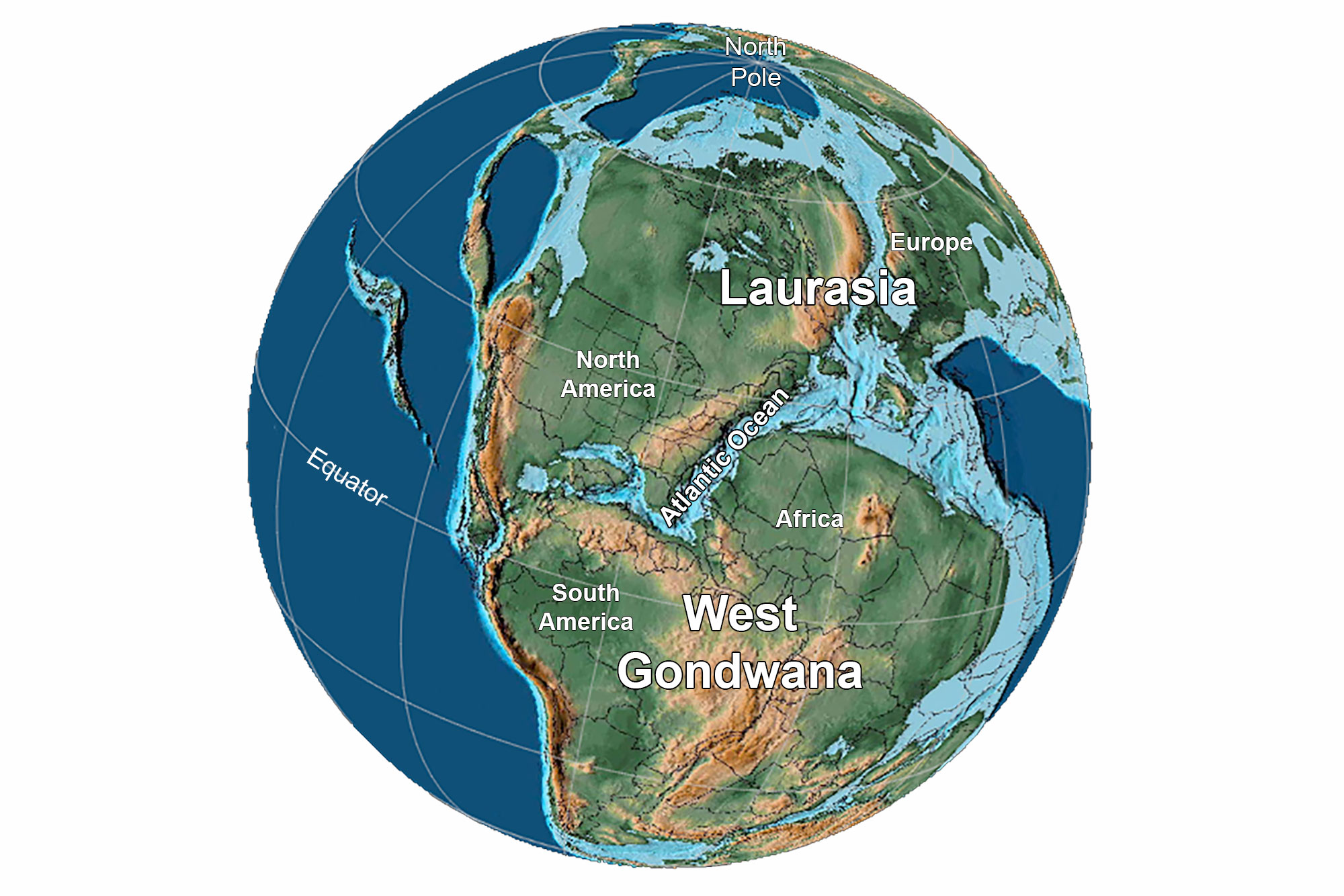
Earth 175 million years ago, during the Jurassic Period. Reconstruction created using Paleomap (by C. Scotese) for GPlates. Reconstruction created using basemap from the PALEOMAP PaleoAtlas for GPlates and the PaleoData Plotter Program, PALEOMAP Project by C. R. Scotese (2016); map annotations by Jonathan R. Hendricks and E.J. Hermsen for PRI's Earth@Home project (CC BY-NC-SA 4.0 license).
The Coastal Plain's sediment and rock includes gravel, sand, silt, clay, marl, limestone, and uncommon layers of concentrated shell material called coquina. Much of the Coastal Plain’s "rock" is actually unconsolidated sediment that has not had enough time to be lithified, cemented, or sufficiently compacted into hard rock.
Coastal Plain sediment forms a wedge of gently dipping layers of sediment and sedimentary rock that thickens toward the Atlantic Ocean, overlying older bedrock. As the Atlantic Ocean widened following the breakup of Pangaea, the weight of millions of years of sediment accumulation in the basins caused coastal areas to subside, creating a gentle slope eastward toward the Atlantic. At its innermost edge, the wedge of sediments is very thin, but under the continental shelf in the Atlantic Ocean, the wedge of sediment is as much as 4000 meters (13,100 feet) thick.
Cretaceous
The oldest sediment deposits exposed at the surface in the Coastal Plain are found along the region's inner edge and record the erosion of the Appalachian Mountains. As rivers transported sediment to the coast, successive layers of gravel, sand, silt, and clay fanned out onto the continental shelf. Cretaceous sediments and clays can also be found on Martha’s Vineyard at Gay Head Cliff, where they were uplifted and pushed forward by the ice sheet during the Quaternary. A variety of clays are found in the Cretaceous rocks of the Northeast, including kaolinite, a valuable economic resource that is mined in certain areas.
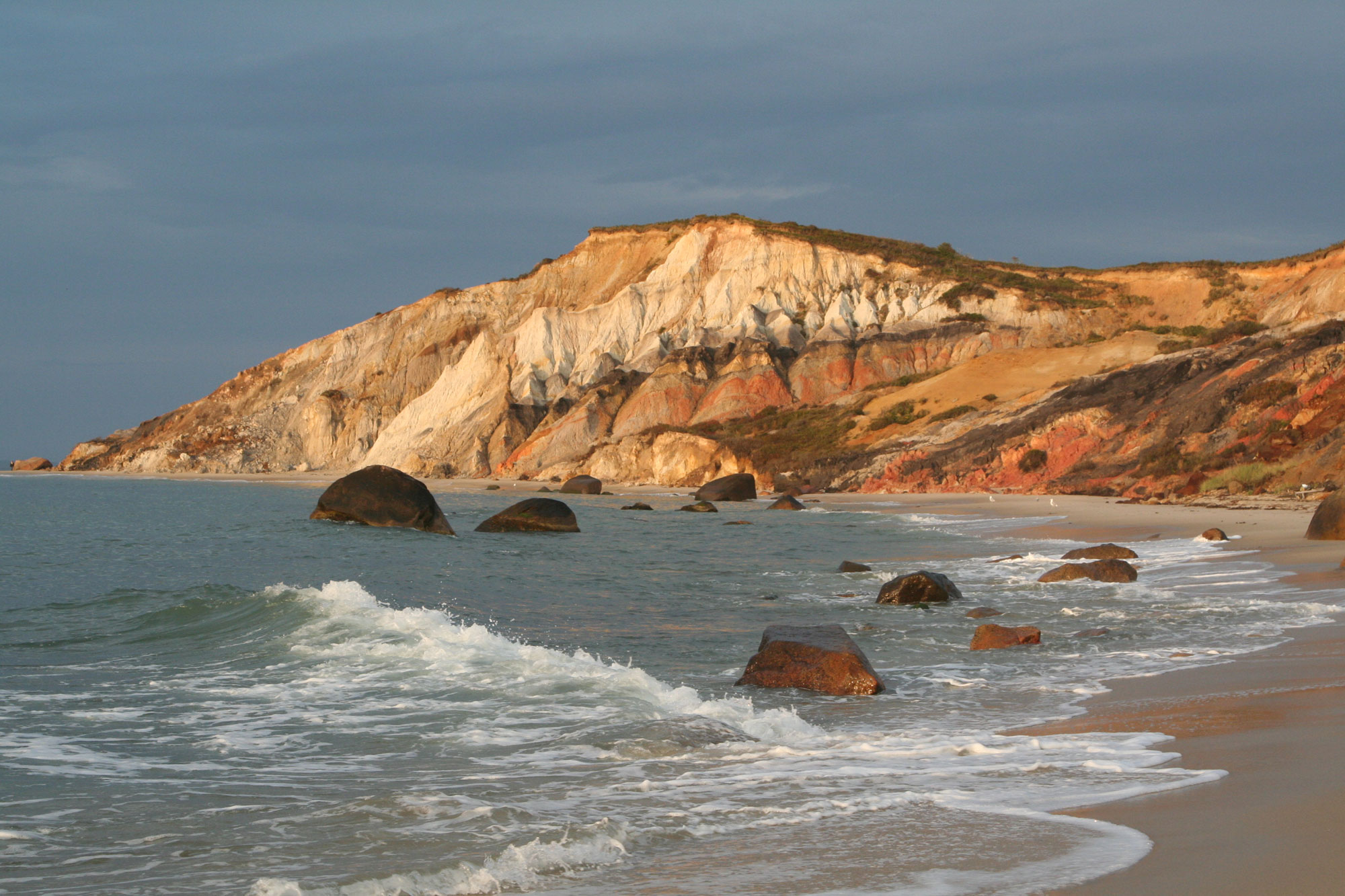
Gay Head Cliff, Martha's Vineyard, Massachusetts. Photo by William Waterway (flickr, Creative Commons Attribution-ShareAlike 3.0 Unported license, image resized).
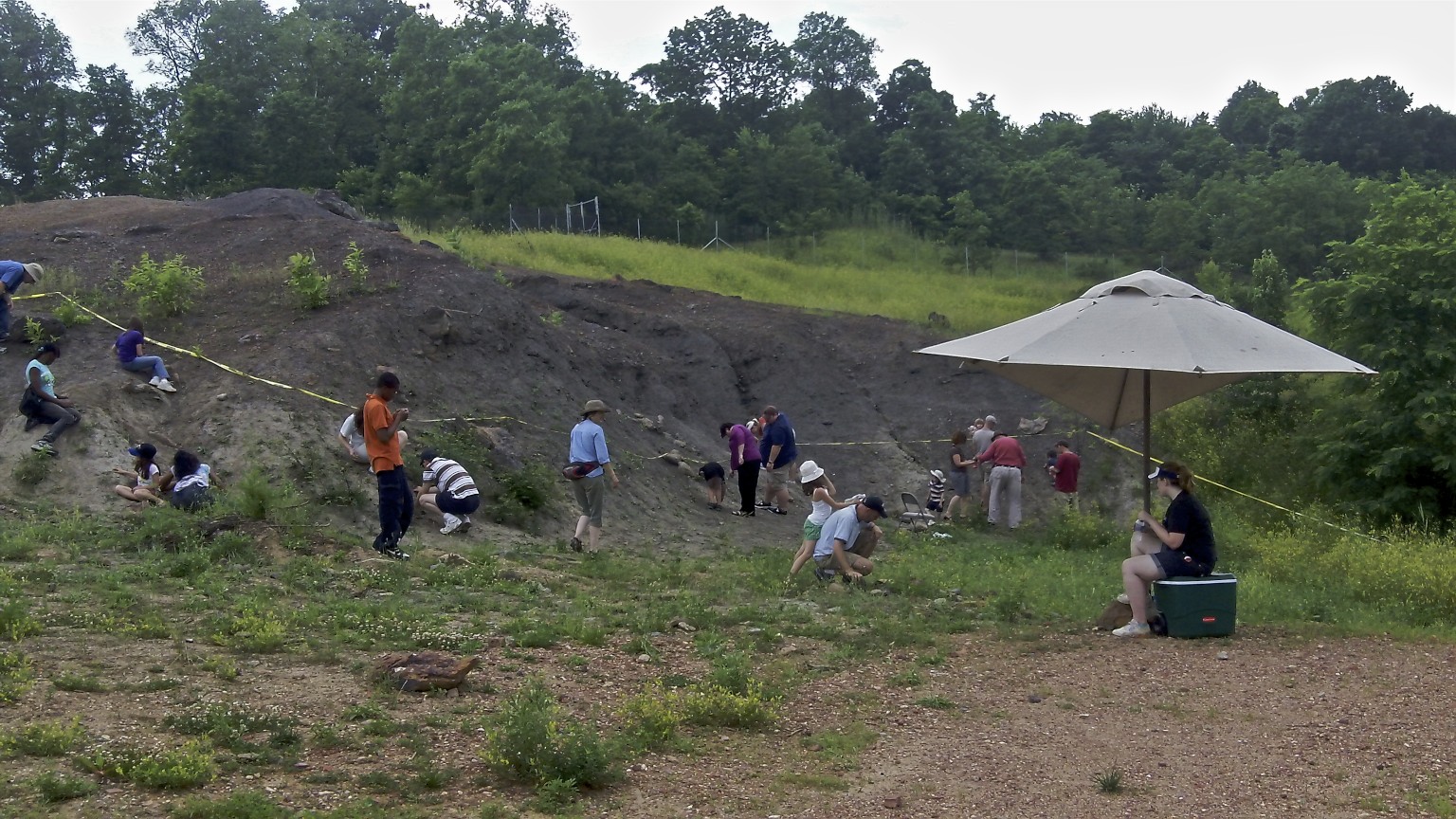
People searching for fossils in the Lower Cretaceous Arundel Clay (Potomac Group), Dinosaur Park, Prince George's County, Maryland. This clay is well known for yielding vertebrate fossils. Photo by Paul (flickr, Creative Commons Attribution-ShareAlike 2.0 Generic license).
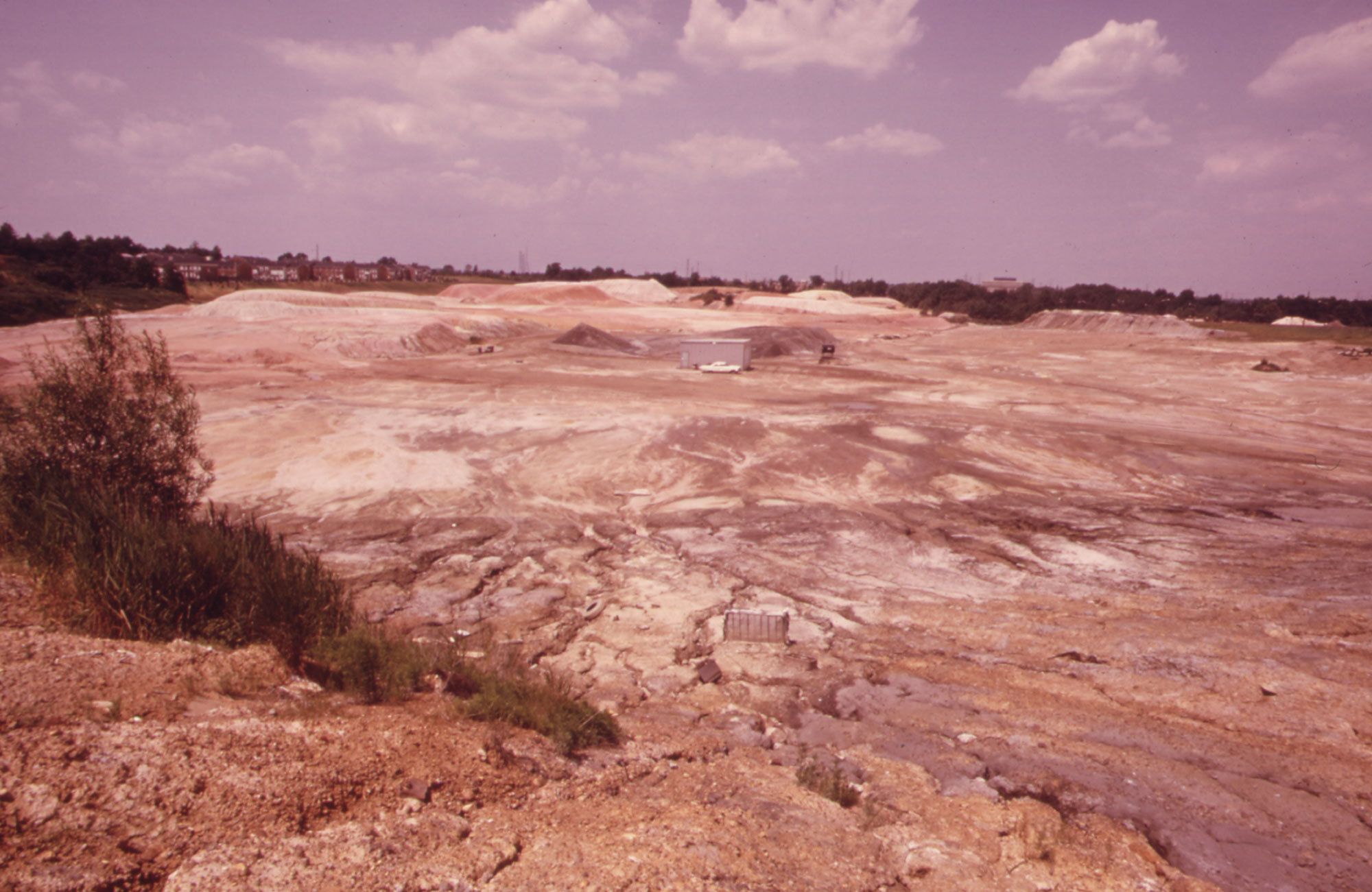
A clay pit in Woodbridge Township, New Jersey, 1973. Upper Cretaceous clays were once quarried in this region and also yield amber and tiny plant fossils. Photo by Ike Vern (DOCUMERICA, US EPA, National Archives Identifier 552004, unrestricted use).
Toward the end of the Cretaceous, global sea level was high, allowing the deposition of marine sediment across much of the Coastal Plain. Greensand, a green-colored sandstone that gets its color from the green mineral glauconite, was deposited in these marine settings during the Cretaceous, Paleogene, and Neogene. Since glauconite is associated with modern marine environments, its presence suggests to geologists that this sediment was deposited in the ocean.
The Cretaceous-Paleogene (K-Pg) boundary is usually indicated by evidence of a bolide (asteroid) impact, such as a spike in the rare earth element iridium and the presence of shocked quartz and spherules. Depending on the environmental context at the boundary, it may or may not be distinguished by a change in lithology. The K-Pg boundary has been identified in sections from New Jersey.
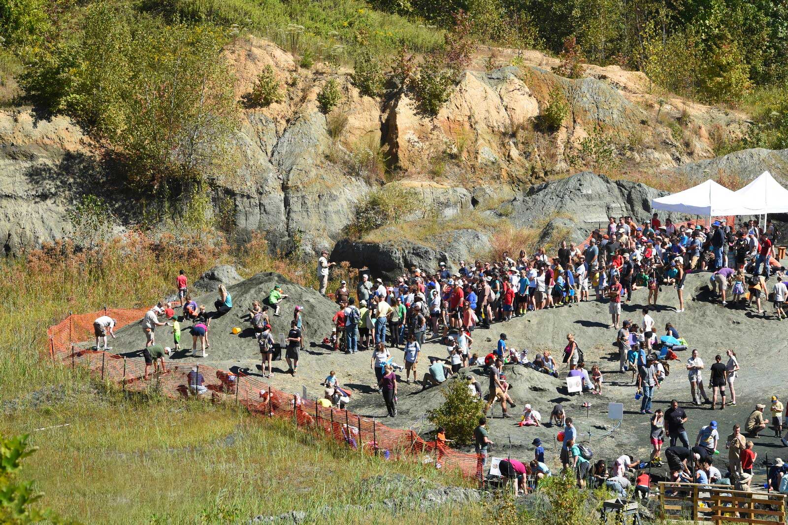
Edelman Fossil Park (also known as the Inversand site, an old greensand quarry), Mantua, New Jersey, during a community dig day. The site preserves glauconitic sand of the Upper Cretaceous Navesink Formation and the Upper Cretaceous to early Paleocene Hornerstown Formation. The location of the K-Pg boundary in this deposit is somewhat unclear, although shocked quartz and iridium occur, indicating that the boundary is present. Photo by Rowan-earth (Wikimedia Commons, Creative Commons Attribution-ShareAlike 4.0 International license).
Sample of glauconitic sandstone from near Hazlet, New Jersey. The greenish color comes from the presence of the mineral glauconite. Sample is 6 cm wide. Model by "rocksandminerals" (Sketchfab; Creative Commons Attribution 4.0 International license).
Paleogene and Neogene
Paleogene and Neogene marine sediments record the rise and fall of sea level over more than sixty million years. Erosion of the Appalachian Mountains continued throughout the Paleogene and Neogene, resulting in a thick band of gravel, sand, silt, and clay that was deposited along the Coastal Plain. By the end of the Neogene, siliciclastic (non-carbonate) sediment deposits had replaced carbonates as the dominant sediment of the Coastal Plain, transforming the entire area into a peninsula dominated by silts, sands, and clays. Sea level fluctuations shifted shorelines, generating cycles of sand, silt, clay, lignite, and carbonate sediments. The Calvert Cliffs in Maryland reveal an extensive deposit of chalks, clays, marls, and sands from the Miocene, derived from the erosion of rocks in the Piedmont region as well as older Coastal Plain deposits.
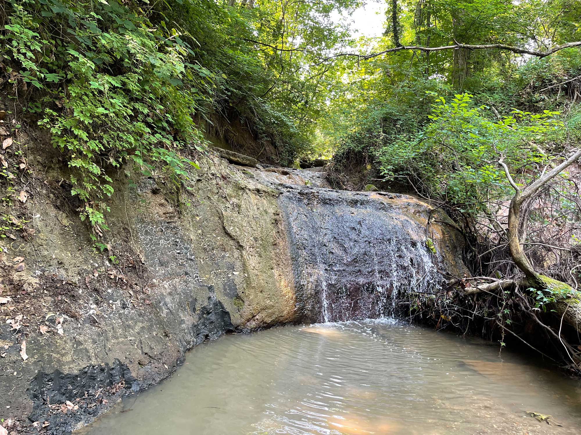
An exposure of the Paleocene Aquia Formation in Prince George's County, Maryland. This formation yields marine fossils. Source: USGS (public domain).
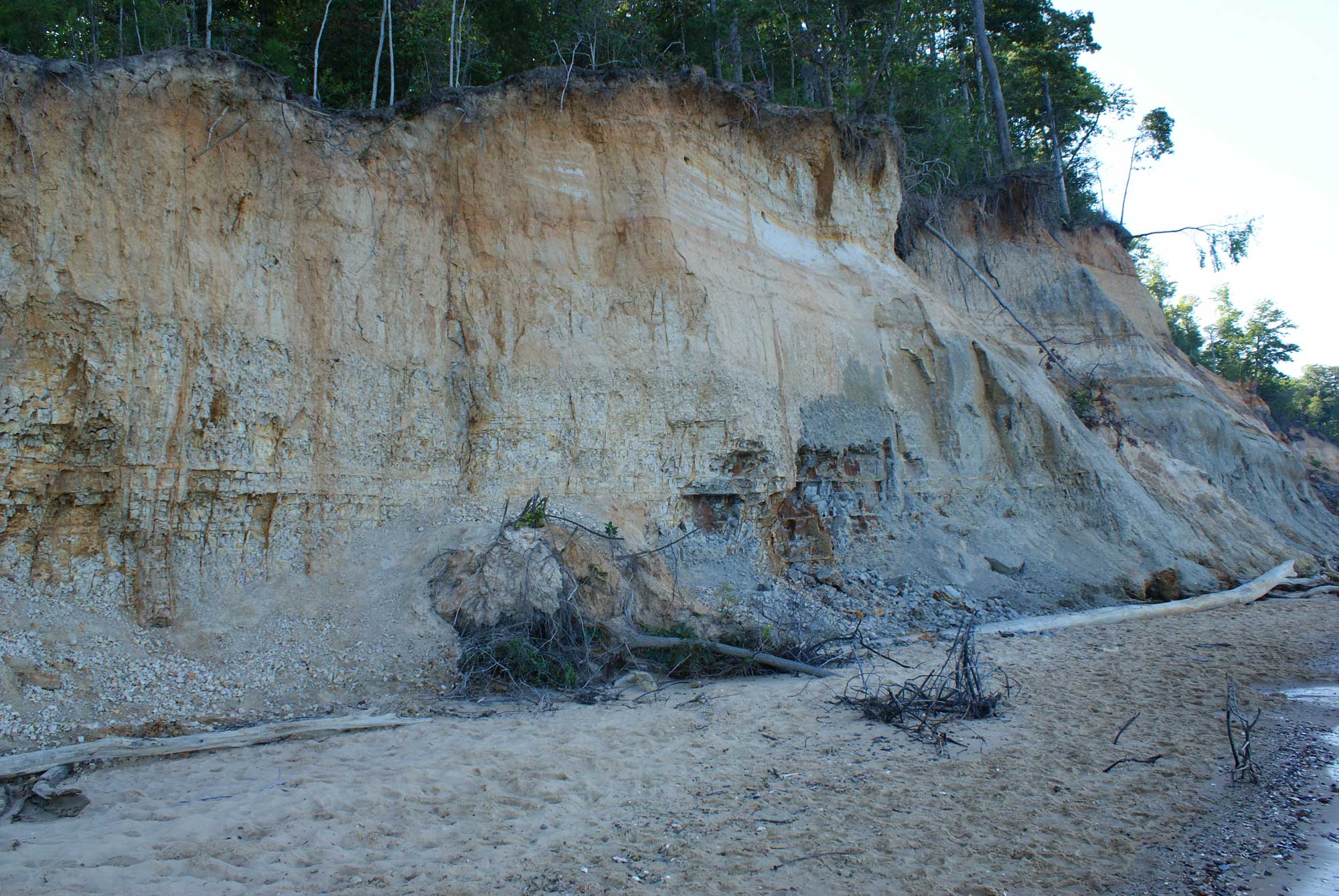
Calvert Cliffs at Calvert Cliffs State Park in Maryland. The Cliffs are made up of Miocene-aged sediments that yield marine fossils. Photo by kezee (flickr, Creative Commons Attribution 2.0 Generic license, image resized).
Quaternary
The Quaternary period is recorded in the youngest sediments of the Coastal Plain, and deposits from this time make up much of the sediment found immediately adjacent to modern estuaries, streams, floodplains, and creek beds throughout the Northeast. As glaciers moved over the northern part of the North American continent, they scraped up the surface and pushed tons of sediment before them like bulldozers. When the climate warmed and ice sheets melted back, sea level rose and meltwater streaming off the retreating glaciers dumped gravel, sand, silt, and clay into streambeds. Where the glacier stood still (neither advancing nor retreating for some time), huge deposits of outwash built up in front of the glacier. These deposits are known as a terminal moraines.
A series of terminal moraines in the Northeast represent the retreat of the glacier toward the north. Long Island, Cape Cod, and several smaller islands off the coast of New England (Block Island, Nantucket, Martha’s Vineyard) are testaments to this process. The islands are actually formed from glacial outwash and represent the maximum extent of the last glacial advance over 20,000 years ago.
The Pleistocene glaciers never advanced further south than Long Island and northern Pennsylvania, but glaciers still left their mark on the area farther south through deposits of gravel, sand, silt and clay that were carried in glacial meltwater. Erratics—boulders, cobbles, pebbles, gravel, and sand carried far from their origin by glacial melt—are also commonly found in the Northeastern states.
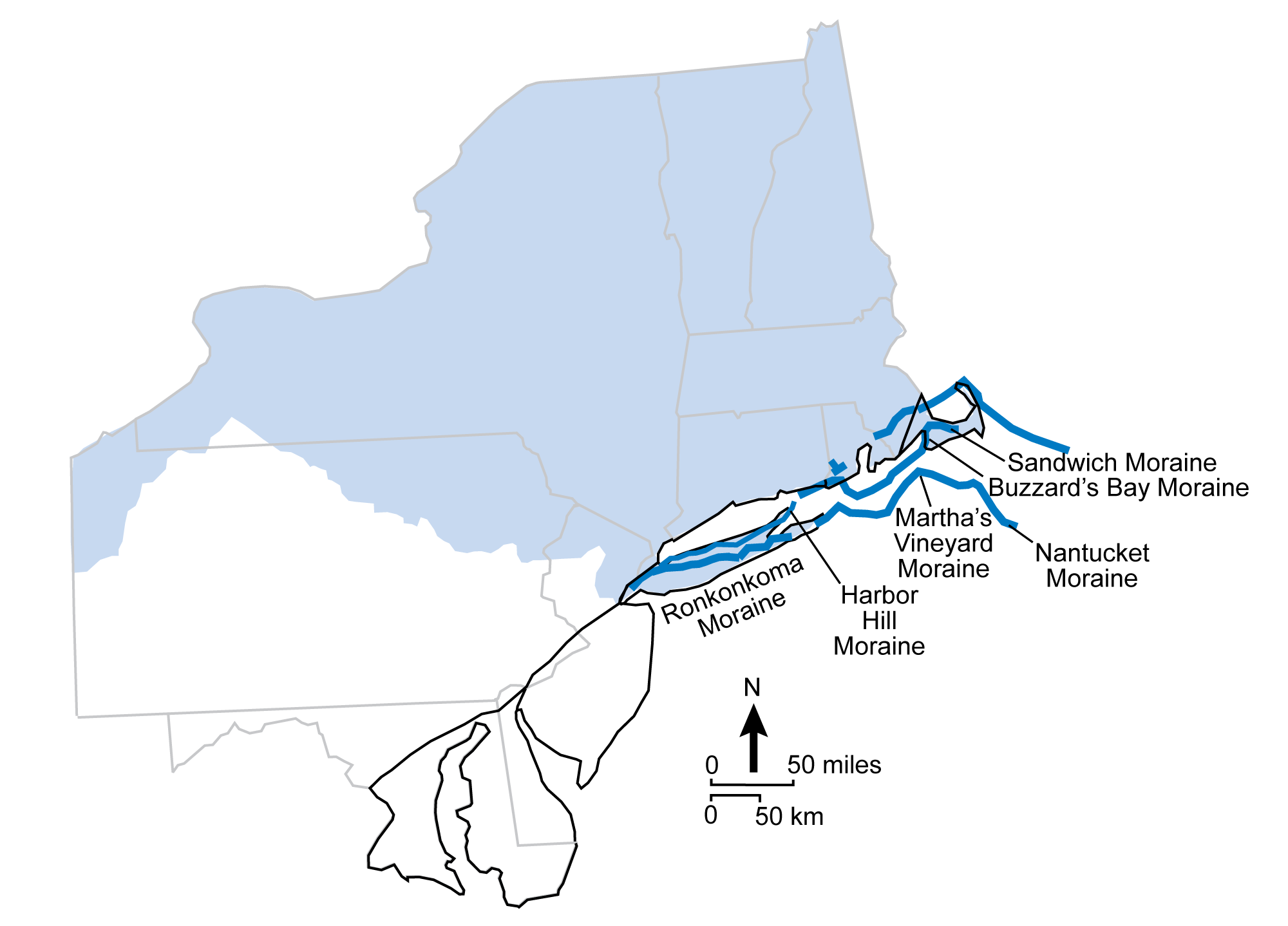
Terminal moraines of the Coastal Plain. The black line represents the boundary of the Coastal Plain region. The light blue shading represents the maximum extent of the most recent continental ice sheet. The dark blue lines are terminal moraines. Modified from figure 3.16 in The Teacher-Friendly Guide to the Geology of the Northeastern U.S. by J. E. Ansley (published in 2000 by the Paleontological Research Institution, reprinted in 2016).
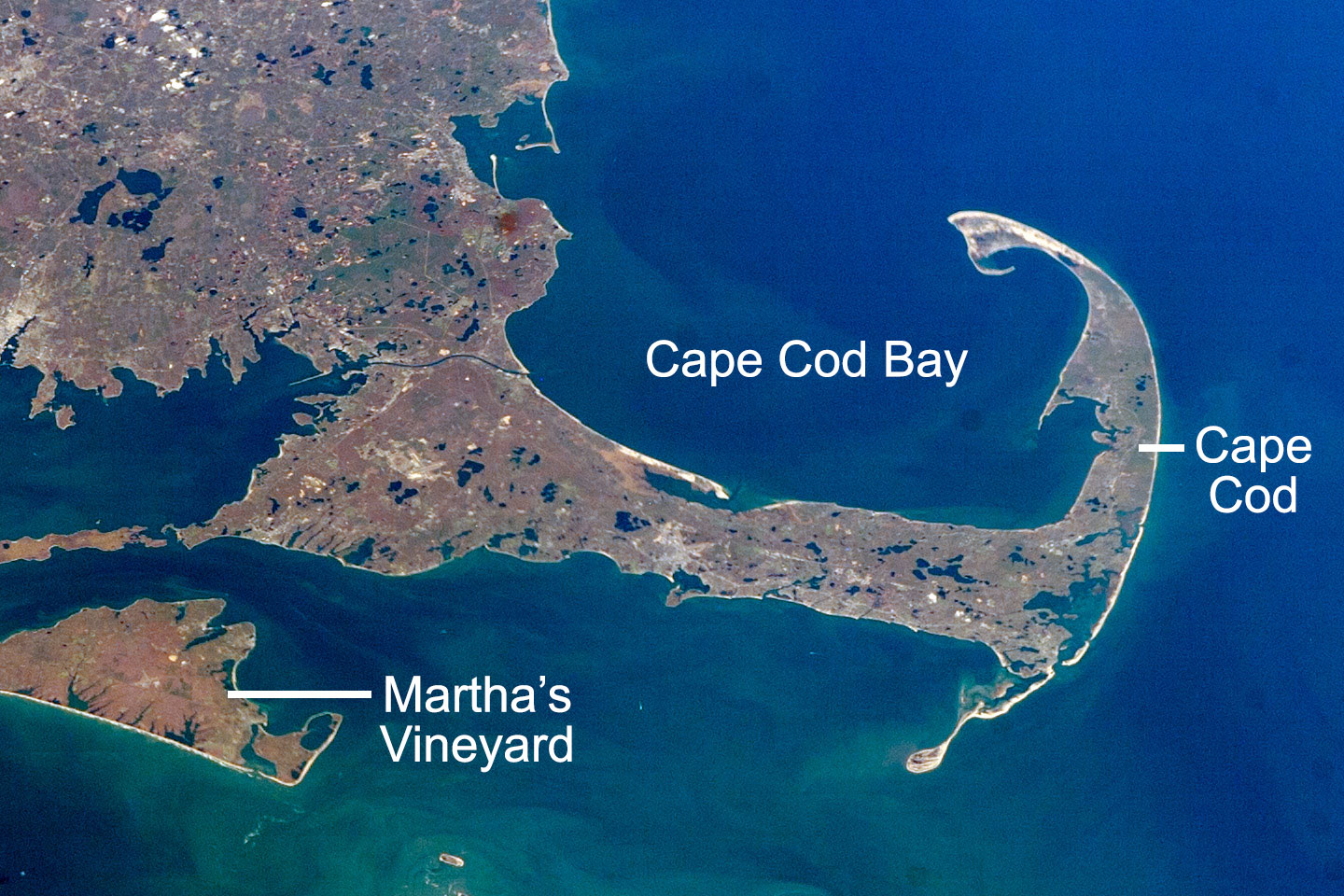
Satellite photo of Cape Cod, Massachusetts, and part fo Martha's Vineyard, November 7, 2007. These landforms are made up of moraines. Kettle lakes (discussed below) can be seen on Cape Cod and in mainland Massachusetts. Source: Astronaut photograph ISS016-E-10312, modified by NASA Earth Observatory (image used following NASA's image use policy).
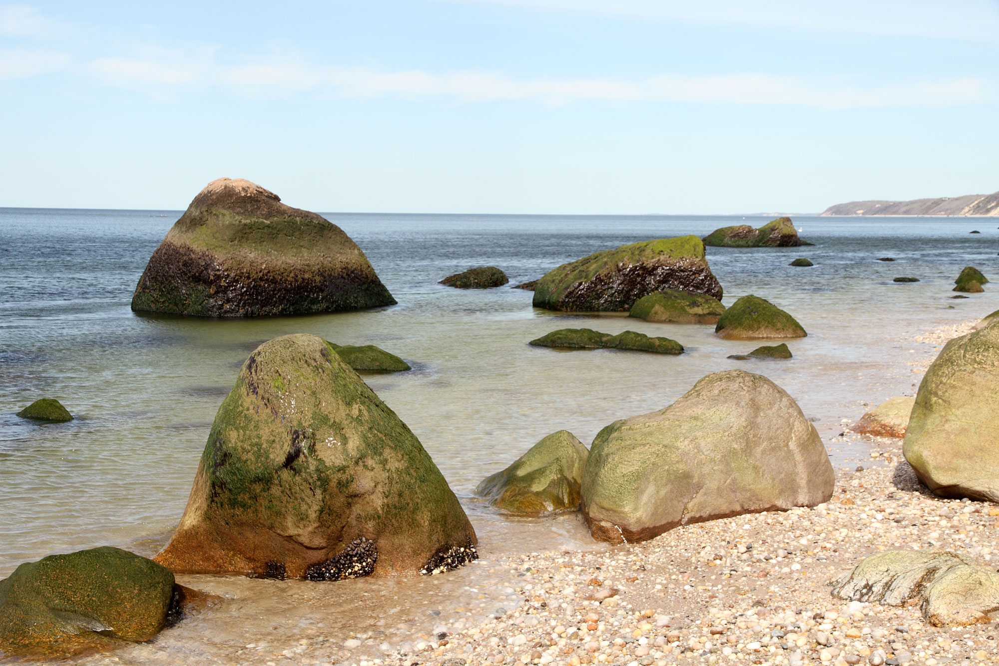
Glaical erratics on a beach bordering Long Island Sound, Baiting Hollow, Long Island, New York. Photo by Sandra Richard (flickr, Creative Commons Attribution-NonCommercial 2.0 Generic license, image resized).
Resources
Resources from the Paleontological Research Institution
Digital Encyclopedia of Earth Science: Minerals.
Earth@Home: Introduction to Rocks.
Earth@Home: Geologic time scale.
Earth@Home: Geologic maps.
Earth@Home Virtual Collection: Rocks (Virtual rock collection featuring 3D models of rock specimens sorted by type.)
Earth@Home: Earth Science of the South-central U.S.: Rocks of the Coastal Plain (continues coverage of the Gulf Coastal Plain in Arkansas, Louisiana, Missouri, Oklahoma, and Texas): https://earthathome.org/hoe/sc/rocks-cp/
Earth@Home: Earth Science of the Southeastern U.S.: Rocks of the Coastal Plain (continues coverage of the Atlantic and Gulf Coastal Plains in Alabama, Florida, Georgia, Kentucky, Mississippi, North Carolina, South Carolina, Tennessee, and Virginia): https://earthathome.org/hoe/se/rocks-cp/