

Page snapshot: Michigan State Geologic Map; Fossil; Rock; Mineral; Gem; Highest and Lowest Elevations; Places to Visit; and Additional Resources.
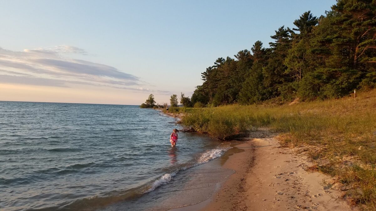
Image above: A child hunts for Petoskey stones near Antrim, Michigan. Photograph by "marada" (Flickr; Creative Commons Attribution-NoDervis 2.0 Generic license).
Geologic Map of Michigan
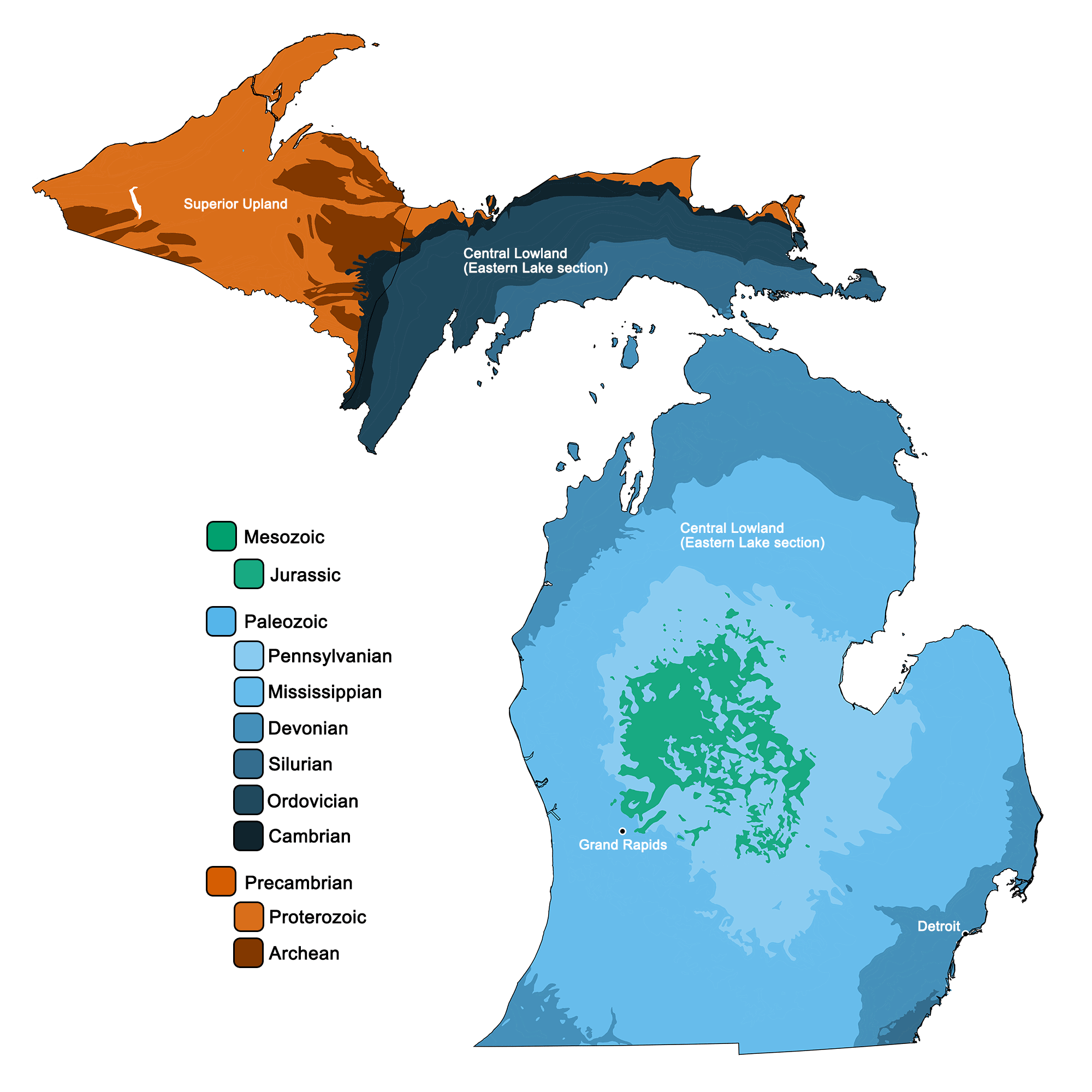
Geologic map of Michigan showing maximum ages of mappable units. Image by Jonathan R. Hendricks for the Earth@Home project developed using QGIS and USGS data (public domain) from Fenneman and Johnson (1946) and Horton et al. (2017).
Michigan State Fossil: American Mastodon
The official state fossil of Michigan is the American mastodon, Mammut americanum.
"Museum on the Move: Tracking the Mastodons" by U-M College of Literature, Science, and the Arts (YouTube).
Michigan State Rock: Petoskey stone
Petoskey stone is fossilized Hexogonaria coral from the Devonian Period.
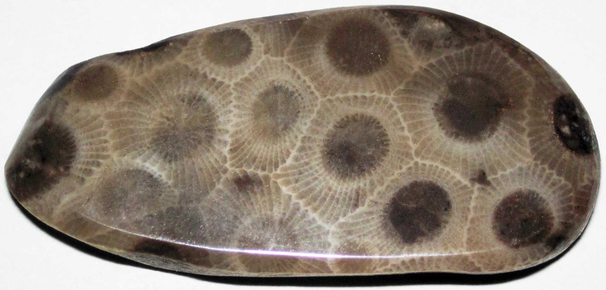
Petoskey stone (Hexagonaria coral) from Michigan; hexagons represent individual corallites. Photograph by James St. John (Flickr; Creative Commons Attribution 2.0 Generic license).
"Why Michigan is Full of Extinct Coral Fossils | Petoskey Stones" by Alexis Dahl (YouTube).
Michigan State Mineral: None
Michigan does not yet have an official state mineral.
Michigan State Gem: Chlorastrolite
Also called Michigan Greenstone, chlorastrolite is a variety of pumpellyite with a distinctive “turtleback” pattern created by its interlocking green crystals. It formed in void spaces in basalt during the Midcontinental Rift event, and, because it is substantially harder than the surrounding igneous rock, it is often found as loose, bean-sized pebbles. It is especially abundant on Michigan’s Isle Royale.
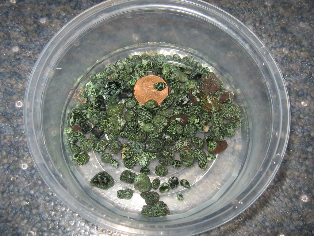
Small pieces of chlorastrolite from Michigan. Photograph by Charles Dawley (Flickr; Creative Commons Attribution-NonCommercial-NoDerivs 2.0 Generic license).
Michigan's Highest and Lowest Elevations
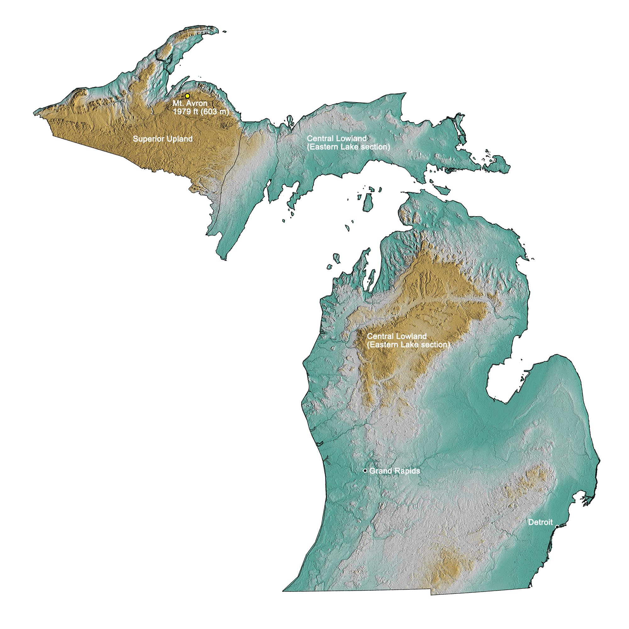
Topographic map of Michigan with physiographic regions and point of highest elevation identified. Topographic data are derived from the Shuttle Radar Topography Mission (SRTM GL3) Global 90m (SRTM_GL3) (Farr, T. G., and M. Kobrick, 2000, Shuttle Radar Topography Mission produces a wealth of data. Eos Trans. AGU, 81:583-583).
Highest Elevation: Mt. Avron
Michigan’s highest point, located on the Upper Peninsula, is Mt. Arvon at 603 meters (1979 feet).
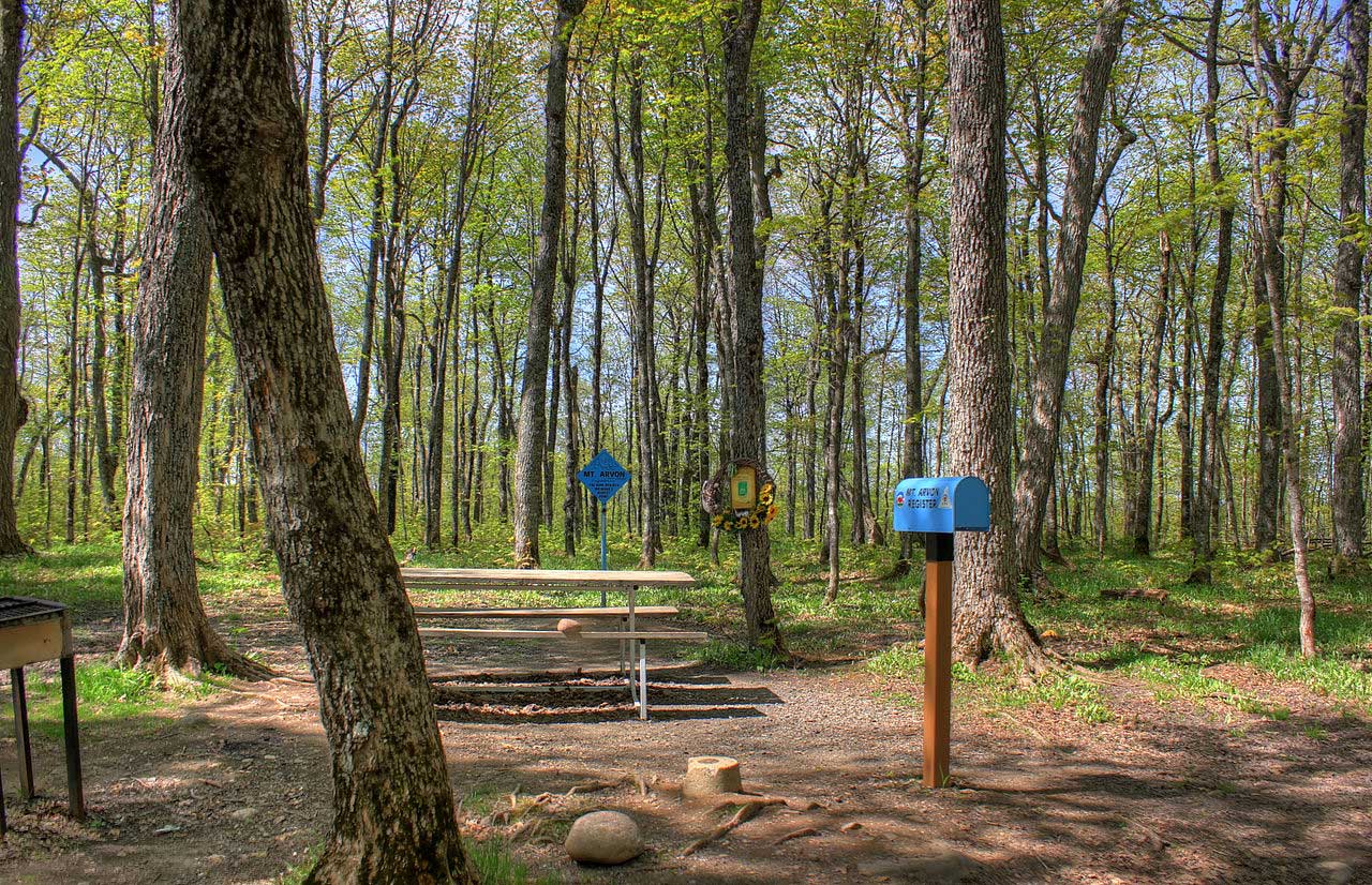
Summit of Mt. Avron, the point of highest elevation in Michigan. Photograph by Yinan Chen (Flickr; public domain).
Lowest Elevation: Lake Erie
Lake Erie is 174 meters (571 feet) above sea level, the lowest elevation in Michigan.
Places to Visit
"Michigan Minds: The New U-M Museum of Natural History" by University of Michigan (YouTube).
Schmaltz Geology Museum and Dinosaur Park
Department of Geological and Environmental Sciences, Western Michigan University, Kalamazoo, Michigan.
Petoskey, Michigan
Hunt for Petoskey stones!
Additional resources
Earth@Home resources about Michigan and nearby states:
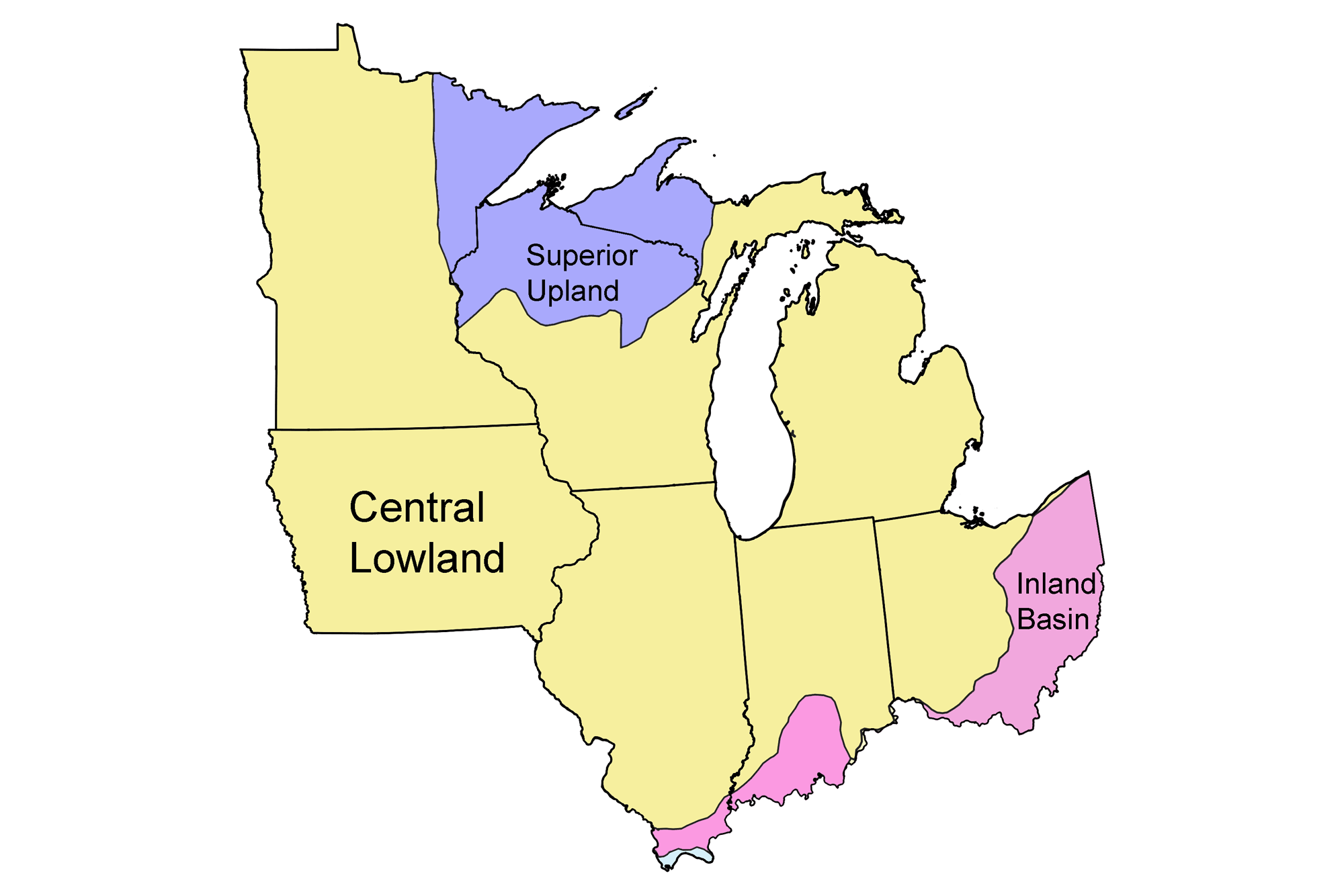
- Rocks: Superior Upland, Central Lowland, and Inland Basin
- Fossils: Superior Upland, Central Lowland, and Inland Basin
- Topography: Superior Upland, Central Lowland, and Inland Basin
- Mineral Resources: Superior Upland, Central Lowland, and Inland Basin
Earth@Home resources about the Midwest region of the United States: