

Page snapshot: Minnesota State Geologic Map; Fossil; 3D models; Rock; Mineral; Gem; Highest and Lowest Elevations; Places to Visit; and Additional Resources.
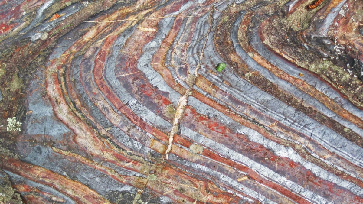
Image above: Archean-aged (~2.7 Ga) banded iron formation at Soudan, Minnesota. Photograph by James St. John (Flickr; Creative Commons Attribution 2.0 Generic license; image cropped and resized).
Geologic Map of Minnesota
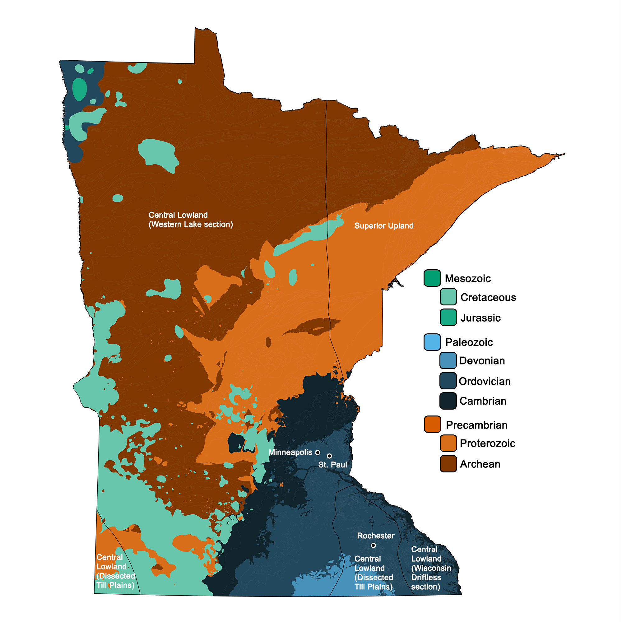
Geologic map of Minnesota showing maximum ages of mappable units. Image by Jonathan R. Hendricks for the Earth@Home project developed using QGIS and USGS data (public domain) from Fenneman and Johnson (1946) and Horton et al. (2017).
Minnesota State Fossil: None
Minnesota does not yet have an official state fossil.
3D Models of fossils from Minnesota
Fossil specimen of the discosorid cephalopod Westonoceras sp. from the Ordovician Galena Formation of Fillmore County, Minnesota (PRI 70364). Specimen is from the collections of the Paleontological Research Institution. Maximum length of specimen (not including surrounding rock matrix) is approximately 5.5 cm.
Trace fossil specimen of Raufella palmipes from the Ordovician Decorah Shale of St. Paul, Minnesota (PRI 76853). Specimen is from the research collections of the Paleontological Research Institution, Ithaca, New York. Length of specimen is approximately 7.5 cm.
Fossil angiosperm leaf from the Cretaceous Dakota Sandstone of south central Minnesota. Specimen is from the Cornell University Paleobotanical Collection (CUPC), Ithaca, New York (#2076.10). Length of specimen is approximately 12.5 cm.
Minnesota State Rock: None
Minnesota does not yet have an official state rock.
Minnesota State Mineral: None
Minnesota does not yet have an official state mineral.
Minnesota State Gem: Lake Superior agate
Characteristically red, Lake Superior agate originates near its namesake lake, but glaciers have redistributed enough of the stone that it may be found throughout much of the state.
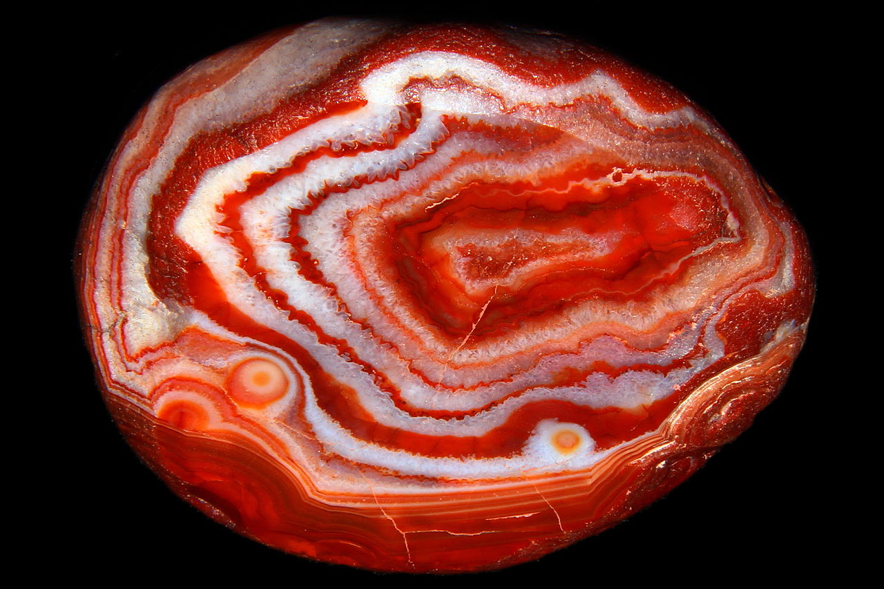
A Lake Superior agate from Duluth, Minnesota. Photograph by Lech Darski (Wikimedia Commons; Creative Commons Attribution-Share Alike 3.0 Unported license).
Minnesota's Highest and Lowest Elevations
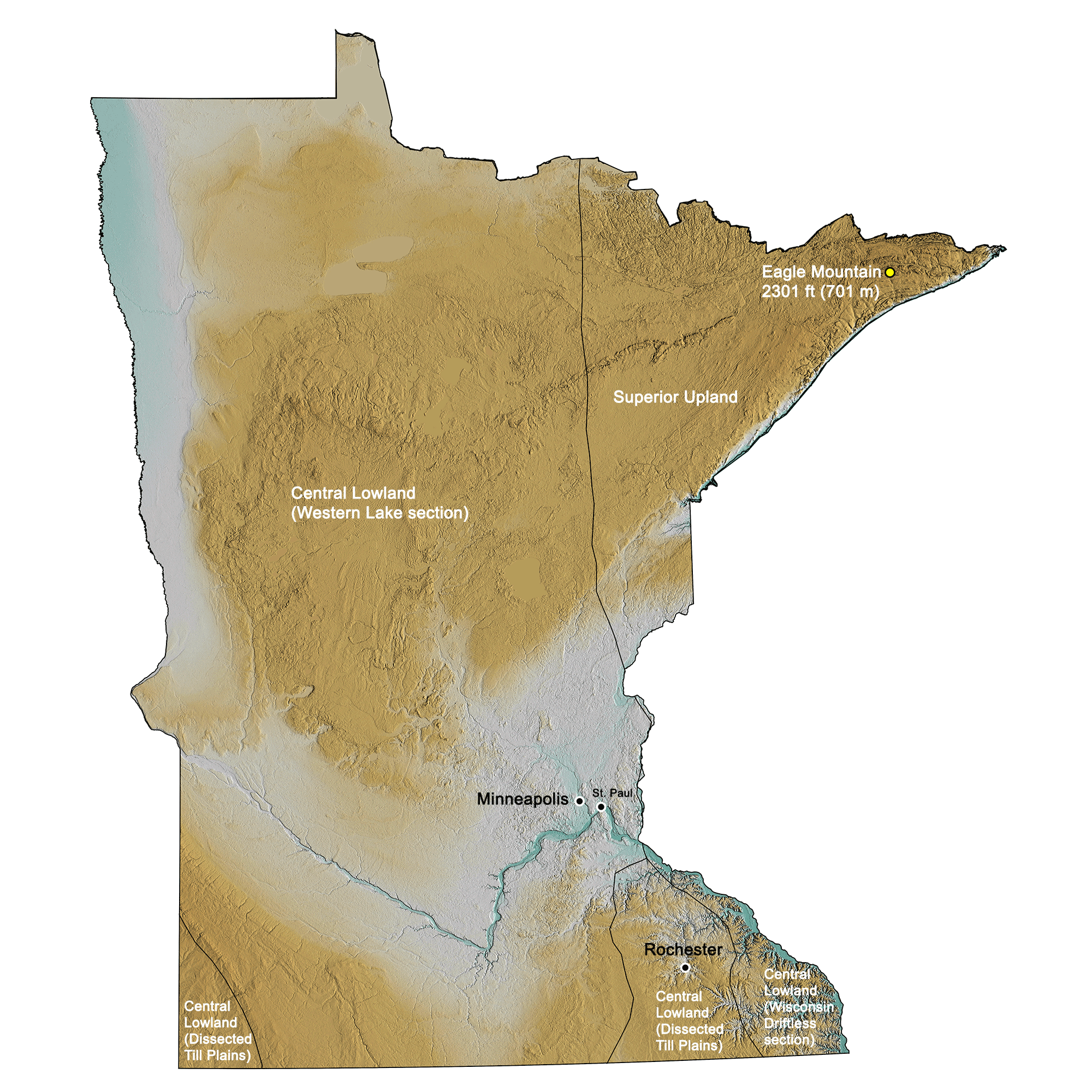
Topographic map of Michigan with physiographic regions and point of highest elevation identified. Topographic data are derived from the Shuttle Radar Topography Mission (SRTM GL3) Global 90m (SRTM_GL3) (Farr, T. G., and M. Kobrick, 2000, Shuttle Radar Topography Mission produces a wealth of data. Eos Trans. AGU, 81:583-583).
Highest Elevation: Eagle Mountain
Eagle Mountain is the highest point in Minnesota at 701 meters (2301 feet).
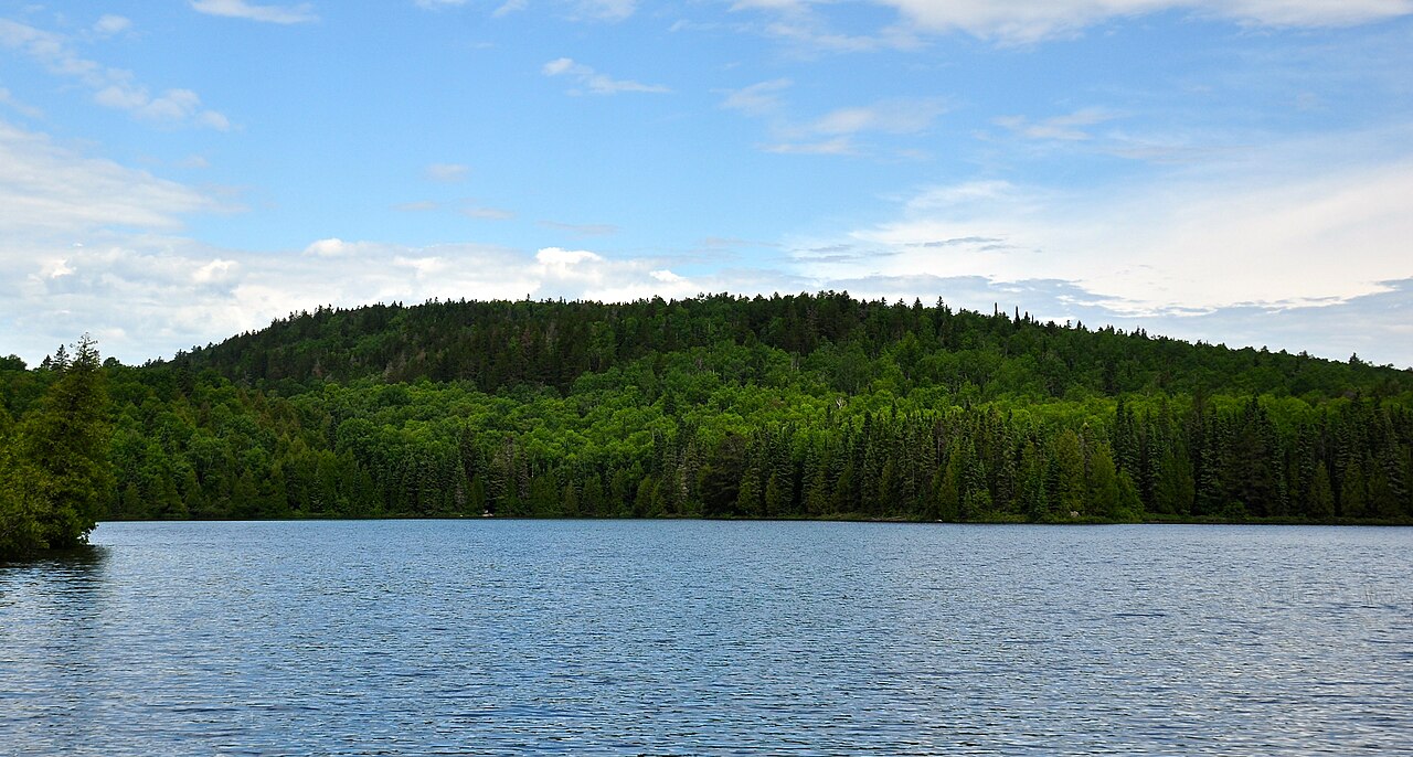
Eagle Mountain, the point of highest elevation in Minnesota. Photograph by Skye Marthaler (Wikimedia Commons; Creative Commons Attribution-Share Alike 3.0 Unported license).
Lowest Elevation: Lake Superior
Lake Superior, at 183 meters (601 feet) above sea level, is Minnesota's lowest elevation.
Places to Visit

The Science Museum of Minnesota. Photograph by "jpellgen" (Flickr; Creative Commons Attribution-NonCommercial-NoDerivs 2.0 Generic license).
Moose Lake Agate and Geological Center
Moose Lake, Minnesota.
Additional resources
Earth@Home resources about Minnesota and nearby states:
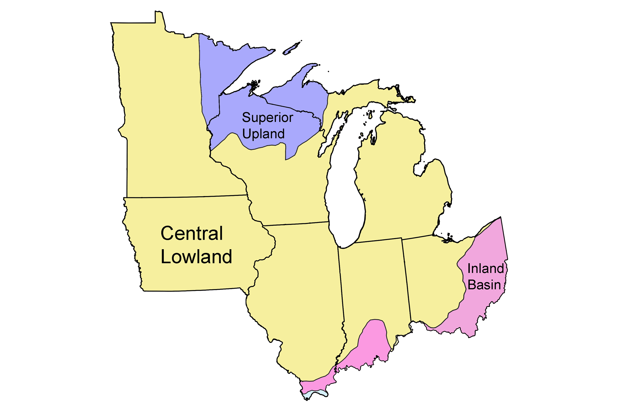
- Rocks: Superior Upland, Central Lowland, and Inland Basin
- Fossils: Superior Upland, Central Lowland, and Inland Basin
- Topography: Superior Upland, Central Lowland, and Inland Basin
- Mineral Resources: Superior Upland, Central Lowland, and Inland Basin
Earth@Home resources about the Midwest region of the United States: