

Page snapshot: North Dakota State Geologic Map; Fossil; Rock; Mineral; Gem; Highest and Lowest Elevations; Places to Visit; and Additional Resources.
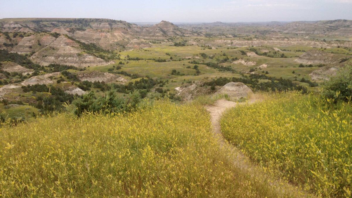
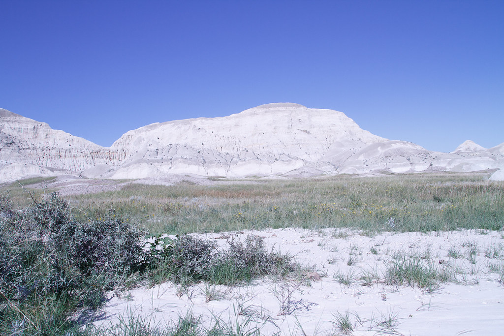
Image above: Badlands at Theodore Roosevelt National Park, North Dakota. Photograph by Jonathan R. Hendricks.
Geologic Map of North Dakota
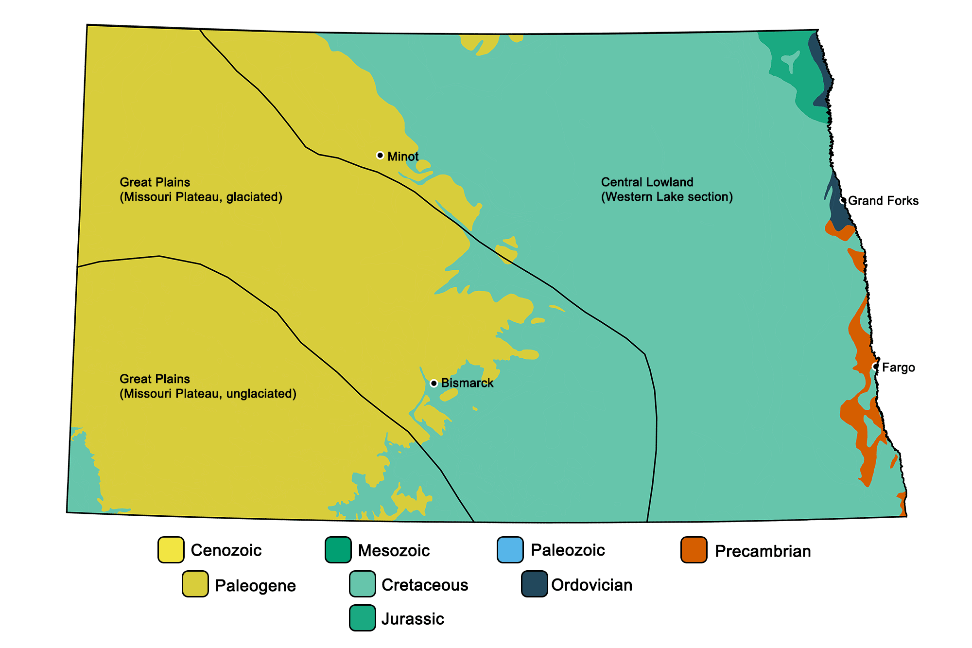
Geologic map of North Dakota showing maximum ages of mappable units. Image by Jonathan R. Hendricks for the Earth@Home project developed using QGIS and USGS data (public domain) from Fenneman and Johnson (1946) and Horton et al. (2017).
North Dakota State Fossil: Teredo Petrified Wood
Teredo Petrified Wood is the state fossil of North Dakota. Before burial and fossilization, this permineralized “petrified” wood was bored by a group of clams known as teredinids (one genus of which is Teredo). These clams are also known as “shipworms” for their tendency to “foul” wooden ships, docks, and other human structures.
Because of the steps described above, North Dakota is the only state that has an official state fossil that is actually composed of three separate types of fossils! These include: 1) ancient wood; 2) fossil clam; and 3) the burrow itself (a type of trace fossil called Teredolites).
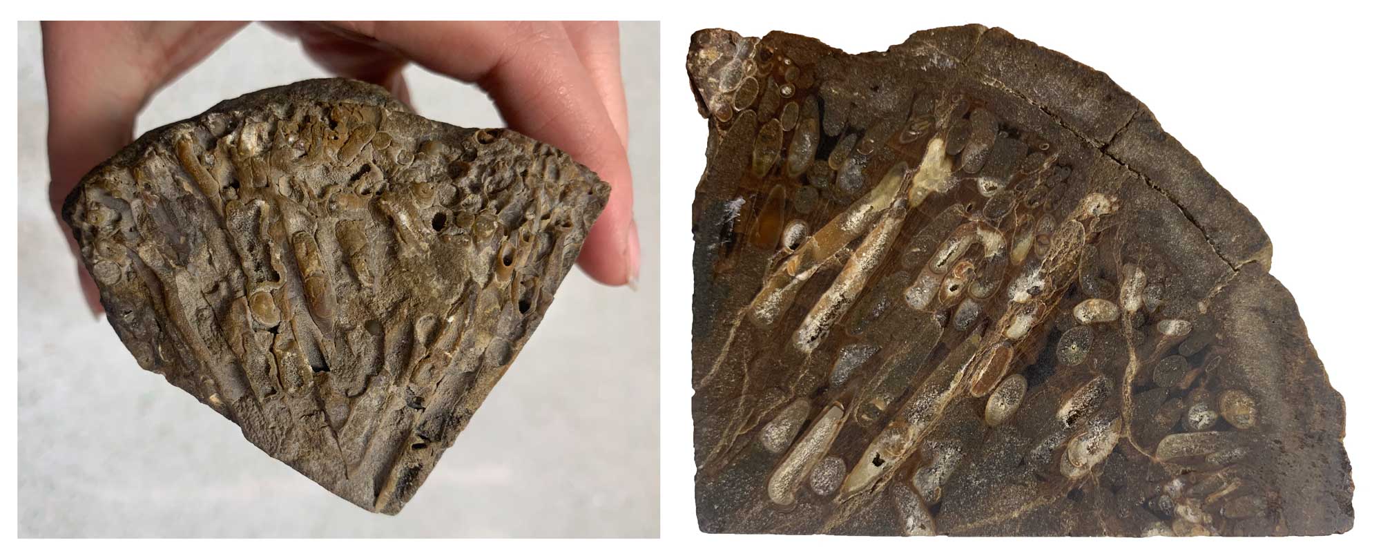
Specimen of Teredo Petrified Wood from North Dakota. Photographs provided by Lydia Tackett.
North Dakota State Rock: None
North Dakota does not yet have an official state rock. What do you think it should be?
North Dakota State Mineral: None
North Dakota does not yet have an official state mineral. What do you think it should be?
North Dakota State Gem: None
North Dakota does not yet have an official state gem. What do you think it should be?
North Dakota's Highest and Lowest Elevations
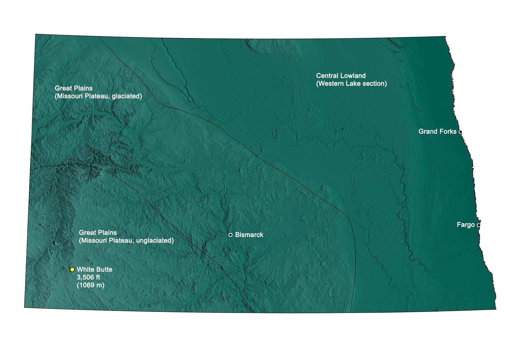
Topographic map of North Dakota with physiographic regions and point of highest elevation identified. Topographic data are derived from the Shuttle Radar Topography Mission (SRTM GL3) Global 90m (SRTM_GL3) (Farr, T. G., and M. Kobrick, 2000, Shuttle Radar Topography Mission produces a wealth of data. Eos Trans. AGU, 81:583-583).
Highest Elevation: White Butte
White Butte, located in North Dakota’s southwestern badlands, is the highest point in the state, rising to 1069 meters (3506 feet) in elevation. The butte, about 10 kilometers (6.5 miles) south of the town of Amidon, is on privately owned land, but a trail allows visitors to access the landmark.
White Butte, the highest point in North Dakota. Photograph by "alanpare" (Flickr; Creative Commons Attribution-NonCommercial-NoDerivs 2.0 Generic license).
Lowest Elevation: Red River
The lowest part of North Dakota, at 229 meters (751 feet) in elevation, is found along the Red River where it flows into Manitoba.
Places to Visit
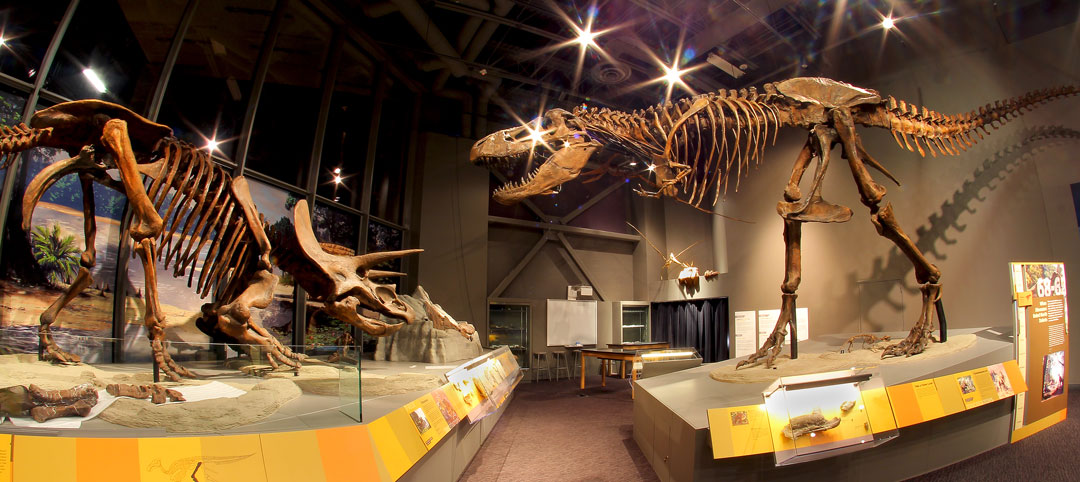
Dinosaur skeletons at the North Dakota Heritage Center & State Museum. Photograph by the State Historical Society of North Dakota (Wikimedia Commons; Creative Commons Attribution 4.0 International license).
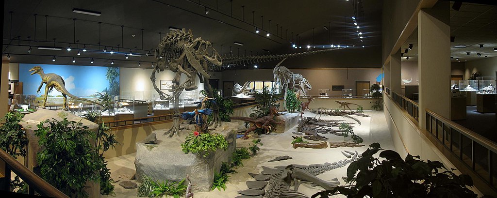
Dinosaur skeletons at the Dickinson Museum Center in Dickinson, North Dakota. Photograph by "Df9465" (Wikimedia Commons; Creative Commons Attribution-Share Alike 4.0 International license).
Additional resources
Earth@Home resources about North Dakota and nearby states:
- Rocks: Great Plains, Central Lowland
- Fossils: Great Plains, Central Lowland
- Topography: Great Plains, Central Lowland
- Energy: Great Plains, Central Lowland
- Mineral Resources: Great Plains, Central Lowland
Earth@Home resources about the Northwest Central region of the United States: