Page snapshot: Nebraska State Geologic Map; Fossil; 3D models; Rock; Mineral; Gem; Highest and Lowest Elevations; Places to Visit; and Additional Resources.
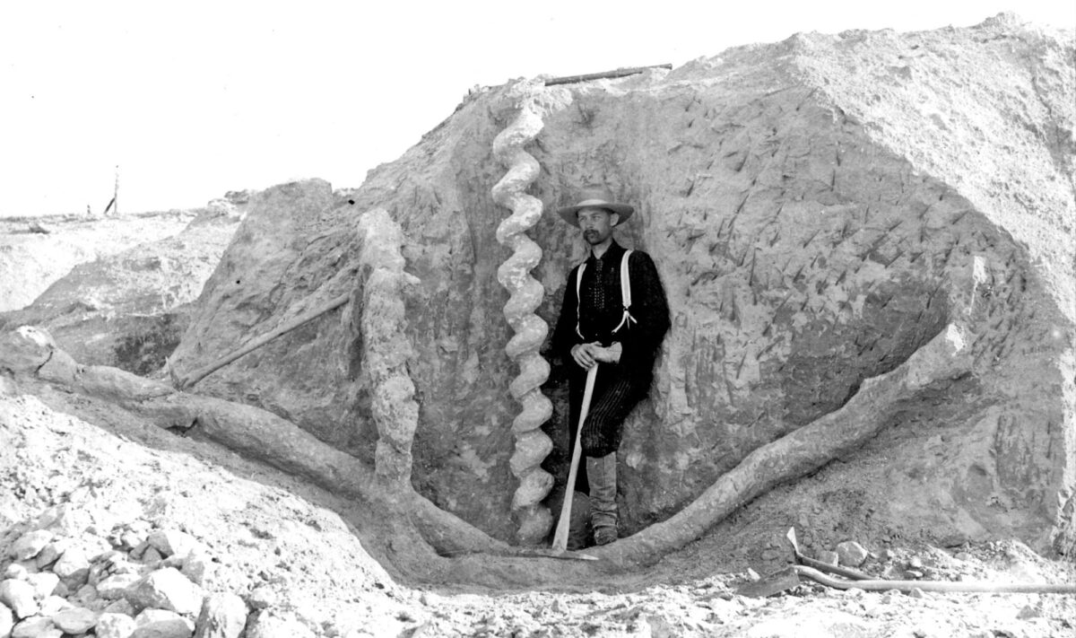
Image above:Fossil burrows, known as Daemonelix (“devil’s corkscrew”), of the extinct beaver Palaeocastor. This large burrow was discovered in the late 19th century at Agate Fossil Beds National Monument. Photo of a vintage photo by James St. John (Wikimedia Commons, Creative Commons Attribution 2.0 Generic license, image resized).
Geologic Map of Nebraska
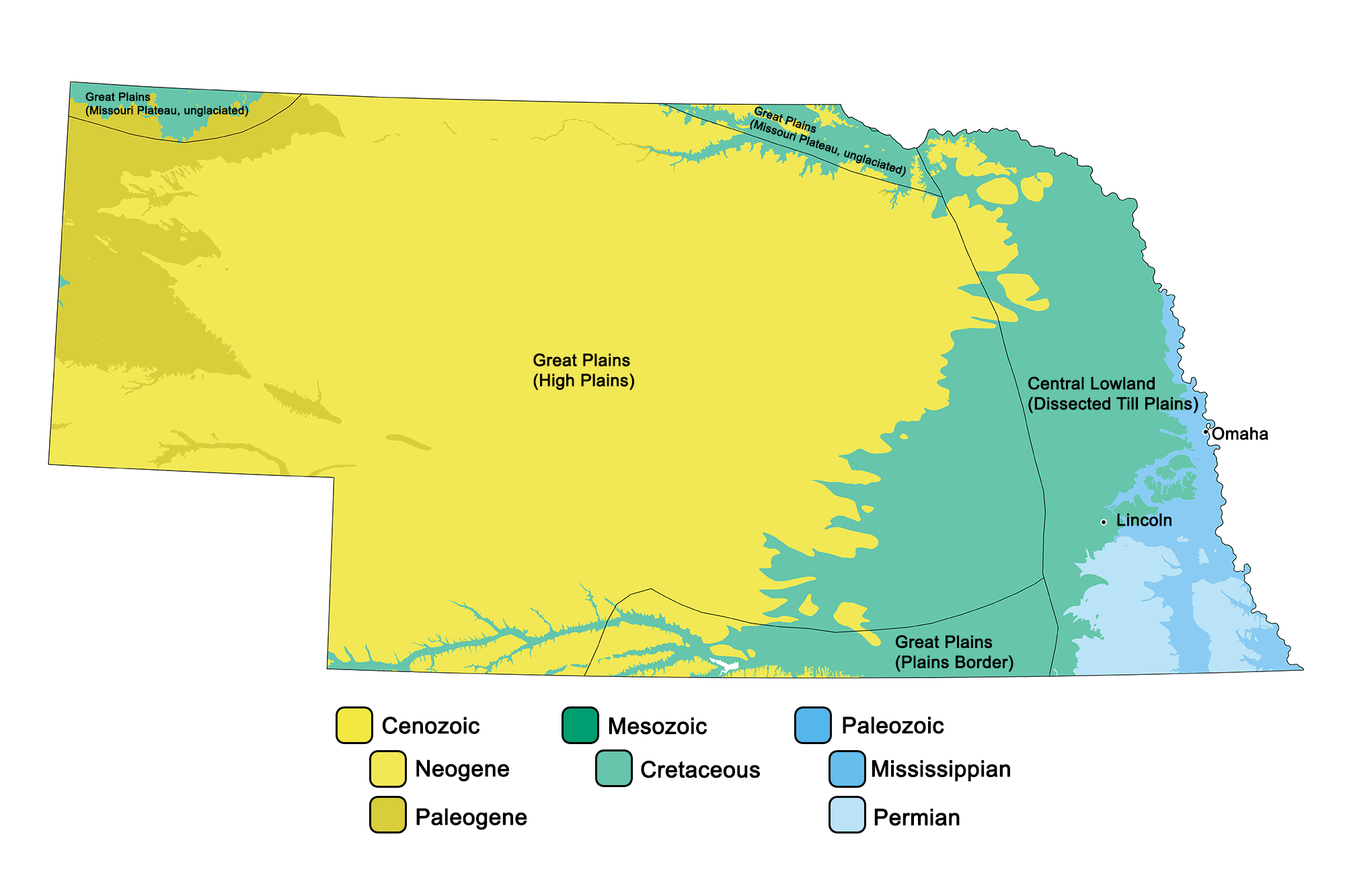
Geologic map of Nebraska showing maximum ages of mappable units. Image by Jonathan R. Hendricks for the Earth@Home project developed using QGIS and USGS data (public domain) from Fenneman and Johnson (1946) and Horton et al. (2017).
Nebraska State Fossil: Mammuthus columbi
The state fossil of Nebraska is the Neogene Columbian mammoth, Mammuthus columbi.
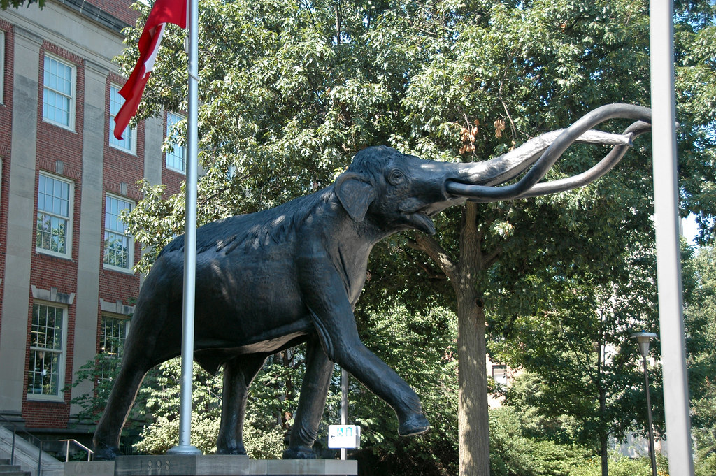
Model of a Columbian mammoth outside the Nebraska State Museum of Natural History in Lincoln. Photograph by James St. John (Flickr; Creative Commons Attribution 2.0 Generic license).
3D Models of fossils from Nebraska
Fossil brachiopod specimen of Composita subtilita from the Pennsylvanian of Nebraska (PRI 76919). Specimen is from the collections of the Paleontological Research Institution, Ithaca, New York. Longest dimention of specimen is approximately 3 cm.
Nebraska State Rock: Prairie agate
Prairie agate is a semiprecious variety of chalcedony known for its lack of the coarse banding present in most types of agate. It is found in abundance in the Ogalalla National Grasslands.
Nebraska State Mineral: None
Nebraska does not have an official state mineral. What do you think it should be?
Nebraska State Gem: Blue agate
This dark blue variety of chalcedony often exhibits blue and white banding. Blue agates formed from wind-blown silt and claystone deposited during the Oligocene and are found in northwestern Nebraska.
Nebraska's Highest and Lowest Elevations
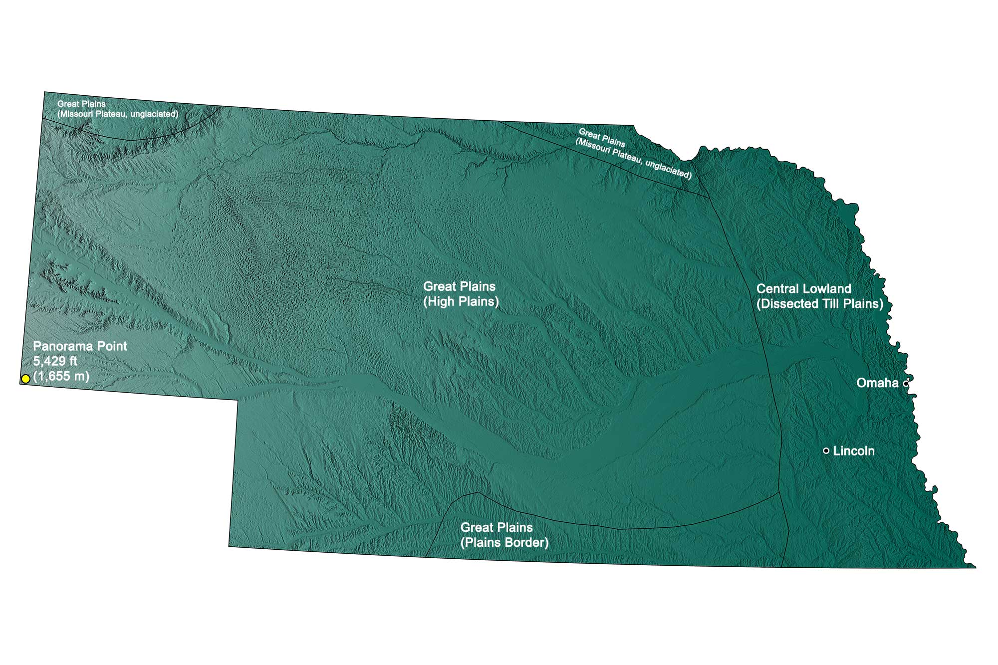
Topographic map of Nebraska with physiographic regions and point of highest elevation identified. Topographic data are derived from the Shuttle Radar Topography Mission (SRTM GL3) Global 90m (SRTM_GL3) (Farr, T. G., and M. Kobrick, 2000, Shuttle Radar Topography Mission produces a wealth of data. Eos Trans. AGU, 81:583-583).
Highest Elevation: Panorama Point
Panorama Point, located near the juncture of Colorado, Nebraska, and Wyoming, is the state’s highest point, with an elevation of 1655 meters (5,429 feet). Despite its name, this “point” is neither a peak nor a hill, but simply a rolling portion of the High Plains, marked only by an engraved stone and guest register.
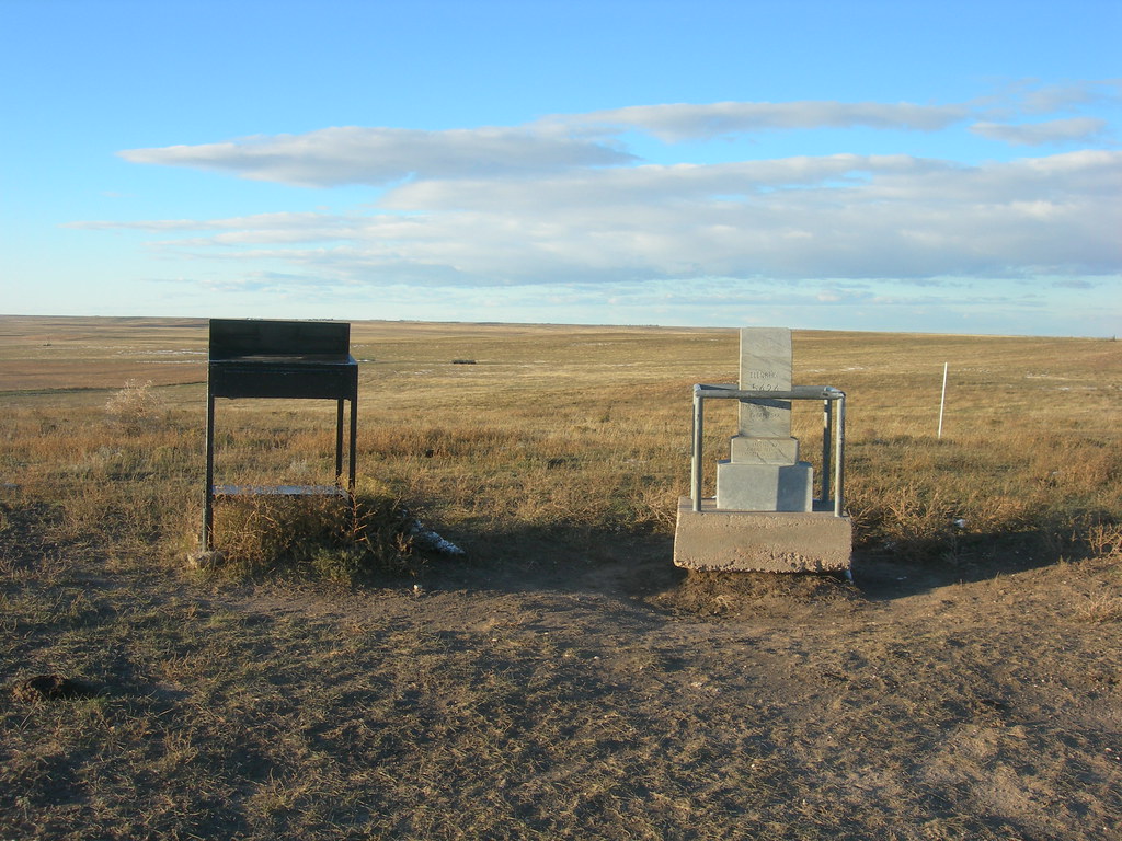
Panorama Point, the location of highest elevation in Nebraska. Photograph by Jimmy Emerson (Flickr; Creative Commons Attribution-NonCommercial-NoDerivs 2.0 Generic license).
Lowest Elevation: Missouri River
Nebraska’s lowest point, at 256 meters (840 feet) above sea level, is located along the Missouri River in Richardson County.
Places to Visit
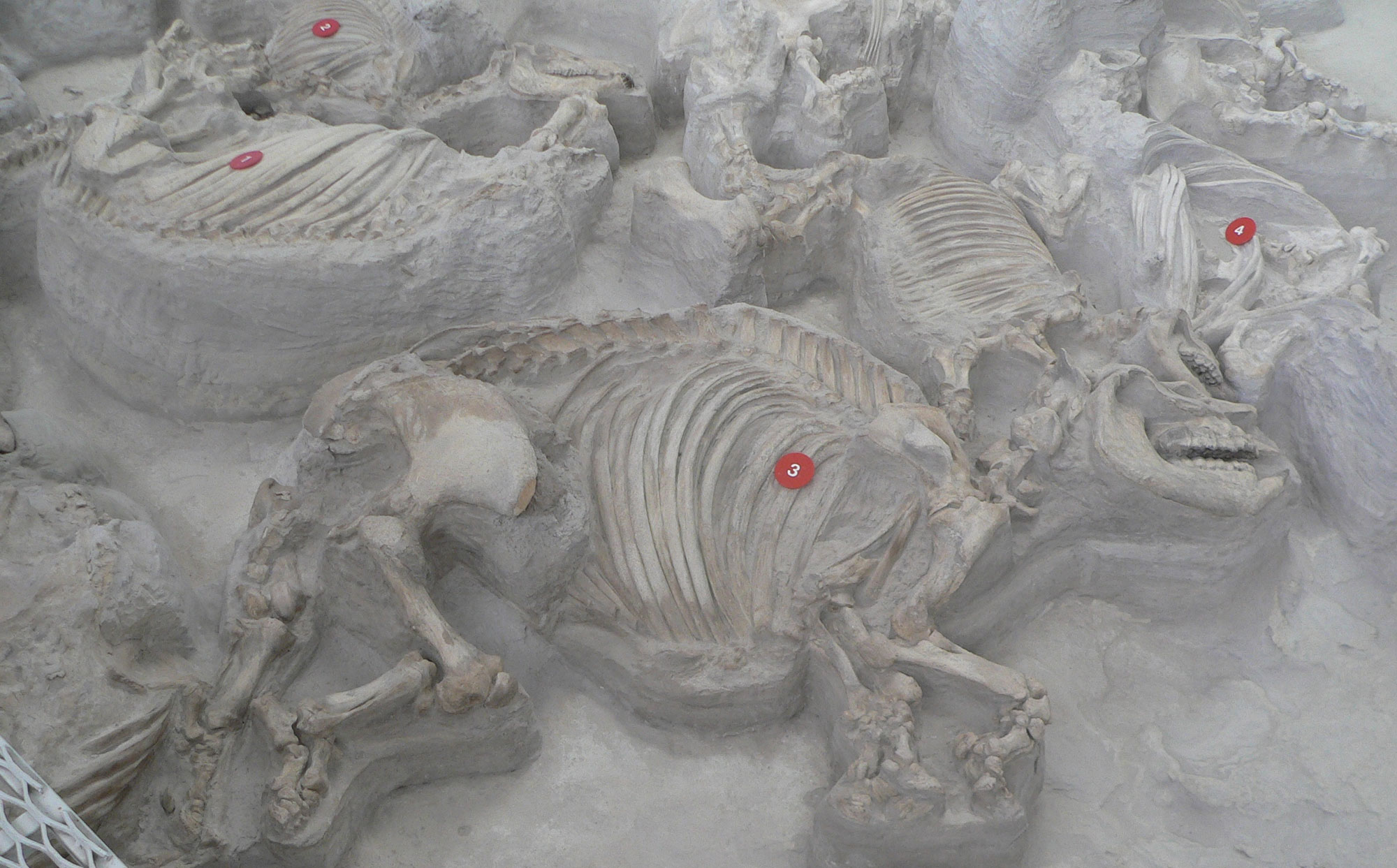
Skeletons of the North American rhino Teleoceras major preserved in a Miocene ash deposit, Ashfall Fossil Beds State Park, Antelope County, Nebraska. Photo by Ammodramus (Wikimedia Commons, CC0 1.0 Universal/public domain dedication).
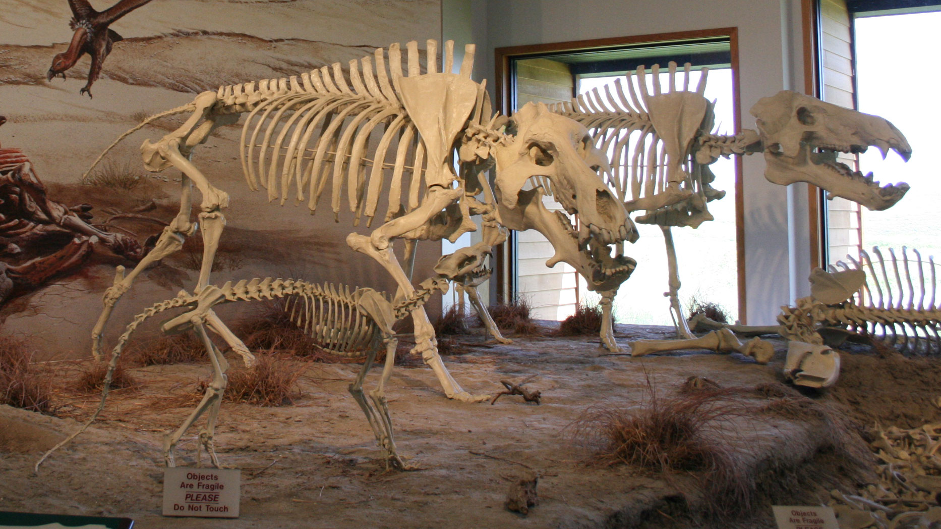
Recreated skeletons of two large entelodonts (hell pigs, Daeodon) and a beardog (Daphoenodon), Miocene, Agate Fossil Beds National Monument, Sioux County, Nebraska. The skeleton laying in the background is Moropus (see below). Photo by Jllm06 (Wikimedia Commons, Creative Commons Attribution-ShareAlike 4.0 International license, image cropped).
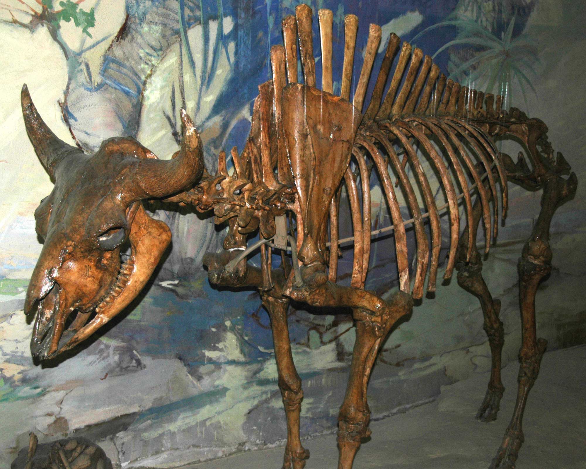
Bison antiquus, Pleistocene, Scotts Bluff County, Nebraska. Specimen on display in the Nebraska State Museum of Natural History, Lincoln, Nebraska. Photo by James St. John (flickr, Creative Commons Attribution 2.0 Generic license, image cropped and resized).
Additional resources
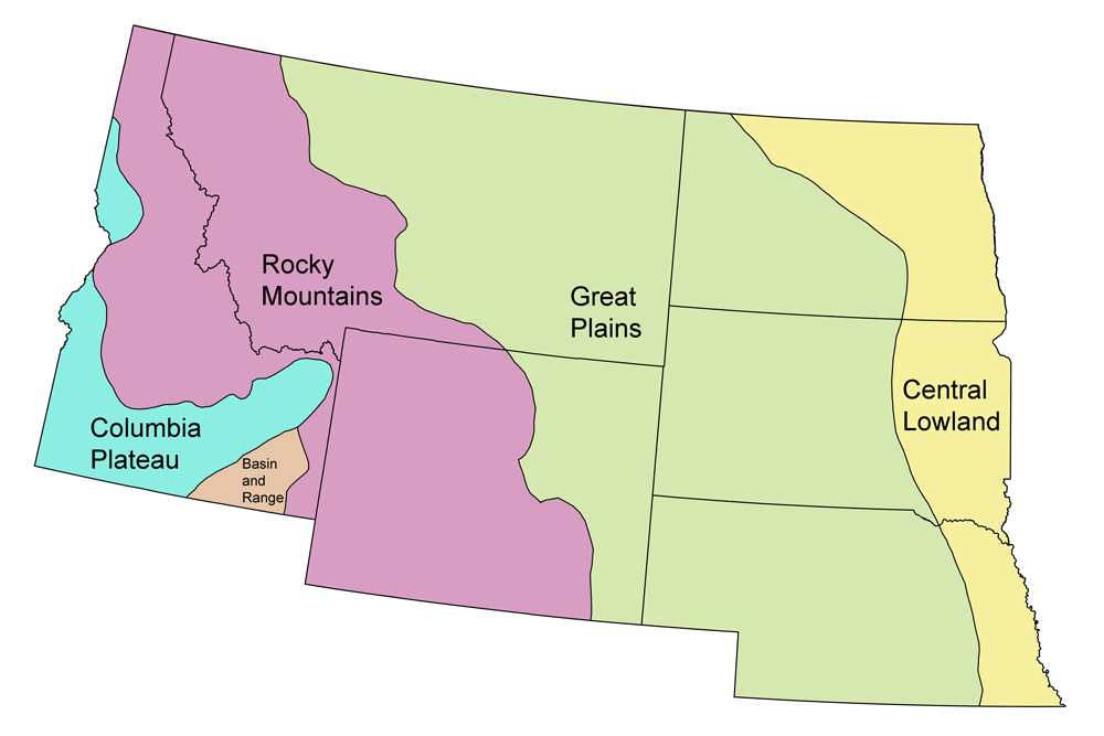
Earth@Home resources about Nebraska and nearby states:
- Rocks: Great Plains, Central Lowland
- Fossils: Great Plains, Central Lowland
- Topography: Great Plains, Central Lowland
- Energy: Great Plains, Central Lowland
- Mineral Resources: Great Plains, Central Lowland
Earth@Home resources about the Northwest Central region of the United States:


