Page snapshot: Montana State Geologic Map; Fossil; 3D models; Rock; Mineral; Gem; Highest and Lowest Elevations; Places to Visit; and Additional Resources.
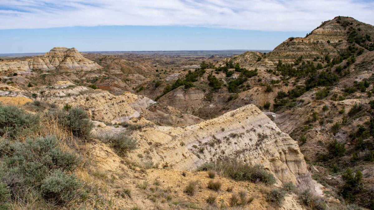
Image above: Terry Badlands, eastern Montana. Photograph by Ann Boucher, Bureau of Land Management (Flickr; public domain; image cropped and resized).
Geologic Map of Montana
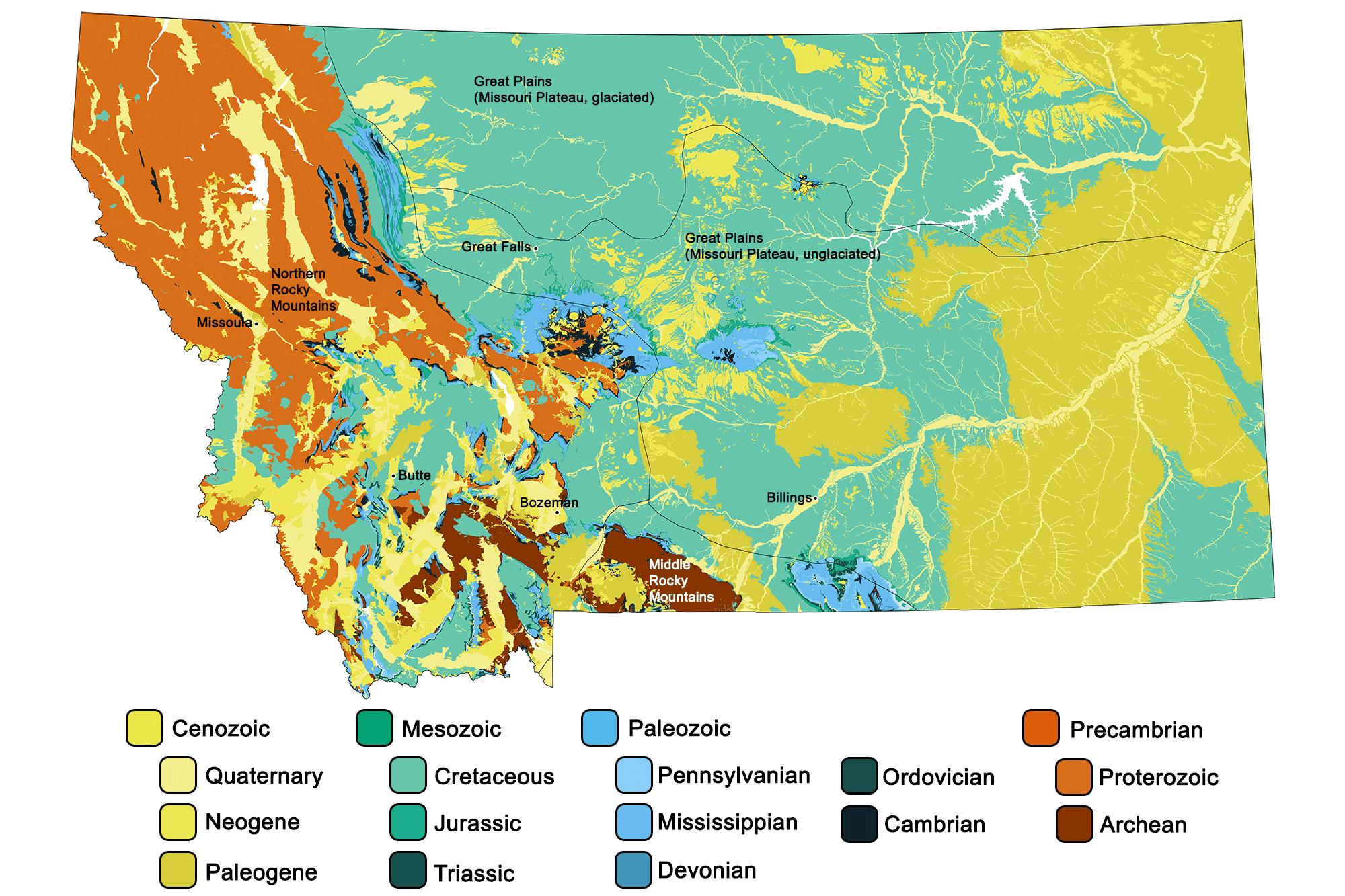
Geologic map of Montana showing maximum ages of mappable units. Image by Jonathan R. Hendricks for the Earth@Home project developed using QGIS and USGS data (public domain) from Fenneman and Johnson (1946) and Horton et al. (2017).
Montana State Fossil: Maiasaura peeblesorum
In the late 1970s and 1980s, nests of dinosaur eggs—some containing embryos—were discovered in rocks of Montana’s Two Medicine Formation, as well as adult skeletons of the same dinosaur. It was named Maiasaura, meaning “good mother lizard.” Maiasaura was a medium-sized hadrosaur, about 8 meters (26 feet) long. It was bipedal and plant-eating. Maiasaura was the first dinosaur ever found associated with nests of babies, and its embryos were the first ever found of a dinosaur. One of the sites where these fossils were found was named Egg Mountain, west of Choteau in Teton County, Montana. The fossils showed that Maiasaura made a shallow nest in the ground about 2 meters (6.5 feet) in diameter, in which it laid clutches of 30 to 40 eggs. Because different nests had different-sized babies, paleontologists suggested that the babies were living in the nests when they died, and were being cared for by their parents. Maiasaura has only been found in Montana.
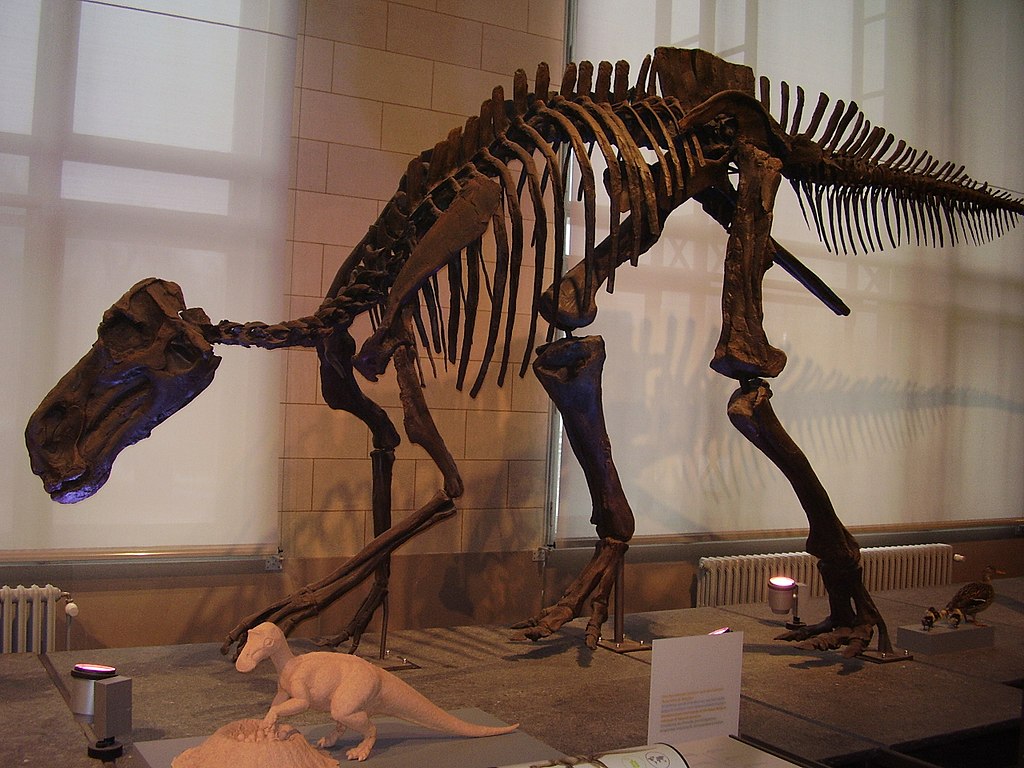
Skeleton of Maiasaura peeblesorum on display at the Brussels Natural History Museum. Photograph by Vladimir Socha (Wikimedia Commons; Creative Commons Attribution-Share Alike 4.0 International license).
3D Models of fossils from Montana
Fossil specimen of the stromatolite Collenia versiformis from the Proterozoic of Montana. Specimen is from the Cornell University Paleobotanical Collection (CUPC), Ithaca, New York.
Calcareous alga fossil Fisherites reticulatus (previously known as Receptaculites oweni) from the Ordovician of Montana (PRI 76292). Specimen is on display at the Museum of the Earth, Ithaca, New York. Longest dimension of specimen is approximately 29 cm.
Fossil specimen of a Tyrannosaurus rex tooth (fragment) from the Cretaceous Hell Creek Formationof Montana. Specimen is from the research collections of the Paleontological Research Institution, Ithaca, New York. Length of specimen is approximately 6 cm.
Small fossil crocodile (Borealosuchus sternbergi) jaw bone with teeth from the Cretaceous Hell Creek Formation of Montana. Specimen is from the research collections of the Paleontological Research Institution, Ithaca, New York. Length of specimen is approximately 7.5 cm.
Montana State Rock: None
Montana does not yet have an official state rock. What do you think it should be?
Montana State Mineral: None
Montana does not yet have an official state mineral. What do you think it should be?
Montana State Gems: Montana agate and sapphire
Montana agates are usually light yellow or clear in color, and contain bands and inclusions of red and black iron and other mineral oxides. They are found in Pleistocene-aged gravel deposits around the Yellowstone River and its tributaries.
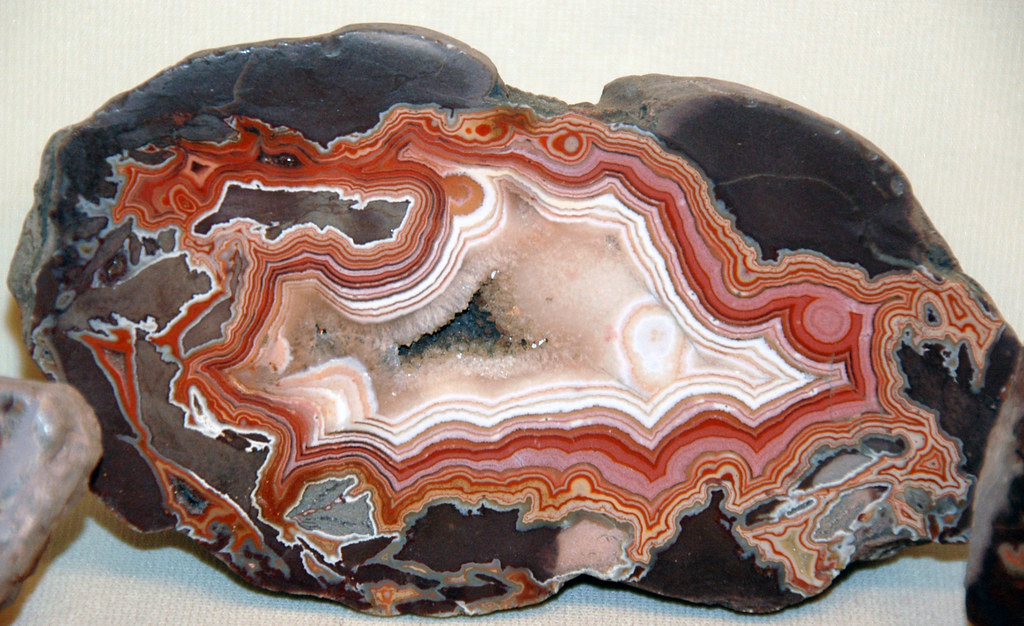
Banded agate inside a geode from Montana. Photograph by James St. John (Flickr; Creative Commons Attribution 2.0 Generic license).
Montana sapphires are found in four major areas: the Missouri River, the Sapphire Mountains, Yogo Gulch, and Deer Lodge. These gemstones appear in a greater variety of colors than sapphires found anywhere else in the world, leading to Montana’s nickname as the “Treasure State.”
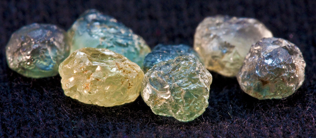
A variety of uncut sapphires from Montana. Photograph by "Orbital Joe" (Flickr; Creative Commons Attribution-NonCommercial-NoDerivs 2.0 Generic license).
Montana's Highest and Lowest Elevations
Topographic map of Montana with physiographic regions and point of highest elevation identified. Topographic data are derived from the Shuttle Radar Topography Mission (SRTM GL3) Global 90m (SRTM_GL3) (Farr, T. G., and M. Kobrick, 2000, Shuttle Radar Topography Mission produces a wealth of data. Eos Trans. AGU, 81:583-583).
Highest Elevation: Granite Peak
At 3904 meters (12,807 feet) in elevation, Granite Peak is Montana’s highest point and a popular mountain climbing destination. The mountain, part of the Beartooth range located 16 kilometers (10 miles) north of the Wyoming border, is considered the second most difficult state high point to climb.
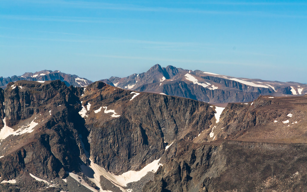
Granite Peak, Montana. Photograph by Troy Smith (Flickr; Creative Commons Attribution-NonCommercial-NoDerivs 2.0 Generic license).
Lowest Elevation: Kootenai River at Kootenai Falls
At the Montana-Idaho border, the Kootenai River tumbles over Kootenai Falls to land at an elevation of 555 meters (1820 feet), Montana’s lowest point.
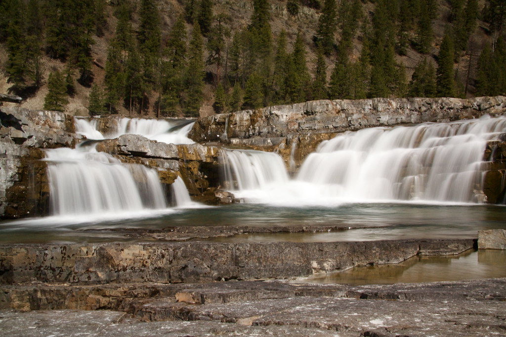
Kootenai Falls, Montana. Photograph by Troy Smith (Flickr; Creative Commons Attribution-NonCommercial-NoDerivs 2.0 Generic license).
Places to Visit
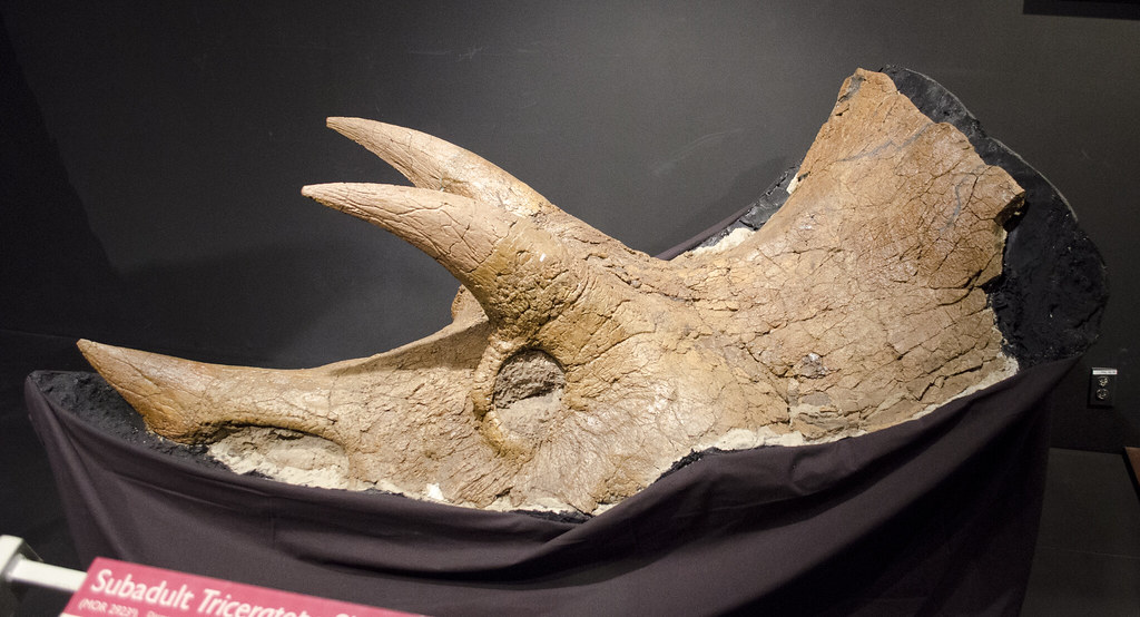
Skull of a subadult Triceratops on display at the Museum of the Rockies, Bozeman, Montana.
Montana Technological University Mineral Museum
Great Plains Dinosaur Museum & Field Station
Malta, Montana.
Montana Dinosaur Center
Bynum, Montana.
Additional resources
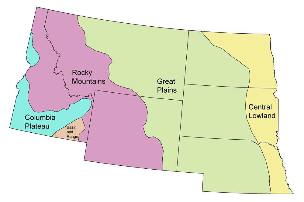
Earth@Home resources about Montana and nearby states:
- Rocks: Rocky Mountains, Great Plains
- Fossils: Rocky Mountains, Great Plains
- Topography: Rocky Mountains, Great Plains
- Energy: Rocky Mountains, Great Plains
- Mineral Resources: Rocky Mountains, Great Plains
Earth@Home resources about the Northwest Central region of the United States:


