Page snapshot: Wyoming State Geologic Map; Fossil; 3D models; Rock; Mineral; Gem; Highest and Lowest Elevations; Places to Visit; and Additional Resources.
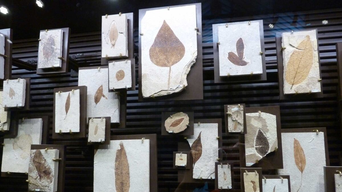
Image above: Eocene fossil plants from Fossil Butte National Monument in Wyoming. Photograph by Jonathan R. Hendricks.
Geologic Map of Wyoming
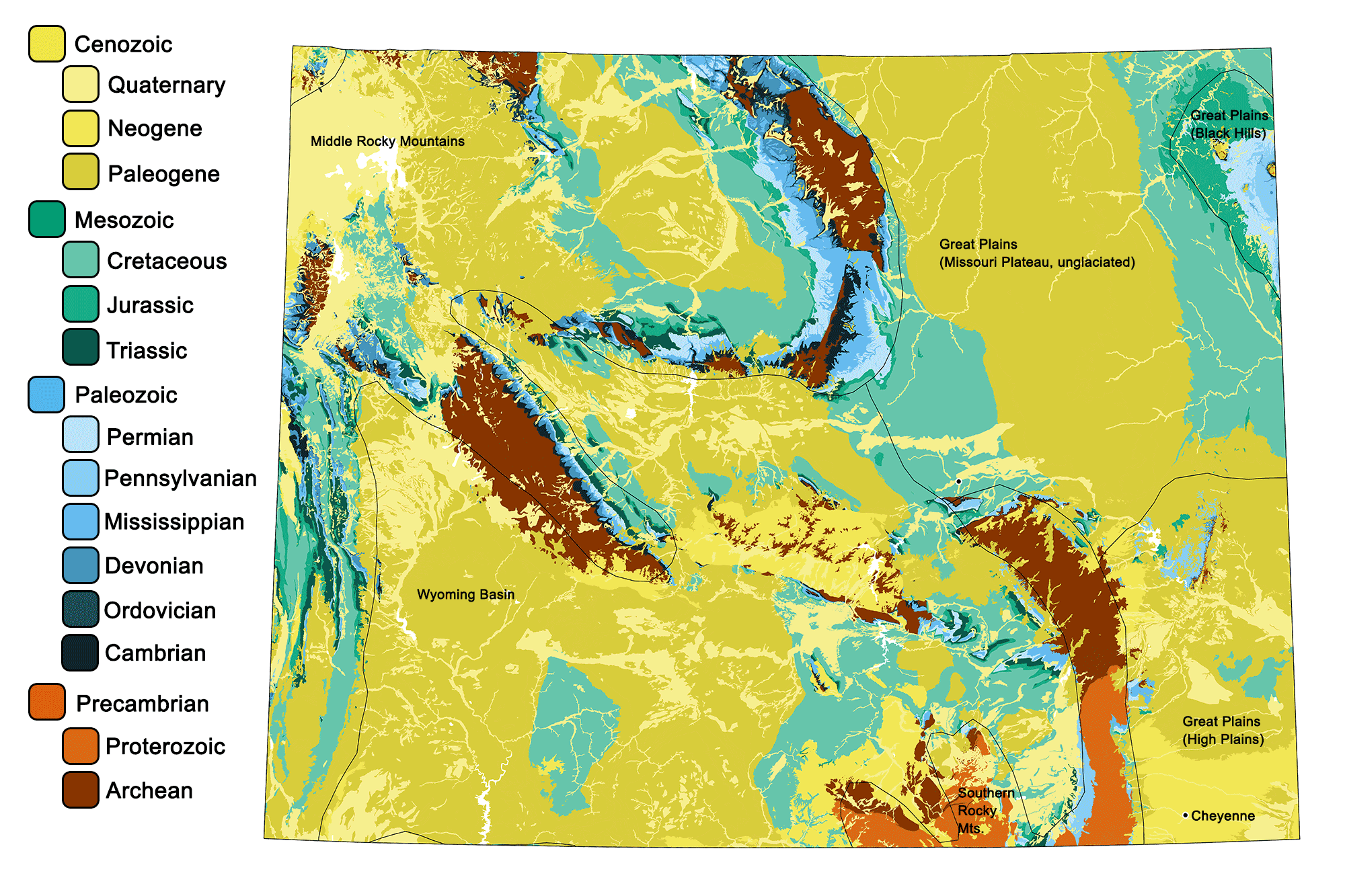
Geologic map of Wyoming showing maximum ages of mappable units. Image by Jonathan R. Hendricks for the Earth@Home project developed using QGIS and USGS data (public domain) from Fenneman and Johnson (1946) and Horton et al. (2017).
Wyoming State Fossil: Knightia eocaena
Wyoming's state fossil is the Eocene fish Knightia eocaena.
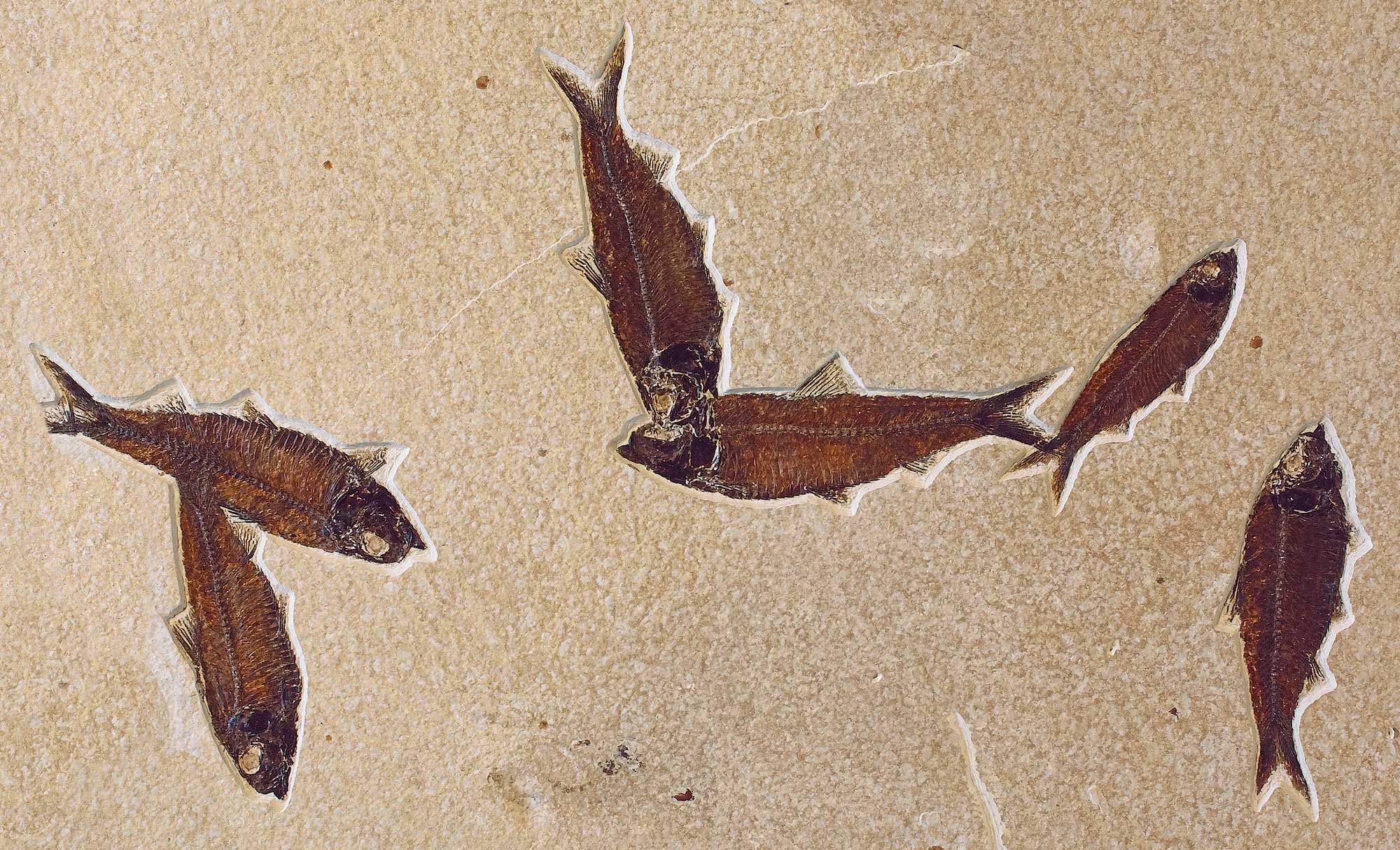
Slab showing mass mortality of Knightia eocaena, a freshwater fish similar to a herring, Fossil Lake, Wyoming. Photo by National Park Service (public domain).
3D Models of fossils from Montana
Fossil specimen of the stromatolite Chlorellopsis coloniata from the Eocene of Wyoming. Specimen is from the Cornell University Paleobotanical Collection (CUPC), Ithaca, New York.
Fossil specimen of the cephalopod (belemnite) Pachytheuthis densus from the Jurassic of Wyoming (PRI 70604). Specimen is from the collections of the Paleontological Research Institution, Ithaca, New York. Length of specimen is approximately 11.5 cm.
Fossil specimen of a Poebrotherium sp. camel skull exhibiting an endocast of the brain; specimen is from the Oligocene of Wyoming and is on exhibit at the Museum of the Earth, Ithaca, New York (PRI 49382).
Fossil bird feather from the Eocene of Lincoln County, Wyoming. Specimen is from the research collections of the Paleontological Research Institution, Ithaca, New York. Length of feather is approximately 3 cm.
Coprolite (fossilized dung) from the Eocene Green River Formation of Wyoming (PRI 76857). Specimen is from the research collections of the Paleontological Research Institution, Ithaca, New York. Longest dimension of coprolite is approximately 5.5 cm.
Wyoming State Rock: None
Wyoming does not yet have an official state rock. What do you think it should be?
Wyoming State Mineral: None
Wyoming does not yet have an official state mineral. What do you think it should be?
Wyoming State Gem: Nephrite Jade
This green stone was first described in the Granite Mountains of central Wyoming in 1936. Wyoming’s jade is considered to be some of the world’s finest nephrite, and it appears in many varieties and colors.
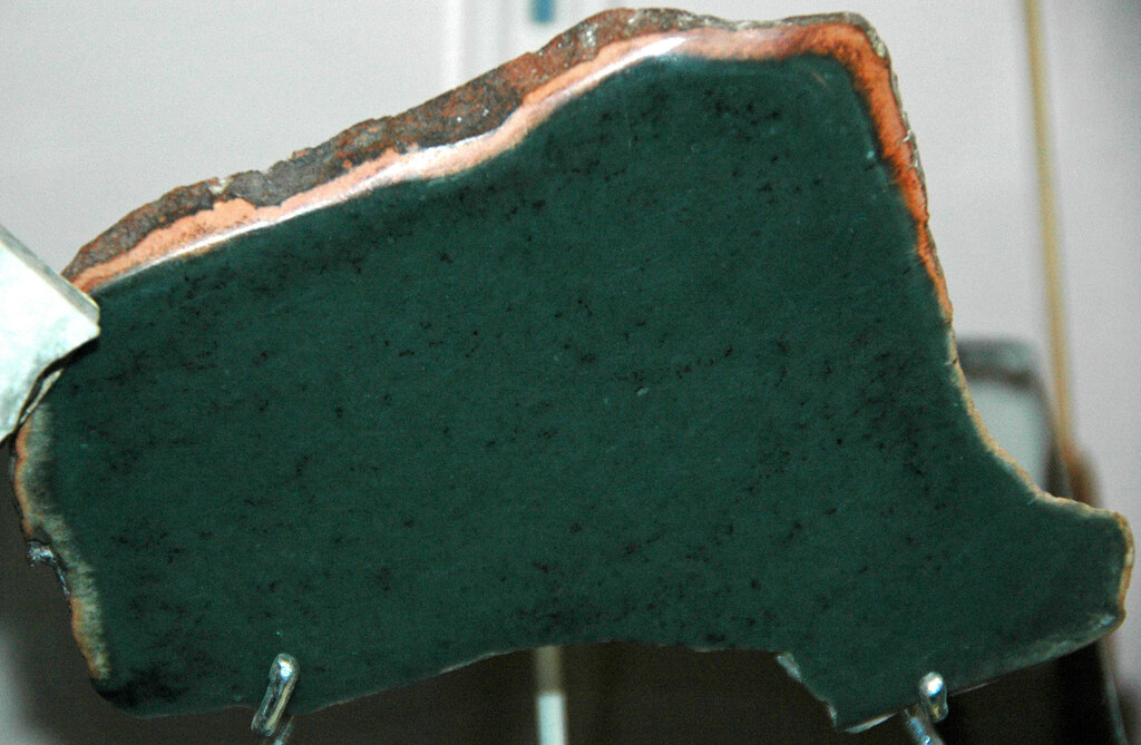
Nephrite jade from Wyoming. Photograph by James St. John (Flickr; Creative Commons Attribution 2.0 Generic license).
Wyoming's Highest and Lowest Elevations
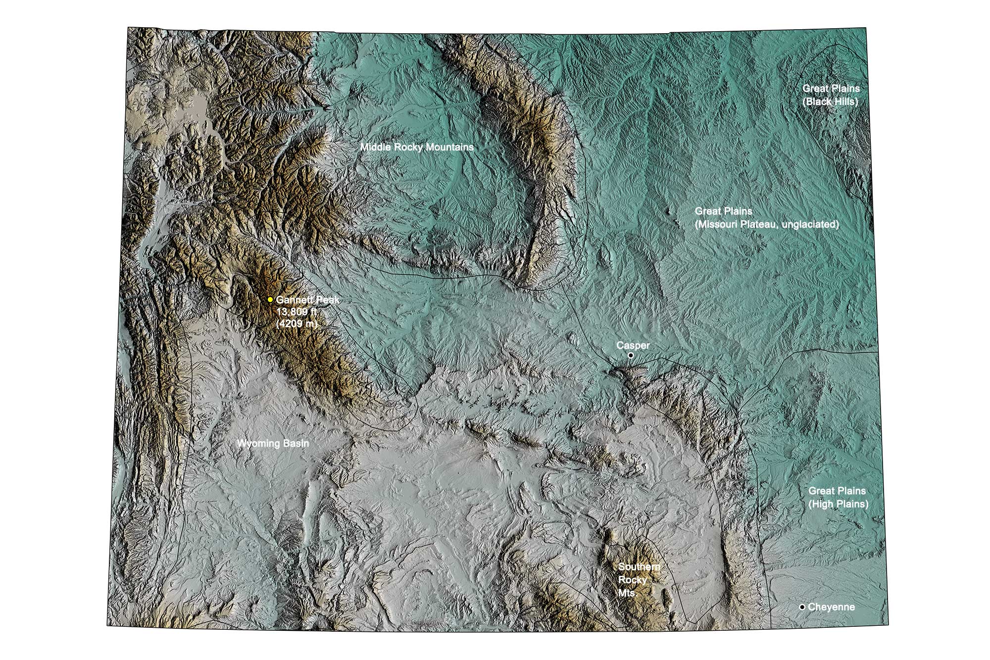
Topographic map of Montana with physiographic regions and point of highest elevation identified. Topographic data are derived from the Shuttle Radar Topography Mission (SRTM GL3) Global 90m (SRTM_GL3) (Farr, T. G., and M. Kobrick, 2000, Shuttle Radar Topography Mission produces a wealth of data. Eos Trans. AGU, 81:583-583).
Highest Elevation: Gannett Peak
Rising to an elevation of 4209 meters (13,809 feet) above sea level, Gannett Peak is the highest point in Wyoming—and the entire Northwest Central—as well as the highest mountain in the Rockies outside of Colorado. Gannett Glacier, the largest glacier in the American Rocky Mountains, flows from Gannett Peak’s north slopes.
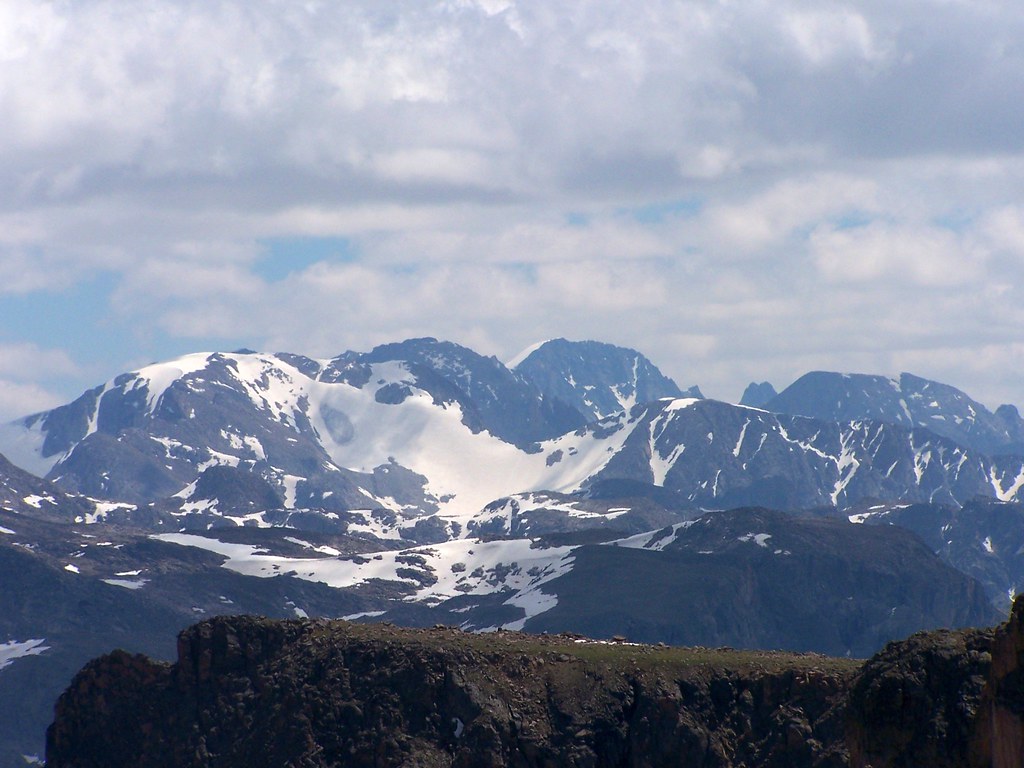
Gannett Peak, the highest point of elevation in Wyoming. Photograph by Bryant Olsen (Flickr; Creative Commons Attribution-NonCommercial 2.0 Generic license).
Lowest Elevation: Belle Fourche River
The Belle Fourche River, which reaches an elevation of 945 meters (3099 feet) at the South Dakota border, is Wyoming’s lowest point.
Places to Visit
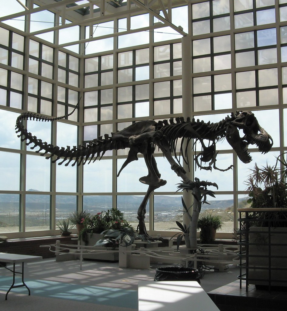
Tyrannosaurus rex skeleton on display at the Museum of Natural History Museum, Western Wyoming Community College, Rock Springs, Wyoming. Photograph by Greg Goebel (Flickr; Creative Commons Attribution-ShareAlike 2.0 Generic license).
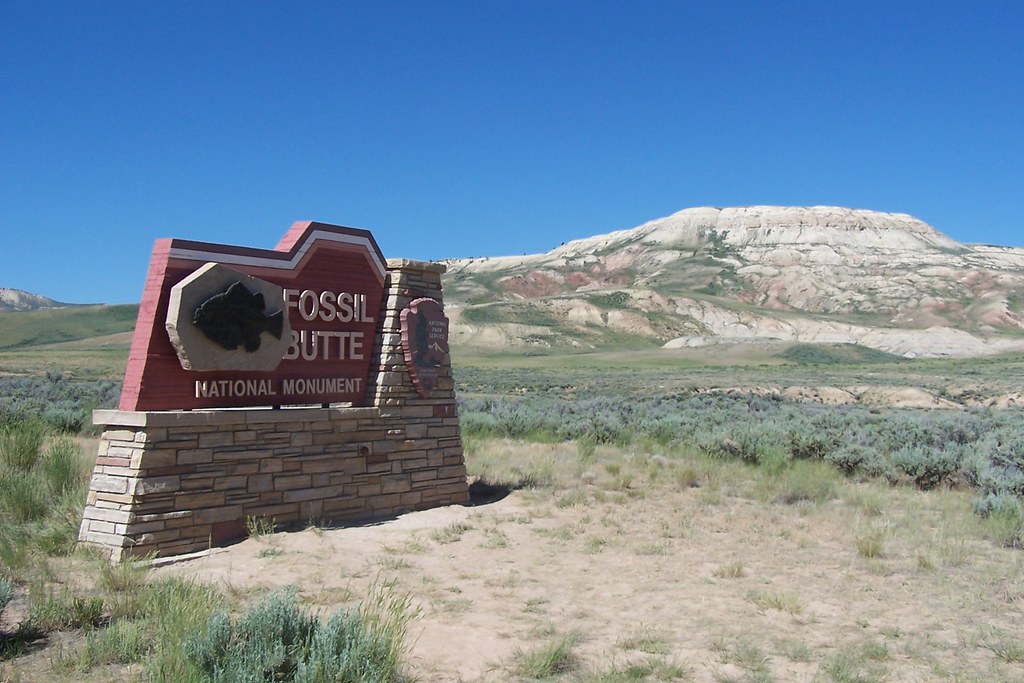
Fossil Butte National Monument in Lincoln County, Wyoming. Photograph by J. Stepher (Flickr; Creative Commons Attribution-NonCommercial 2.0 Generic license).
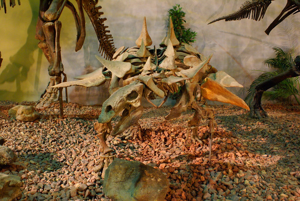
Dinosaur skeleton on display at the Wyoming Dinosaur Center in East Thermopolis, Wyoming. Photograph by Ben Townsend (Flickr; Creative Commons Attribution 2.0 Generic license).
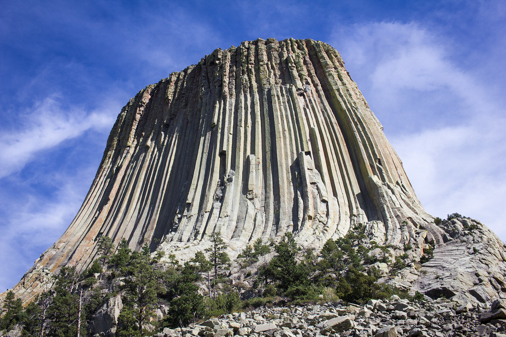
Devils Tower, a large intrusive igneous rock formation with well-developed columnar jointing, in Crook County, Wyoming. Photograph by Christian Collins (Flickr; Creative Commons Attribution-NonCommercial 2.0 Generic license).
Additional resources
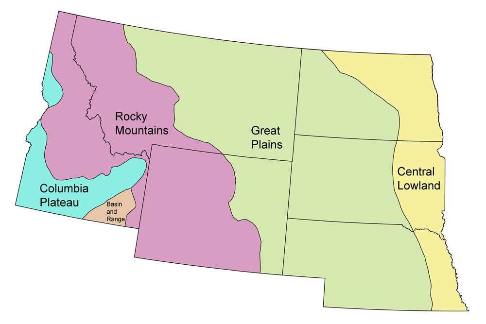
Earth@Home resources about Wyoming and nearby states:
- Rocks: Rocky Mountains, Great Plains
- Fossils: Rocky Mountains, Great Plains
- Topography: Rocky Mountains, Great Plains
- Energy: Rocky Mountains, Great Plains
- Mineral Resources: Rocky Mountains, Great Plains
Earth@Home resources about the Northwest Central region of the United States:


