

Page snapshot: Idaho State Geologic Map; Fossil; 3D models; Rock; Mineral; Gem; Highest and Lowest Elevations; Places to Visit; and Additional Resources.
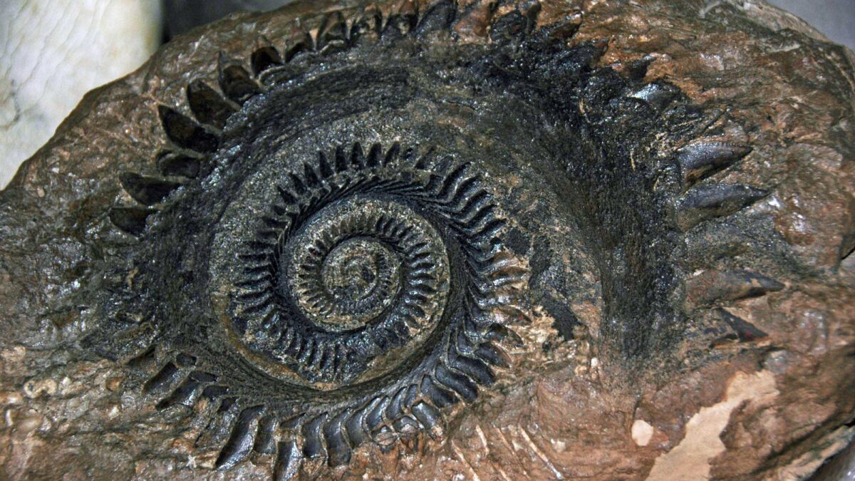
Image above: Fossil tooth whorl from the buzzsaw shark Helicoprion sp. from the Permian of Bingham County, Idaho. Specimen is on display at the Idaho Museum of Natural History. Photograph by James St. John (Flickr; Creative Commons Attribution 2.0 Generic license; image cropped and resized).
Geologic Map of Idaho
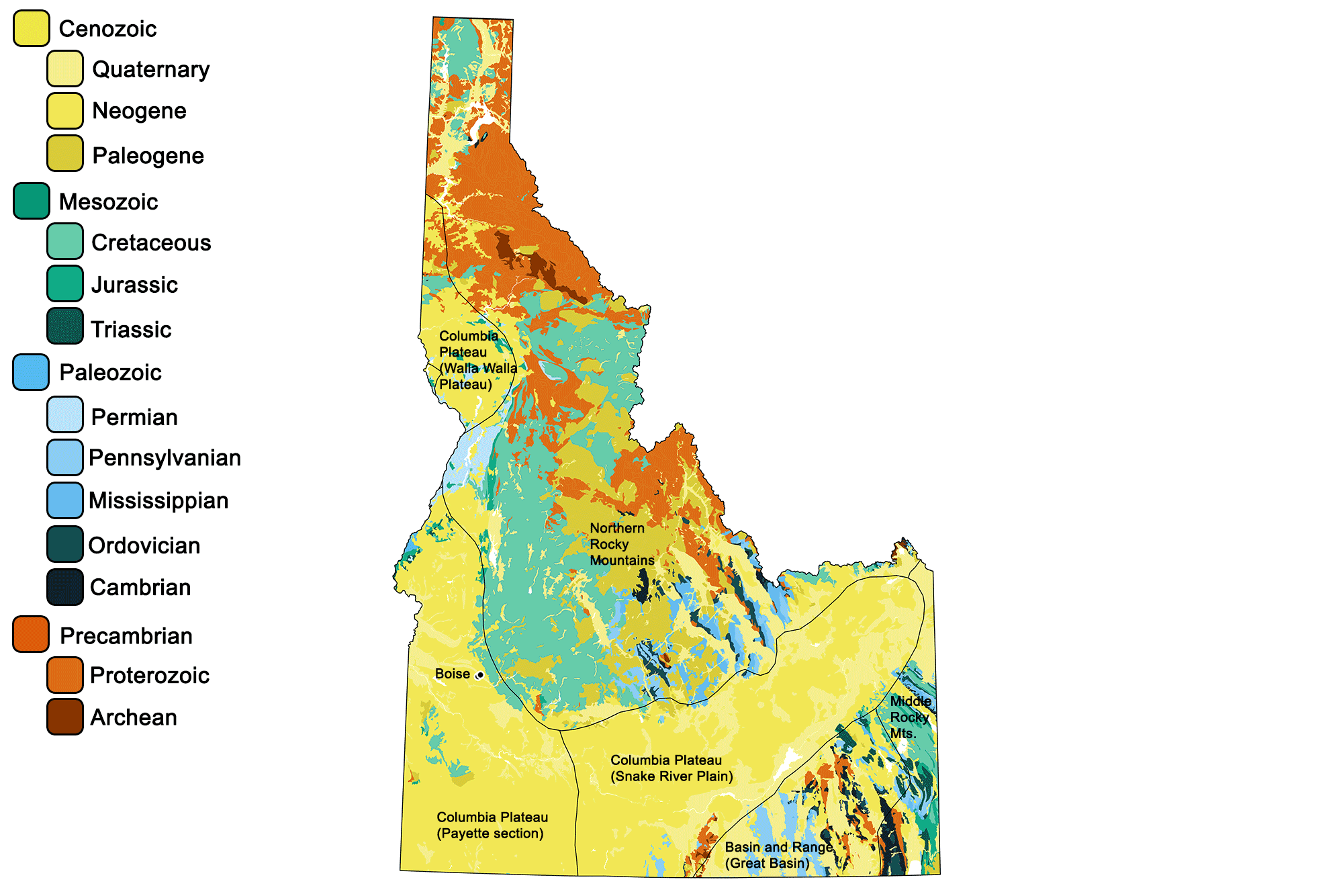
Geologic map of Idaho showing maximum ages of mappable units. Image by Jonathan R. Hendricks for the Earth@Home project developed using QGIS and USGS data (public domain) from Fenneman and Johnson (1946) and Horton et al. (2017).
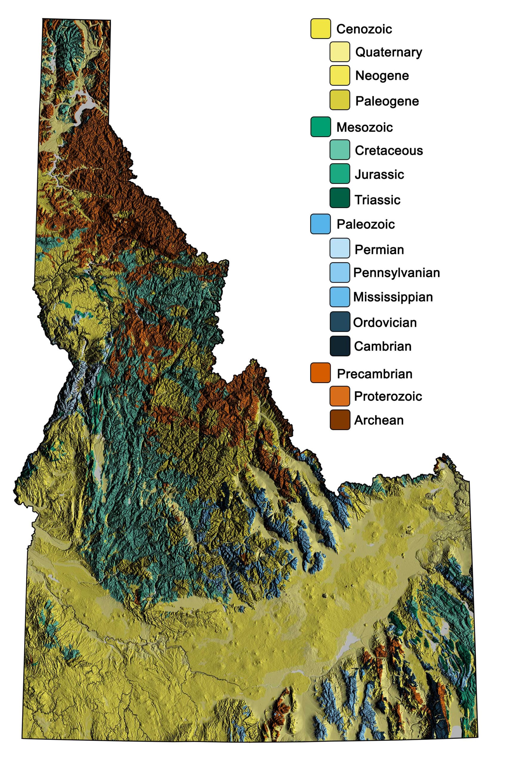
Geologic and topographic map of Idaho. Geologic data from Horton et al. (2017) using the maximum age values for each mapped unit. Topographic data are derived from the Shuttle Radar Topography Mission (SRTM GL3) Global 90m (SRTM_GL3) (Farr, T. G., and M. Kobrick, 2000, Shuttle Radar Topography Mission produces a wealth of data. Eos Trans. AGU, 81:583-583).
Idaho State Fossil: Equus simplicidens
The state fossil of Idaho is the Neogene fossil horse Equus simplicidens.
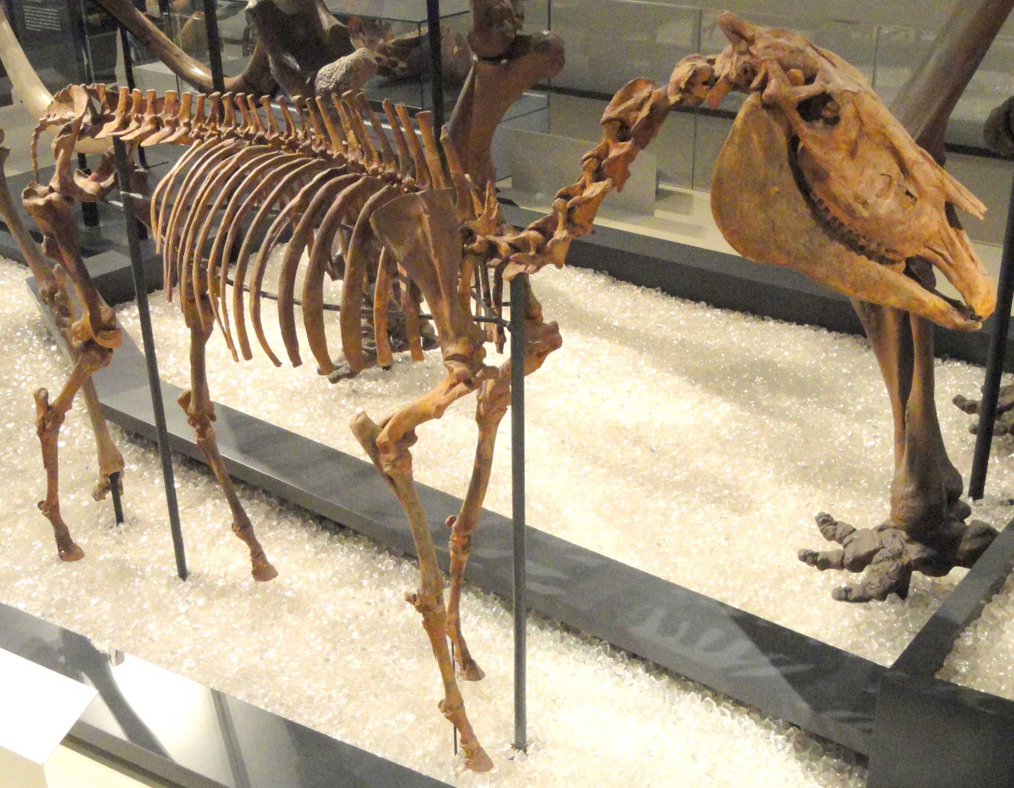
Hagerman horse (Equus simplcidens), Pliocene, Hagerman, Idaho. Specimen on display at the Royal Ontario Museum, Ontario, Canada. Photo by Daderot (Wikimedia Commons, CC0 1.0 Universal/public domain dedication).
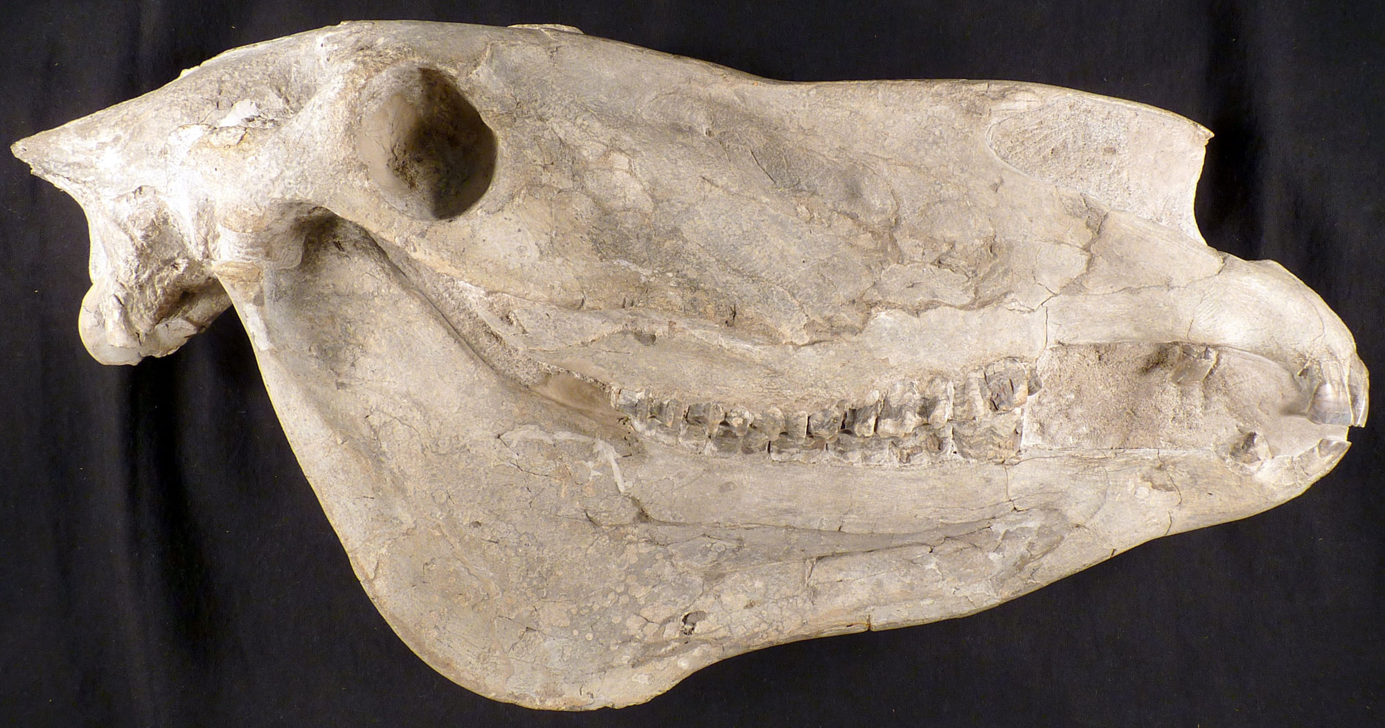
Skull of a Hagerman horse (Equus simplicidens), Pliocene Glenns Ferry Formation, Idaho. Photo of USNM V 11986 by Michael Brett-Surman (Smithsonian National Museum of Natural History, public domain).
3D Models of fossils from Idaho
Fossil specimens of the graptolite Didymograptus artus from the Ordovician Phi Kappa Formation of Idaho (PRI 76792). Specimen is from the collections of the Paleontological Research Institution, Ithaca, New York. Longest dimension of rock is approximately 4.5 cm.
Fossil specimens of the graptolite Didymograptus artus from the Ordovician Phi Kappa Formation of Idaho (PRI 76792). Specimen is from the collections of the Paleontological Research Institution, Ithaca, New York. Longest dimension of rock is approximately 8 cm.
Fossil leafy branchlets of the Dawn Redwood Metasequoia occidentalis from the Paleocene of Alberta, preserved as carbonizations. The only living species of Metasequoia, M. glyptostroboides, is native to China. Specimen is from the Cornell University Paleobotanical Collection (CUPC), Ithaca, New York (#2081). Length of specimen is approximately 16 cm.
Section of fossil tree fern Tempskya wesselli from the Cretaceous of Idaho. Tempskya is in an extinct family of ferns, Tempskyaceae. Ferns cannot produce true wood. Instead, the “trunk” of Tempskyaconsists of multiple narrow stems (visible as circles on one face of this specimen) surrounded by roots. This specimen is from the paleobotanical collections of the School of Integrative Plant Sciences at Cornell University, Ithaca, New York. Longest dimension of specimen is approximately 8.5 cm.
Idaho State Rock: None
Idaho does not yet have an official state rock. What do you think it should be?
Idaho State Mineral: None
Idaho does not yet have an official state mineral. What do you think it should be?
Idaho State Gem: Star Garnet
These dark purple silicate crystals are found in great quantity in only two places in the world: India, and Idaho’s panhandle. Star garnets have a unique property that causes them, when polished, to display a refl ection that looks like a four- or six-pointed star.
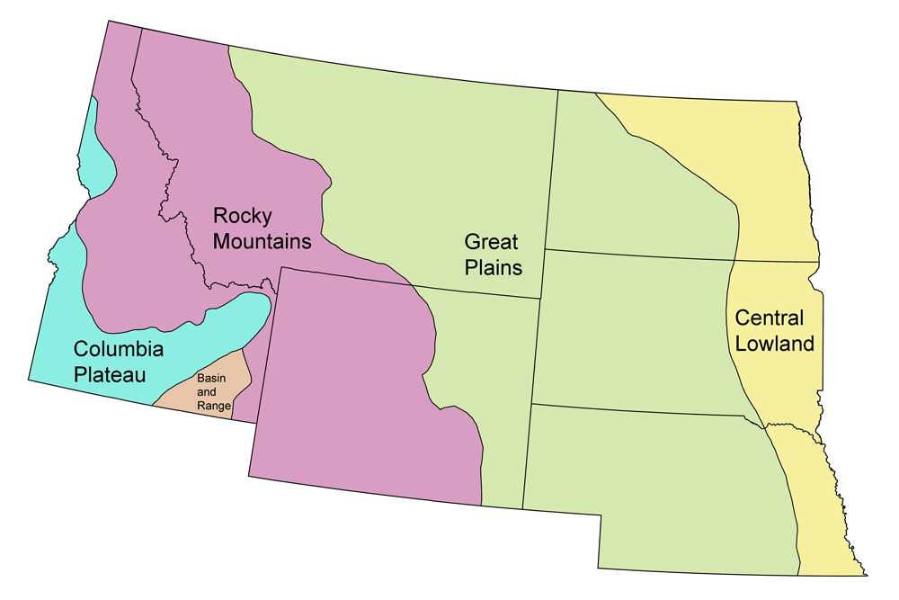
Idaho's Highest and Lowest Elevations
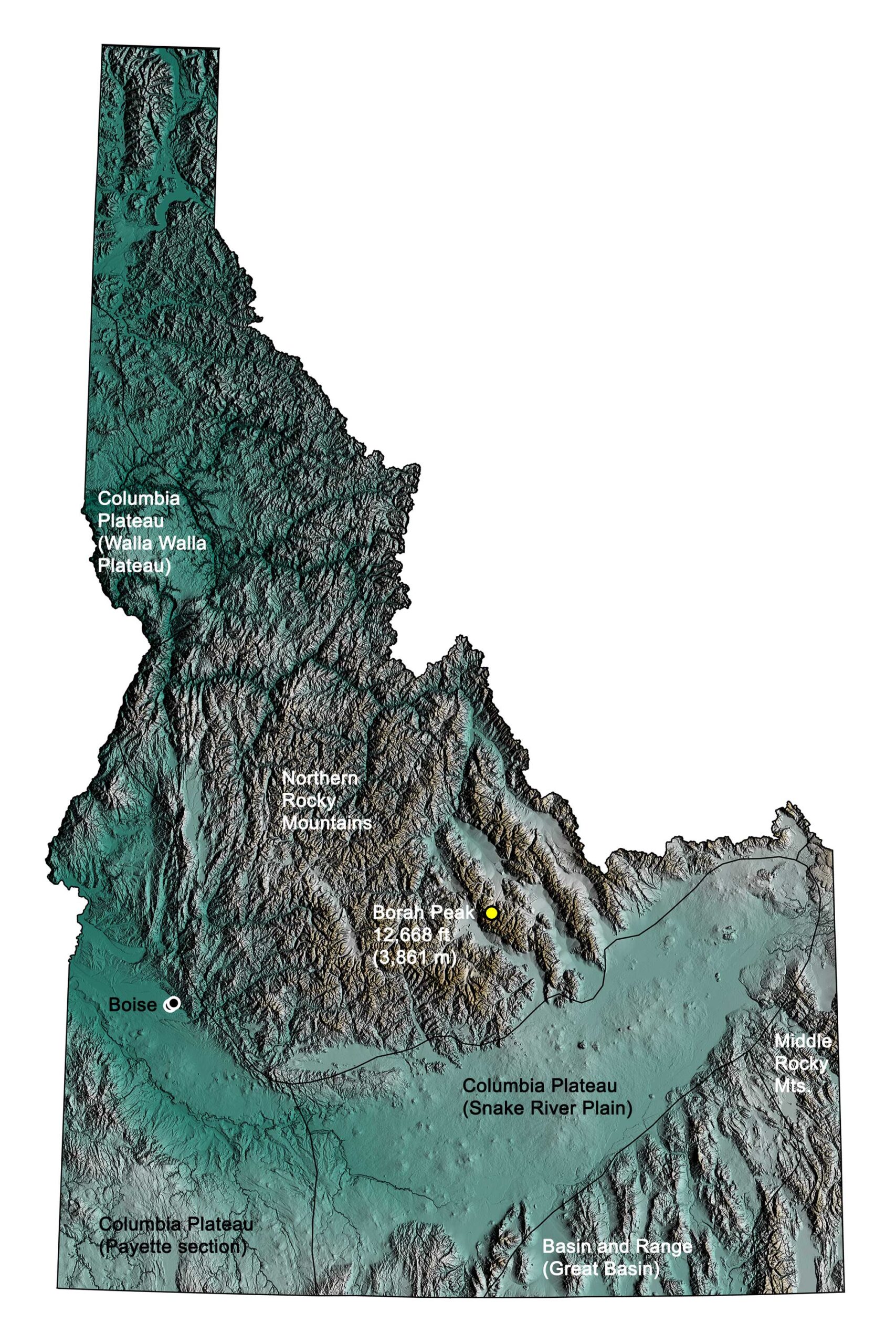
Topographic map of Idaho with physiographic regions and point of highest elevation identified. Topographic data are derived from the Shuttle Radar Topography Mission (SRTM GL3) Global 90m (SRTM_GL3) (Farr, T. G., and M. Kobrick, 2000, Shuttle Radar Topography Mission produces a wealth of data. Eos Trans. AGU, 81:583-583).
Highest Elevation: Borah Peak
Idaho’s highest point is Borah Peak, a 3861-meter-high (12,668-foot-high) mountain in the central Lost River Range, Custer County. The mountain was named in 1937 for Idaho senator William Borah, who had been in office for almost 27 years. In 2010, a magnitude 7.1 earthquake rocked Borah Peak, lifting it an additional two meters (seven feet) and scarring its west face.
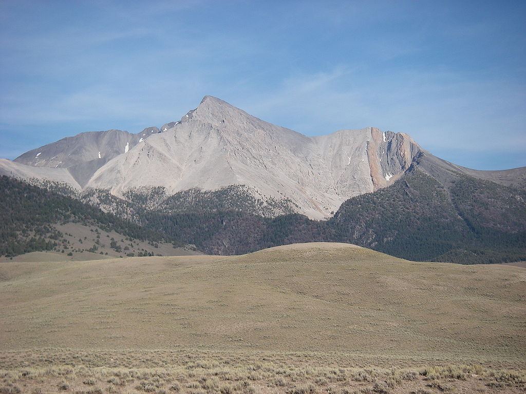
Borah Peak, Idaho. Photograph by "Leaflet" (Wikimedia Commons; public domain).
Lowest Elevation: Snake River
The Snake River in Nez Perce County is Idaho’s lowest point, flowing at 216 meters (710 feet) above sea level.
Places to Visit
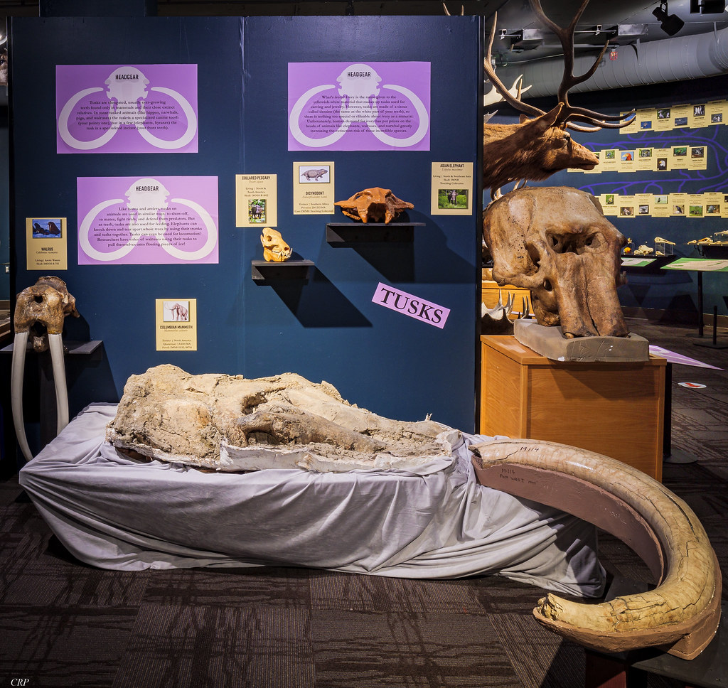
An exhibit about skulls at the Idaho Museum of Natural History, Idaho State University, Pocatello. Photograph by Charles Peterson (Flickr; Creative Commons Attribution-NonCommercial-NoDerivs 2.0 Generic license).
Idaho Museum of Mining and Geology
Boise, Idaho.
Romney Geology Museum and Exhibitions
Brigham Young University - Idaho, Rexburg, ID.
Additional resources
Earth@Home resources about Idaho and nearby states:
- Rocks: Columbia Plateau, Basin and Range, Rocky Mountains
- Fossils: Columbia Plateau, Basin and Range, Rocky Mountains
- Topography: Columbia Plateau, Basin and Range, Rocky Mountains
- Energy: Columbia Plateau, Basin and Range, Rocky Mountains
- Mineral Resources: Columbia Plateau, Basin and Range, Rocky Mountains
Earth@Home resources about the Northwest Central region of the United States: